Category:Arabic-language SVG maps showing history
Jump to navigation
Jump to search
Subcategories
This category has the following 4 subcategories, out of 4 total.
Media in category "Arabic-language SVG maps showing history"
The following 94 files are in this category, out of 94 total.
-
100 Years War France 1435-ar.svg 948 × 945; 49 KB
-
1910年奧匈帝國民族組成.svg 1,360 × 1,052; 919 KB
-
1947-UN-Partition-Plan-1949-Armistice-Comparison-ar.svg 500 × 1,029; 29 KB
-
Adurbadagan as a Sasanian province-ar.svg 2,871 × 2,186; 1.65 MB
-
Afsharid (1736-1802)-ar.svg 420 × 325; 703 KB
-
Aistulf's Italy-ar.svg 604 × 682; 72 KB
-
Alamein1st1942 07-ar.svg 653 × 656; 94 KB
-
Alboin's Italy-ar.svg 520 × 623; 76 KB
-
AncientGreekDialects (Woodard) ar.svg 660 × 555; 1.64 MB
-
Angevin empire-ar.svg 1,270 × 1,455; 627 KB
-
Ansiedlungsrayon-ar.svg 780 × 684; 492 KB
-
Armenian Genocide Map-ar.svg 2,574 × 1,264; 495 KB
-
Asia Minor ca 842 AD-ar.png 1,325 × 688; 1.26 MB
-
Asia Minor ca 842 AD-ar.svg 1,325 × 688; 1.7 MB
-
Assyrian genocide o2p-ar.svg 1,062 × 806; 400 KB
-
Austria Hungary ethnic-ar.svg 1,360 × 1,052; 1,000 KB
-
Battaglia di Civitate - 18 06 1053-ar.svg 744 × 720; 26 KB
-
Borno in 1810-ar.svg 280 × 270; 468 KB
-
BritishMandatePalestine1920-ar.svg 675 × 542; 162 KB
-
Byzantine and Sassanid Empires in 600 CE-ar.svg 4,093 × 1,892; 190 KB
-
ByzantineEmpire717+extrainfo+themes-ar.svg 800 × 366; 138 KB
-
Byzantium1230-ar.svg 512 × 357; 208 KB
-
Cilician Armenia-ar.svg 2,508 × 1,789; 848 KB
-
Cities of Sumer-ar.svg 436 × 480; 67 KB
-
Coalition action against Libya-ar.svg 972 × 1,022; 674 KB
-
Crusade of 1101 v1-ar.svg 1,039 × 726; 350 KB
-
Danzig 1919–1939-ar.svg 1,004 × 652; 27 KB
-
Deportation of Jews by Assyrians-ar.svg 600 × 423; 291 KB
-
DesmembramientoDelIljanato1337–1432-ar.svg 959 × 663; 886 KB
-
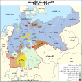
Deutsches Reich (1871-1918)-ar.svg 830 × 836; 624 KB
-
Duchy of Benevento-ar.svg 1,241 × 845; 107 KB
-
Egypt 1450 BC ar.svg 1,300 × 1,500; 442 KB
-
Egypt NK edit-ar.svg 1,282 × 1,501; 247 KB
-
Frankish Empire 481 to 814-ar.svg 1,591 × 1,205; 1.71 MB
-
French Mandate for Syria and the Lebanon map ar.svg 922 × 762; 190 KB
-
Hammurabi's Babylonia 1-ar.svg 655 × 570; 99 KB
-
Herodotus world map-ar.svg 788 × 476; 198 KB
-
Imperio Español Completo-ar.svg 921 × 472; 6.39 MB
-
ImperioOtomanoSimplificado-ar.svg 912 × 750; 901 KB
-
Italian East Africa (1938–1941)-ar.svg 1,079 × 969; 162 KB
-
Italy Lothar II-ar.svg 459 × 461; 375 KB
-
Italy1328-ar.svg 600 × 600; 36 KB
-
Jordan frontiers-ar.svg 1,050 × 1,138; 31 KB
-
Kingdom of Aragon-1037-ar.svg 882 × 612; 207 KB
-
Kingdom of Sicily 1154-ar.svg 712 × 807; 342 KB
-
Lahsa Eyalet, Ottoman Empire (1683)-ar.svg 900 × 750; 180 KB
-
Libyan Uprising-ar.svg 690 × 715; 47 KB
-
Libyan war final-ar.svg 1,100 × 1,100; 94 KB
-
Lombard state 526-ar.svg 950 × 550; 48 KB
-
Magellan Elcano Circumnavigation-ar.svg 2,246 × 1,139; 222 KB
-
Map Almoravid empire-ar.svg 546 × 702; 29 KB
-
Map athenian empire 431 BC-ar.svg 993 × 794; 3.44 MB
-
Map Battle of Stalingrad-ar.svg 1,699 × 1,806; 979 KB
-
Map Byzantine Empire 1025-ar.svg 2,094 × 1,178; 807 KB
-
Map County of Edessa 1098-1131-ar.svg 787 × 581; 183 KB
-
Map Crusader states 1190-ar.svg 978 × 1,330; 444 KB
-
Map Europe alliances 1914-ar.svg 1,069 × 633; 203 KB
-
Map Macedonia 336 BC-ar.svg 992 × 794; 3.37 MB
-
Map of Ancient Rome 271 AD-ar.svg 800 × 473; 174 KB
-
Map of ibn Abi Mahalli State - Arabic.svg 746 × 580; 306 KB
-
Map of Septimania in 537 AD-ar.svg 488 × 349; 22 KB
-
Maya civilization location map-ar.svg 1,800 × 1,500; 1.53 MB
-
Mesopotamia in 2nd millennium BC-ar.svg 577 × 599; 45 KB
-
Mongol raids in Syria and Palestine 1260-ar.svg 657 × 901; 318 KB
-
Muslim-Byzantine troop movement (635-636) ar.svg 1,210 × 1,516; 272 KB
-
NorteDeGuatemalaSiglosXVI-XVII-ar.svg 1,386 × 1,064; 14.38 MB
-
Oqba Ibn Naafi en Afrique du nord ARABE.svg 1,160 × 658; 94 KB
-
Ottoman Syria 1900-ar.svg 356 × 500; 56 KB
-
Periplous of the Erythraean Sea-ar.svg 1,280 × 903; 1.38 MB
-
Piris Reis expedition map-ar.svg 533 × 356; 162 KB
-
Plan de la bataille d'Arsouf-ar.svg 756 × 1,737; 78 KB
-
Portuguese colonial war-ar.svg 677 × 756; 480 KB
-
PrincipadodeAntioquía-ar.svg 2,039 × 2,272; 324 KB
-
Second Crusade-ar.svg 955 × 1,315; 153 KB
-
Seljuq - ar.svg 1,067 × 600; 543 KB
-
Semitic 1st AD-ar.svg 636 × 653; 120 KB
-
Semitic languages - ar.svg 712 × 917; 1.15 MB
-
Seven Hills of Rome-ar.svg 654 × 624; 24 KB
-
Simele ar.svg 700 × 620; 75 KB
-
Sirt Front-ar.svg 3,800 × 1,940; 224 KB
-
Sirt Front-final-ar.svg 3,800 × 1,940; 235 KB
-
SpanishEmpire1790-ar.svg 921 × 472; 5.7 MB
-
Sultanate of Rûm-ar.svg 1,019 × 744; 96 KB
-
Sykes-Picot-ar.svg 800 × 900; 104 KB
-
The Byzantine Empire c.1180-ar.svg 926 × 425; 462 KB
-
The fall of Constantinople, 6 april 1453 - 29 may 1453-ar.png 2,504 × 2,001; 1.26 MB
-
Third Intermediate Period map-ar.svg 1,002 × 1,891; 273 KB
-
Transoxiana 8th century - ar.svg 1,387 × 672; 2.2 MB
-
Tripolitanian Front-ar.svg 3,400 × 1,400; 217 KB
-
Tripolitanian Front-final-ar.svg 3,400 × 1,400; 240 KB
-
Vaslui Battle map-ar.svg 660 × 863; 29 KB
-
Viking Expansion AR Vector.svg 800 × 524; 924 KB
-
Viking Expansion AR.svg 800 × 524; 662 KB
-
West Mediterranean sea areas of influence 509BC-ar.svg 812 × 408; 1.26 MB


