File:Gebco atlantic.jpg
From Wikimedia Commons, the free media repository
Jump to navigation
Jump to search
Gebco_atlantic.jpg (550 × 554 pixels, file size: 213 KB, MIME type: image/jpeg)
File information
Structured data
Captions
Captions
Add a one-line explanation of what this file represents
Summary
[edit]| DescriptionGebco atlantic.jpg |
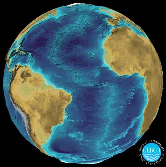
English: Atlantic 3D-visualisation made by Martin Jakobsson at the Center for Coastal and Ocean Mapping/Joint Hydrographic Center, University of New Hampshire, using Fledermaus software.
Italiano: Visualizzazione 3D dell'area atlantica prodotta da Martin Jakobsson presso il "Center for Coastal and Ocean Mapping/Joint Hydrographic Center" dell'Università del New Hampshire, utilizzando il software Fledermaus. |
| Date | |
| Source | Gebco web site |
| Author | Martin Jakobsson |
| Permission (Reusing this file) |
Permesso concesso dall'autore |
Licensing
[edit]
|
Permission is granted to copy, distribute and/or modify this document under the terms of the GNU Free Documentation License, Version 1.2 or any later version published by the Free Software Foundation; with no Invariant Sections, no Front-Cover Texts, and no Back-Cover Texts. A copy of the license is included in the section entitled GNU Free Documentation License.http://www.gnu.org/copyleft/fdl.htmlGFDLGNU Free Documentation Licensetruetrue |
| This file is licensed under the Creative Commons Attribution-Share Alike 3.0 Unported license. | ||
| ||
| This licensing tag was added to this file as part of the GFDL licensing update.http://creativecommons.org/licenses/by-sa/3.0/CC BY-SA 3.0Creative Commons Attribution-Share Alike 3.0truetrue |
File history
Click on a date/time to view the file as it appeared at that time.
| Date/Time | Thumbnail | Dimensions | User | Comment | |
|---|---|---|---|---|---|
| current | 08:15, 23 September 2008 |  | 550 × 554 (213 KB) | Paolo LUSIANI~commonswiki (talk | contribs) | {{Information |Description={{en|1=Atlantic 3D-visualisation made by Martin Jakobsson at the Center for Coastal and Ocean Mapping/Joint Hydrographic Center, University of New Hampshire, using Fledermaus software. }} {{it|1=Visualizzazione 3D dell'area atla |
You cannot overwrite this file.
File usage on Commons
There are no pages that use this file.
File usage on other wikis
The following other wikis use this file:
- Usage on de.wikipedia.org
- Usage on en.wikipedia.org
- Usage on en.wikibooks.org
- Usage on es.wikipedia.org
- Usage on fr.wikipedia.org
- Usage on it.wikipedia.org
- Usage on pl.wikipedia.org
- Usage on tr.wikipedia.org
- Usage on vi.wikipedia.org
- Usage on www.wikidata.org
Metadata
This file contains additional information such as Exif metadata which may have been added by the digital camera, scanner, or software program used to create or digitize it. If the file has been modified from its original state, some details such as the timestamp may not fully reflect those of the original file. The timestamp is only as accurate as the clock in the camera, and it may be completely wrong.
| _error | 0 |
|---|
Hidden categories:
