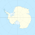
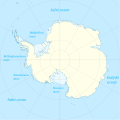
Datei:Antarctica location map.svg
Zur Navigation springen
Zur Suche springen

Größe der PNG-Vorschau dieser SVG-Datei: 600 × 600 Pixel. Weitere aus SVG automatisch erzeugte PNG-Grafiken in verschiedenen Auflösungen: 240 × 240 Pixel | 480 × 480 Pixel | 768 × 768 Pixel | 1.024 × 1.024 Pixel | 2.048 × 2.048 Pixel | 1.200 × 1.200 Pixel
Originaldatei (SVG-Datei, Basisgröße: 1.200 × 1.200 Pixel, Dateigröße: 233 KB)
Dateiversionen
Klicke auf einen Zeitpunkt, um diese Version zu laden.
| Version vom | Vorschaubild | Maße | Benutzer | Kommentar | |
|---|---|---|---|---|---|
| aktuell | 01:31, 9. Apr. 2015 |  | 1.200 × 1.200 (233 KB) | Ravenpuff | Minor changes |
| 17:16, 3. Mai 2011 |  | 1.200 × 1.200 (232 KB) | Alexrk2 | - | |
| 17:14, 3. Mai 2011 |  | 1.200 × 1.200 (232 KB) | Alexrk2 | + Peter I. Insel | |
| 15:24, 21. Feb. 2010 |  | 1.200 × 1.200 (217 KB) | Alexrk2 | == Summary == {{Information |Description= {{de|Positionskarte Antarktis, Mittabstandstreue Azimutalprojektion}} {{en|Location map Antarctica, Azimuthal equidistant projection}} * Longitude of central meridian: 0° * La |
Dateiverwendung
Die folgenden 45 Seiten verwenden diese Datei:
- Arctowski-Leuchtturm
- Belgrano-I-Station
- Belgrano-II-Station
- Belgrano-III-Station
- Britisches Antarktis-Territorium
- British Antarctic Survey
- Dreifaltigkeitskirche (Antarktis)
- Esperanza-Station
- Estación Científica Antártica Ruperto Elichiribehety
- Estação Antártica Comandante Ferraz
- Estrella Polar
- Flugplatz Wolf’s Fang
- Fossil-Bluff-Station
- Framheim
- González-Videla-Antarktis-Station
- Ice Sphinx Hole
- Jang-Bogo-Station
- Marambio-Station
- Mario-Zucchelli-Station
- Mendel-Polarstation
- Orton Cave
- Petrel-Station
- Plateau-Observatorium
- Pol der Unzugänglichkeit (Antarktis-Forschungsstation)
- Polheim (Camp)
- Ridge A
- Rothera-Station
- Sakralbauten in der Antarktis
- Sauna Cave
- Scott Base
- Sky Blu (Forschungsstation)
- Südlichste Orte der Erde
- Südpol
- Villa Las Estrellas
- Wernadski-Station
- Wilkins Runway
- Benutzer:Alexrk2/KWS
- Benutzer:Mr.Oppenheimer/Spielwiese2
- Benutzer:Zumthie/Impaktkrater Antarktis
- Wikipedia:Kartenwerkstatt/Archiv/2013-10
- Wikipedia:Kartenwerkstatt/Positionskarten/Andere
- Wikipedia Diskussion:WikiProjekt Georeferenzierung/Archiv/2008-IV
- Vorlage:Positionskarte Antarktis
- Vorlage Diskussion:Positionskarte/Archiv/1
- Vorlage Diskussion:Positionskarte Antarktis
Globale Dateiverwendung
Die nachfolgenden anderen Wikis verwenden diese Datei:
- Verwendung auf af.wikipedia.org
- Verwendung auf ar.wikipedia.org
- Verwendung auf arz.wikipedia.org
- Verwendung auf ast.wikipedia.org
- Monte Hope (L'Antártida)
- Base Vostok
- Base Antártica Xuan Carlos I
- Base Concordia
- Monte Erebus
- Macizu Vinson
- Montes Tresantárticos
- Módulu:Mapa de llocalización/datos/Antártida
- Módulu:Mapa de llocalización/datos/Antártida/usu
- Picu del Príncipe d'Asturies
- Aeródromu Teniente Rodolfo Marsh Martin
- Aeródromu Wilkins
- Aeródromu de Molodiózhnaya
- Aeródromu de Punta Rothera
- Aeródromu de Troll
- Base Casey
- Base Davis
- Base Edgeworth David
- Base Fossil Bluff
- Base Halley
- Base Mario Zucchelli
- Base Mawson
- Base N
- Base Plateau
- Base SANAE IV
- Campamentu Glaciar Unión
- Estación Kohnen
- Islla Cacho
- Verwendung auf av.wikipedia.org
- Verwendung auf az.wikipedia.org
Weitere globale Verwendungen dieser Datei anschauen.


