Papers by William Mackaness
Journal of Management Studies, 2001
... Close to arterial route 'Gateway' to town Road improvements... more ... Close to arterial route 'Gateway' to town Road improvements ... T+/- Position within centre Phasing Ren tal level ... Figure 1. Cognitive map of high performing superstores: Retail Estates Manager Figure 2. Cognitive map of high performing superstores: Operations Manager Page 12. ...
Cartography and Geographic …, 1993
... have shape, William Mackaness is a research assistant professorfor the Na-tional Center for G... more ... have shape, William Mackaness is a research assistant professorfor the Na-tional Center for Geographic Information and Analysis (NCGIA) in the Department of Surveying Engineering, University of Maine, ME 04469. Kate ...

An understanding of the space around us (spatiality) is fundamental to our consciousness and in t... more An understanding of the space around us (spatiality) is fundamental to our consciousness and in the explanation of heritage• the idea that a map represents both the world we live in and our experiences of it For example, the visual language of Aboriginal maps represents a synergistic amalgam of the metaphorical, metaphysical and material worlds. Thus maps can be said \0 be representations that facilitate an understanding of things, concepts, conditions, processes or events in the human world and provide a way of ordering our knowledge of our environment Our research is concerned with the exploration of these concepts in the context of the design of maps arid other graphics to support negotiations and legal proceedings regarding native title land tenure claims in Australia. This paper reports progress on the muHidisciplinary research project at Murdoch University, involving the principal disciplines of information systems, cartography and law. The research project is examining how in...
Transactions in GIS, 2004
A growing number of services are now being offered over mobile devices. They typically combine po... more A growing number of services are now being offered over mobile devices. They typically combine positioning technology, wireless technology and spatial analysis methods applied to detailed geographical, time based data to offer services in support of time critical, spatial, mobile decision making. A collection of research issues need
The general public is blissfully unaware of how social media erodes their geo-privacy. We present... more The general public is blissfully unaware of how social media erodes their geo-privacy. We present research exploring people's awareness of how private data can be used to generate geographical profiles. We created a web-based tool for explorative data analysis (EDAMS), which was used to expose our participants to their visualized digital Facebook history. Though users were aware of privacy issues, we found that the aspects of location and geography related to privacy (geoprivacy) were for most of our interviewees unknown. Acknowledging the role of GDPR we believe there is a strong argument in favour of increased efforts towards education (making available open-source visualisation tools), in order to raise awareness of geoprivacy issues when generating and sharing social media content.
The volume and potential value of user generated content (UGC) is ever growing. One such source i... more The volume and potential value of user generated content (UGC) is ever growing. One such source is geotagged images on Flickr. Typically, images on Flickr are tagged with location and attribute information variously describing location, events or objects in the image. Though inconsistent and 'noisy', the terms can reflect concepts at a range of geographic scales. From a spatial data integration perspective, the information relating to 'place' is of primary interest and the challenge is in selecting the most appropriate tag(s) that best describe the geography of the image. This paper presents a methodology for searching among the 'tag noise' in order to identify the most appropriate tags across a range of scales, by varying the size of the sampling area within which Flickr imagery falls. This is applied in the context of urban environments. Empirical analysis was then used to assess the correctness of the chosen tags (whether the tag correctly described the ge...

This paper examines the relationship between scale of observation and landform features and their... more This paper examines the relationship between scale of observation and landform features and their representation in map form. The research is premised on the idea that large scale features are defined by the smaller features that comprise them (that mountain ranges are a collection of clustered yet individually identifiable mountains or hills). In preference to subjective selection of the higher order features, we propose a methodology for automatically discerning mountain ranges as well as the smaller hills that constitute them. A mountainous region can be defined by its prominence (relative height among surrounding features) and various morphological characteristics including the variability in morphology. The algorithm presented here uses derivatives of elevation and the density of morphological properties in order to automatically identify individual hills or mountains and ranges together with their extents. Being able to create generalised views of landscape morphology is consi...

This research is concerned with the automatic generalisation of road networks from a single detai... more This research is concerned with the automatic generalisation of road networks from a single detailed database. The challenge of representing networks at changing scales is that we retain the essence of connectivity and continuity throughout the network, whilst reducing the level of detail. The algorithm builds on prior work concerning the perceptual organisation of map objects, and has as its focus the urban network (rather than the rural) where particular challenges exist. When simplifying the city network, it is important to retain its links with the surrounding rural region. The algorithm focuses on identifying and retaining those parts of the network that best define and demarcate the various regions that typically comprise the city. It does this through the use of both graph theoretic constructs, and analysis of the areal partitions created by the existence of a network. The implementation, within an object oriented GIS is outlined, and the effectiveness of the technique illust...
We present a city navigation and tourist information mobile dialogue app with integrated question... more We present a city navigation and tourist information mobile dialogue app with integrated question-answering (QA) and geographic information system (GIS) modules that helps pedestrian users to navigate in and learn about urban environments. In contrast to existing mobile apps which treat these problems independently, our Android app addresses the problem of navigation and touristic questionanswering in an integrated fashion using a shared dialogue context. We evaluated our system in comparison with Samsung S-Voice (which interfaces to Google navigation and Google search) with 17 users and found that users judged our system to be significantly more interesting to interact with and learn from. They also rated our system above Google search (with the Samsung S-Voice interface) for tourist information tasks. 1
1.0 Introduction Isolines have proved to be a highly effective way of conveying the shape of a su... more 1.0 Introduction Isolines have proved to be a highly effective way of conveying the shape of a surface (most commonly in the form of height contours to convey geographical landscape). Selecting the right contour interval is a compromise between showing sufficient detail in flat regions, whilst avoiding excessive crowding of lines in steep and morphologically complex areas. The traditional way of avoiding coalescence and confusion across steep regions has been to manually remove short sections of intermediate contours, while retaining index contours. But incorporating humans in automated environments is not viable. One approach has been to automate manual approaches using map generalisation methodologies. This research reports on the design, implementation and evaluation of an automated solution to this problem involving the automatic identification of coalescing lines, and removal of line segments to ensure clarity in the interpretation of the geographical surface. The algorithm was...
We present an approach to extending previous work related to non-lateral geospatial queries on gr... more We present an approach to extending previous work related to non-lateral geospatial queries on graph structures such that we can surface single journey views for complex multimodal routes. The focus is on automating the provision of map content to support cognitively smooth transitions between scales and levels of schematisation on mobile devices. The aim is to reduce the cognitive load of wayfinding information while maintaining an element of ‘seamfulness’; that is to say a user experience of navigational applications that is not entirely passive and encourages engagement with the overall structure and character of the geography.
Proceedings of the ICA, 2018
Land registration is important in land tenure security and often resolves land-related issues. Vo... more Land registration is important in land tenure security and often resolves land-related issues. Volunteered geographic information is a cheap and quick alternative to formal and traditional approaches to land registration. This research investigates the extent to which this tool is meaningful for land registration, with the Scottish crofting com- munity as a case study. CroftCappture was developed to record points along boundaries and save geotagged photo- graphs and descriptions. The project raised interesting questions over usability, functionality and accuracy, as well issues of privacy, crofting practices, digital competency, and highlighted the fractal nature of the digital divide.
Intuitive and meaningful interpretation of geographical phenomenon requires their representation ... more Intuitive and meaningful interpretation of geographical phenomenon requires their representation at multiple levels of detail. This is due to the scale dependent nature of their properties. Considerable interest remains in capturing once geographical information at the fine scale, and from this, automatically deriving information at various levels of detail and scale via the process of generalisation. Prior to the cartographic portrayal of that information, model generalisation is required in order to derive higher order phenomenon associated with the smaller scales. This paper presents an approach for aggregation of source database objects into composite objects at higher level of abstraction based on partonomic relationships. The benefits of these relationships in terms of database transformation and spatial analysis is discussed and illustrated with results.
A workshop comprising experts in the field of map generalization came together with experts in on... more A workshop comprising experts in the field of map generalization came together with experts in ontological modelling in order to explore the role of ontologies in map generalization. A sequence of participatory activities identified the need for ontologies related to tasks, algorithms, data quality and truth, content selection, layout constraints, and geographical modelling (the set of relations among a set of map features). The workshop resulted in a deeper shared understanding of relationships between concepts that lie at the heart of map generalization. At the conclusion to the workshop attendees were tasked with developing case studies that will be shared via a wiki, and reported upon in a subsequent meeting devoted to ontological modelling for map generalization. This report is not exhaustive in its presentation of all the ideas and material presented at the workshop, but seeks to convey the over-arching methodology and its core findings. Introduction A one and a half day works...
Proceedings of the ICA, 2021
The vision of automated cartography is built around the idea of a highly detailed representation ... more The vision of automated cartography is built around the idea of a highly detailed representation of the world from which we can construct a continuum of dynamic outputs ranging to the very smallest scale. Deriving higher order objects from the grouping of lower order constituent parts can be framed as a pattern recognition task. We can devise a prototypical representation of a higher order object – represented as an ontology. The ontology can then be used as a basis for searching the database for higher order objects (eg cities, airports, ports) based on the proximity between their constituent parts. A city defined in terms of {suburbs, municipal buildings, transport networks}; airports in terms of {runways, passenger terminals, taxiways}, and ports in terms of {harbours, docks, container ports}). Such an approach provides a basis for extending the range of scale dependent representations of geographical concepts – in turn facilitating the automated creation of thematic maps. By tak...
We demonstrate a spoken dialogue-based information system for pedestrians. The system is novel in... more We demonstrate a spoken dialogue-based information system for pedestrians. The system is novel in combining geographic information system (GIS) modules such as a visibility engine with a question-answering (QA) system, integrated within a dialogue system architecture. Users of the demonstration system can use a web-based version (simulating pedestrian movement using StreetView) to engage in a variety of interleaved navigation and QA conversations.
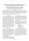
Our interest is in people’s capacity to efficiently and effectively describe geographic objects i... more Our interest is in people’s capacity to efficiently and effectively describe geographic objects in urban scenes. The broader ambition is to develop spatial models capable of equivalent functionality able to construct such referring expressions. To that end we present a newly crowd-sourced data set of natural language references to objects anchored in complex urban scenes (In short: The REAL Corpus ― Referring Expressions Anchored Language). The REAL corpus contains a collection of images of real-world urban scenes together with verbal descriptions of target objects generated by humans, paired with data on how successful other people were able to identify the same object based on these descriptions. In total, the corpus contains 32 images with on average 27 descriptions per image and 3 verifications for each description. In addition, the corpus is annotated with a variety of linguistically motivated features. The paper highlights issues posed by collecting data using crowd-sourcing w...







Uploads
Papers by William Mackaness