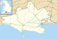
Hinton St Mary is a village and civil parish in the county of Dorset in southern England. It is sited on a low Corallian limestone ridge beside the River Stour, 1 mile (1.6 km) north of the market town Sturminster Newton. It lies within the North Dorset administrative district. In 2001 the parish had 97 households and a population of 221.[1] In 2013 the estimated population of the parish was 260.[2]
| Hinton St Mary | |
|---|---|
 Parish church of St Peter | |
Location within Dorset | |
| Population | 260 |
| OS grid reference | ST786162 |
| District | |
| Shire county | |
| Region | |
| Country | England |
| Sovereign state | United Kingdom |
| Police | Dorset |
| Fire | Dorset and Wiltshire |
| Ambulance | South Western |
The parish church, dedicated to St Peter, has a 15th-century tower.[3] The manor house next to the church was once owned by the nuns of Shaftesbury Abbey.[3]
Roman mosaic
In 1963 a Roman building of unknown type, possibly a villa or a church, was discovered in the village. On the floor of one room was laid a large 4th-century mosaic depicting Bellerophon and the Chimera (illustrating good defeating evil) and a portrait bust that may be a depiction of Christ.[4] The bust is now on display in the British Museum. The rest is kept in storage.
Millennium Garden
The village has a community garden constructed in an episode of the BBC series Charlies Garden Angels, hosted by Charlie Dimmock. The garden was made during 1999, with local people and businesses helping to create it. It is now known as the Millennium Garden as it was built to celebrate the new millennium.
Cutt Mill
Cutt Mill, sited on the River Stour to the northwest of the village, was burned down in 2003 by vandals. The building remains unused as the structure is now unsafe, although there have been plans proposed to either rebuild it, turn it into holiday flats, or turn it into a source of hydro-electric power[citation needed].
References
- ^ "Parish Headcounts". Neighbourhood Statistics. Office for National Statistics. 28 April 2004. Retrieved 28 December 2014.
- ^ "Parish Population Data". Dorset County Council. 20 January 2015. Retrieved 21 January 2015.
- ^ a b North Dorset District Council, Official District Guide, Home Publishing Co. Ltd., c.1983, p35
- ^ [1]
