Ealing was a local government district from 1863 to 1965 around the town of Ealing.
| Ealing | |
|---|---|
 Ealing within Middlesex in 1961 | |
| Area | |
| • 1894 | 2,947 acres (11.9 km2) |
| • 1965 | 8,783 acres (35.5 km2) |
| Population | |
| • 1901 | 33,031 |
| • 1961 | 183,077 |
| History | |
| • Created | 1863 |
| • Abolished | 1965 |
| • Succeeded by | London Borough of Ealing |
| Status | Local board of health 1863 - 1894 Urban district 1894 - 1901 Municipal borough 1901 - 1965 |
| Government | |
| • HQ | Ealing |
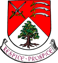
| • Motto | Respice Prospice (Look backward, look forward) |
 | |

A local board of health was formed for the southern part of the parish of Ealing, Middlesex, in 1863. In 1873 the board's area was extended to the rest of the parish.[1]
It was created an urban district in 1894, by the Local Government Act 1894. In 1901 it was granted a charter of incorporation to become the first municipal borough in Middlesex. The urban district council was replaced by a corporation consisting of a mayor, 6 aldermen and 18 councillors.
The borough was greatly enlarged in 1926 when it absorbed the urban districts of Greenford (including the parishes of Perivale and West Twyford) and Hanwell.[2] Accordingly the size of the borough council was increased: by 1960 it consisted of a mayor, 16 aldermen and 48 councillors.[1] In 1952 there was a failed attempt to gain county borough status.[1]
In 1965, under the London Government Act 1963, the municipal borough was abolished and its former area transferred to Greater London to be combined with that of other districts to form the present-day London Borough of Ealing.
References
- ^ a b c Ealing and Brentford Local government, Victoria County History of Middlesex, Volume 7 British History Online
- ^ F. A. Youngs, Guide to the Local Administrative Units of England, Vol.I: Southern England, London, 1979
- Local Government Act 1894
- London Government Act 1963