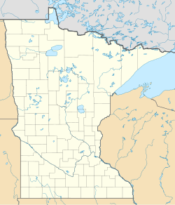
Upper Sioux Agency (or Yellow Medicine Agency), was a federal administrative center established in response to treaties with the Dakota people in what became Yellow Medicine County, Minnesota, United States.[2] Located on the Minnesota River south of Granite Falls, Minnesota, the government-run campus of employee housing, warehouses and a manual labor school was destroyed in the Dakota War of 1862.[3] The grave of Chief Walking Iron Mazomani, a leader of the Wahpetonwan (Dwellers in the Leaves) Dakota tribes, who was killed during the 1862 Dakota War's Battle of Wood Lake, is here.[2] The site was listed on the National Register of Historic Places in 1970 for having state-level significance under the themes of archaeology, architecture, education, and social history.[4]
Upper Sioux Agency | |
 | |
| Location | 5908 Highway 67, Sioux Agency Township, Minnesota, U.S. |
|---|---|
| Nearest city | Granite Falls, Minnesota |
| Coordinates | 44°44′5″N 95°27′24.23″W / 44.73472°N 95.4567306°W |
| Area | 1,300 acres (530 ha) |
| Built | 1854 |
| NRHP reference No. | 70000315[1] |
| Added to NRHP | October 15, 1970 |
Considered sacred for being a place where their ancestors died of starvation, the Upper Sioux Community has been working to regain the land since the 1860s.[5][3] A ceremonial transfer was held in March with tribal officials, Governor Tim Walz and Lieutenant Governor Peggy Flanagan.[6] Established as a Minnesota state park in 1963, the park was closed in February 2024 as authorized by the state legislature.[7] State Route 67, which traverses through the park, was closed after unstable ground beneath the road made the highway impassable. The highway would have required expensive repairs along with the bridge over the Yellow Medicine River that has been compressed by the movement so much that it needs to be removed or replaced.[8] State funds will be used to buy land for replacement recreational opportunities and the removal of structures from the site.[9]
References
edit- ^ "National Register Information System". National Register of Historic Places. National Park Service. January 23, 2007.
- ^ a b Stanley, Greg (July 1, 2023). "State vows to replace amenities of state park after it's closed and returned to tribe". Star Tribune. Retrieved July 3, 2023.
- ^ a b Stanley, Greg (May 11, 2023). "Minnesota poised to close state park, return land to Dakota tribe". Star Tribune. Retrieved May 12, 2023.
- ^ Minnesota Department of Natural Resources (2009). Upper Sioux Agency State Park Management Plan (PDF). Division of Parks and Trails. St. Paul, Minn.: State of Minnesota. Archived (PDF) from the original on May 28, 2024. Retrieved November 11, 2024.
- ^ Janke, Ryan (January 11, 2024). "State park closing as Minnesota set to give land back to tribal community". KFGO. Granite Falls, Minn. Archived from the original on November 11, 2024. Retrieved January 13, 2024.
- ^ Lauritsen, John (March 15, 2024). "Thousand acres of state park land near Granite Falls returned to Upper Sioux Community". CBS News Minnesota. Archived from the original on August 28, 2024. Retrieved March 16, 2024.
- ^ Lauritsen, John (February 15, 2024). "After decades-long fight, state park land will be returned to Upper Sioux Community". CBS News Minnesota. Archived from the original on February 25, 2024. Retrieved February 17, 2024.
- ^ Krueger, Andrew (February 8, 2021). "Western Minnesota highway that's sliding down hillside may be removed, rerouted". MPR News. St. Paul, Minn.: Minnesota Public Radio. Archived from the original on June 23, 2024. Retrieved June 27, 2023.
- ^ "Tribe getting piece of Minnesota back more than a century after ancestors died there". KNSI. Saint Cloud, Minn. Associated Press. September 5, 2023. Archived from the original on November 11, 2024. Retrieved September 6, 2023.
External links
editMedia related to Upper Sioux Agency State Park at Wikimedia Commons

