Al Awaynat: Difference between revisions
Appearance
Content deleted Content added
m Removed link(s) to title (CW error #48: https://checkwiki.toolforge.org/cgi-bin/checkwiki.cgi?project=enwiki&view=only&id=48) (via Bandersnatch) |
No edit summary |
||
| Line 85: | Line 85: | ||
|population_footnotes = |
|population_footnotes = |
||
|population_note = |
|population_note = |
||
|population_total = |
|population_total =3,168 |
||
|population_density_km2 = |
|population_density_km2 = |
||
|population_density_sq_mi = |
|population_density_sq_mi = |
||
Revision as of 17:04, 12 September 2024
Al Awaynat
العوينات Alawinat, Sardalas | |
|---|---|
Town | |
 | |
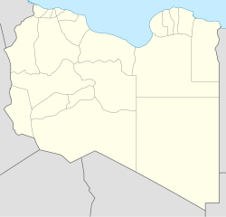
| Coordinates: 25°47′N 10°33′E / 25.783°N 10.550°E | |
| Country | |
| Region | Fezzan |
| District | Ghat |
| Population | |
• Total | 3,168 |
| Time zone | UTC +2 |
Al Awaynat or Alawinat (Template:Lang-ar) or Serdeles is a small town located in the Sahara Desert in Libya. It lies at the entrance of the Djebel Al Akakus. It is located 240 km south west of the city of Ubari and 120 km north of the city of Ghat. Al Awaynat is the gate of Tadrart Acacus and its residents from Toureg tribe.
It is located some 240 km (149 mi) west of Ubari. The name Serdeles in the Tuareg language is meaning small springs,[1] the same meaning of the Arabic name, hence, the Arabic name is probably an Arabizing of the Tuareg name. 25°47′N 10°33′E / 25.783°N 10.550°E
References
- ^ Salem Mohammed ez Zawwam, "Al Mu'jam Al Jughrafi lil Amakin Allibiya", Dar wa Maktabat Ash Sha'b lin Nashr wa Tazee', Misrata, Libya, 2005. pp.84, 170–171.
