Badovinci: Difference between revisions
Appearance
Content deleted Content added
m robot Adding: de:Badovinci, fr:Badovinci, sr:Бадовинци |
RodRabelo7 (talk | contribs) |
||
| (36 intermediate revisions by 20 users not shown) | |||
| Line 1: | Line 1: | ||
{{Infobox settlement |
|||
| ⚫ | |||
|official_name = Badovinci |
|||
|other_name = |
|||
|native_name = {{native name|sr-Cyrl|Бодовинци|italics=off}} |
|||
|nickname = |
|||
|settlement_type = [[List of populated places in Serbia|Village]] ([[village#Slavic countries|Selo]]) |
|||
|motto = |
|||
|image_skyline = Crkva Svete Trojice, Badovinci 025.jpg |
|||
|imagesize = |
|||
|image_caption = |
|||
|image_flag = |
|||
|flag_size = |
|||
|image_seal = |
|||
|seal_size = |
|||
|image_map = |
|||
|mapsize = |
|||
|map_caption = |
|||
|pushpin_map = Serbia |
|||
|pushpin_label_position =bottom |
|||
|pushpin_mapsize= |
|||
|pushpin_map_caption = |
|||
| subdivision_type = [[List of sovereign states|Country]] |
|||
| subdivision_name = {{flag|Serbia}} |
|||
| subdivision_type1 = [[Statistical regions of Serbia|Statistical Region]] |
|||
| subdivision_name1 = [[Šumadija and Western Serbia]] |
|||
| subdivision_type2 = [[List of regions of Serbia|Region]] |
|||
| subdivision_name2 = [[Mačva]] |
|||
| subdivision_type3 = [[Districts of Serbia|District]] |
|||
| subdivision_name3 = [[Mačva District]] |
|||
| subdivision_type4 = [[Municipalities and cities of Serbia|Municipality]] |
|||
| subdivision_name4 = [[Bogatić]] |
|||
|government_footnotes = |
|||
|government_type = |
|||
|leader_title = |
|||
|leader_name = |
|||
|established_title = |
|||
|established_date = |
|||
|area_magnitude = |
|||
|unit_pref =Imperial |
|||
|area_footnotes = |
|||
|area_total_km2 = |
|||
|area_land_km2 = |
|||
|population_as_of =2002 |
|||
|population_footnotes = |
|||
|population_note = |
|||
|population_total = |
|||
|population_density_km2 = |
|||
|timezone =[[Central European Time|CET]] |
|||
|utc_offset = +1 |
|||
|timezone_DST = [[Central European Summer Time|CEST]] |
|||
|utc_offset_DST = +2 |
|||
|coordinates = {{coord|44|47|N|19|22|E|display=inline}} |
|||
|elevation_footnotes = |
|||
|elevation_m = |
|||
|elevation_ft = |
|||
|postal_code_type = |
|||
|postal_code = |
|||
|area_code = |
|||
|blank_name = |
|||
|blank_info = |
|||
|website = |
|||
|footnotes = |
|||
}} |
|||
| ⚫ | |||
==Name== |
|||
The name of the settlement in [[Serbian language|Serbian]] is plural. |
|||
==See also== |
==See also== |
||
| Line 5: | Line 72: | ||
*[[Mačva]] |
*[[Mačva]] |
||
{{Bogatić Municipality}} |
|||
{{Serbia-geo-stub}} |
|||
{{Mačva District}} |
|||
{{coord|44|47|N|19|22|E|display=title|region:RS_type:city_source:GNS-enwiki}} |
{{coord|44|47|N|19|22|E|display=title|region:RS_type:city_source:GNS-enwiki}} |
||
{{MačvaRS-geo-stub}}{{commonscat|Badovinci}} |
|||
[[Category:Mačva]] |
[[Category:Mačva]] |
||
[[Category: |
[[Category:Populated places in Mačva District]] |
||
[[de:Badovinci]] |
|||
[[fr:Badovinci]] |
|||
[[sr:Бадовинци]] |
|||
Latest revision as of 07:40, 10 September 2024
Badovinci
Бодовинци (Serbian) | |
|---|---|
 | |
| Coordinates: 44°47′N 19°22′E / 44.783°N 19.367°E | |
| Country | |
| Statistical Region | Šumadija and Western Serbia |
| Region | Mačva |
| District | Mačva District |
| Municipality | Bogatić |
| Time zone | UTC+1 (CET) |
| • Summer (DST) | UTC+2 (CEST) |
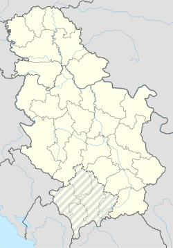
Badovinci (Serbian Cyrillic: Бадовинци, pronounced [badɔ̌v̞iːnt͡si]) is a village in Serbia. It is situated in the Bogatić municipality, in the Mačva District. The village has a Serb ethnic majority and its population numbering 5,406 people (2002 census).
Name
[edit]The name of the settlement in Serbian is plural.
See also
[edit]44°47′N 19°22′E / 44.783°N 19.367°E
Wikimedia Commons has media related to Badovinci.

