Bhilkati: Difference between revisions
Appearance
Content deleted Content added
mNo edit summary |
m Dating maintenance tags: {{Merge to}} |
||
| (60 intermediate revisions by 45 users not shown) | |||
| Line 1: | Line 1: | ||
{{Use dmy dates|date=January 2019}} |
|||
{{cleanup-date|September 2005}} |
|||
{{Use Indian English|date=January 2019}} |
|||
'''Bhilkati''' is a very small village in [[Phaltan tehsil]] of [[Satara]] district in [[Maharashtra]] state of [[India]]. Main profession of the community is [[farming]]. Nearly 1000 people of different casts and religion stay in Bhilkati peacefully since the ages. Community is mainly divided by 50-50 % [[Buddhism|Buddhist]] and [[Hinduism|Hindu]]. Village is having primary school up to the fifth standard. After completion of primer education upto fifth, kids have no option of leaving village for further studies. Students mainly concentrate on nearby villages like [[Phadtarewadi]] and [[Nimbhore]] to study up to matriculation. But some students heads towards nearby town Phaltan. In Bhilkati there is no post office facility, no public transport facility, this mainly causes interest of students to study further. |
|||
{{unreferenced|date=December 2009}} |
|||
{{merge to | Phaltan|date=November 2024}} |
|||
<!-- See [[Wikipedia:WikiProject Indian cities]] for details -->{{Infobox settlement |
|||
| name = Bhilkati |
|||
| other_name = |
|||
| nickname = Bhilkati |
|||
| settlement_type = Village |
|||
| image_skyline = Bhilkati.jpg |
|||
| imagesize = 350 |
|||
| image_alt = |
|||
| image_caption = |
|||
| pushpin_map = India Maharashtra |
|||
| pushpin_label_position = |
|||
| pushpin_map_alt = |
|||
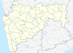
| pushpin_map_caption = Location in Maharashtra, India |
|||
| coordinates = {{coord|18|1|10|N|74|22|26|E|display=inline,title}} |
|||
| subdivision_type = Country |
|||
| subdivision_name = India |
|||
| subdivision_type1 = [[States and territories of India|State]] |
|||
| subdivision_name1 = [[Maharashtra]] |
|||
| subdivision_type2 = [[List of districts of India|District]] |
|||
| subdivision_name2 = [[Satara district|Satara]] |
|||
| established_title = <!-- Established --> |
|||
| established_date = 1942 |
|||
| founder = Kalel Family founder of Bhilkati village, |
|||
| named_for = Shivprasad |
|||
| government_type = Elective Gram Panchayat |
|||
| governing_body = Gram Panchayat |
|||
| unit_pref = Metric |
|||
| area_footnotes = 2 KM village are |
|||
| area_rank = |
|||
| area_total_km2 = |
|||
| elevation_footnotes = Good road built up in 2021 by Chief Minister of Maharashtra, as our Mr.Sanjivraje Naik Nimbalkar done the big contribution towards the work done from government. |
|||
| elevation_m = |
|||
| population_total = 841 |
|||
| population_as_of = |
|||
| population_rank = |
|||
| population_density_km2 = auto |
|||
| population_demonym = |
|||
| population_footnotes = |
|||
| demographics_type1 = Marathi |
|||
| demographics1_title1 = Official |
|||
| demographics1_info1 = [[Marathi language|Marathi]] |
|||
| timezone1 = [[Indian Standard Time|IST]] |
|||
| utc_offset1 = +5:30 |
|||
| postal_code_type = <!-- [[Postal Index Number|PIN]] --> |
|||
| postal_code = |
|||
| registration_plate = |
|||
| website = |
|||
| footnotes = |
|||
}} |
|||
'''Bhilkati''' is a village in [[Phaltan]] tehsil of [[Satara district]] in [[Maharashtra]] state of [[India]]. The main activity of the community is [[farming]]. |
|||
==References== |
|||
{{reflist}} |
|||
[[Category:Cities and towns in Satara district]] |
|||
{{Satara-geo-stub}} |
|||
Latest revision as of 01:32, 4 November 2024
Bhilkati | |
|---|---|
Village | |
 | |
| Nickname: Bhilkati | |
| Coordinates: 18°1′10″N 74°22′26″E / 18.01944°N 74.37389°E | |
| Country | India |
| State | Maharashtra |
| District | Satara |
| Founded by | Kalel Family founder of Bhilkati village, |
| Named for | Shivprasad |
| Government | |
| • Type | Elective Gram Panchayat |
| • Body | Gram Panchayat |
| Population | |
• Total | 841 |
| Marathi | |
| • Official | Marathi |
| Time zone | UTC+5:30 (IST) |
Bhilkati is a village in Phaltan tehsil of Satara district in Maharashtra state of India. The main activity of the community is farming.
References
[edit]
