Bhilkati: Difference between revisions
Appearance
Content deleted Content added
stub |
m Dating maintenance tags: {{Merge to}} |
||
| (45 intermediate revisions by 35 users not shown) | |||
| Line 1: | Line 1: | ||
{{ |
{{Use dmy dates|date=January 2019}} |
||
{{Use Indian English|date=January 2019}} |
|||
| ⚫ | |||
{{unreferenced|date=December 2009}} |
|||
native_name = Bhilkati | |
|||
{{merge to | Phaltan|date=November 2024}} |
|||
type = city | |
|||
| ⚫ | |||
latd = | longd = | |
|||
| name = Bhilkati |
|||
state_name = Maharashtra | |
|||
| other_name = |
|||
district = [[Satara]] | |
|||
| nickname = Bhilkati |
|||
leader_title = | |
|||
| settlement_type = Village |
|||
leader_name = | |
|||
| image_skyline = Bhilkati.jpg |
|||
altitude = | |
|||
| imagesize = 350 |
|||
| ⚫ | |||
| image_alt = |
|||
| ⚫ | |||
| image_caption = |
|||
population_density = | |
|||
| pushpin_map = India Maharashtra |
|||
area_magnitude= sq. km | |
|||
| pushpin_label_position = |
|||
area_total = | |
|||
| pushpin_map_alt = |
|||
area_telephone = | |
|||
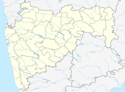
| pushpin_map_caption = Location in Maharashtra, India |
|||
| ⚫ | |||
| coordinates = {{coord|18|1|10|N|74|22|26|E|display=inline,title}} |
|||
vehicle_code_range = | |
|||
| subdivision_type = Country |
|||
sex_ratio = | |
|||
| subdivision_name = India |
|||
unlocode = | |
|||
| subdivision_type1 = [[States and territories of India|State]] |
|||
website = | |
|||
| subdivision_name1 = [[Maharashtra]] |
|||
| ⚫ | |||
| subdivision_type2 = [[List of districts of India|District]] |
|||
| ⚫ | |||
| subdivision_name2 = [[Satara district|Satara]] |
|||
There is no post office or public transport facilities in Bhilkati. |
|||
| established_title = <!-- Established --> |
|||
| established_date = 1942 |
|||
| founder = Kalel Family founder of Bhilkati village, |
|||
| named_for = Shivprasad |
|||
| government_type = Elective Gram Panchayat |
|||
| governing_body = Gram Panchayat |
|||
| unit_pref = Metric |
|||
| area_footnotes = 2 KM village are |
|||
| area_rank = |
|||
| area_total_km2 = |
|||
| elevation_footnotes = Good road built up in 2021 by Chief Minister of Maharashtra, as our Mr.Sanjivraje Naik Nimbalkar done the big contribution towards the work done from government. |
|||
| elevation_m = |
|||
| ⚫ | |||
| ⚫ | |||
| population_rank = |
|||
| population_density_km2 = auto |
|||
| population_demonym = |
|||
| population_footnotes = |
|||
| demographics_type1 = Marathi |
|||
| demographics1_title1 = Official |
|||
| demographics1_info1 = [[Marathi language|Marathi]] |
|||
| timezone1 = [[Indian Standard Time|IST]] |
|||
| utc_offset1 = +5:30 |
|||
| postal_code_type = <!-- [[Postal Index Number|PIN]] --> |
|||
| ⚫ | |||
| registration_plate = |
|||
| website = |
|||
| ⚫ | |||
}} |
|||
| ⚫ | |||
== |
==References== |
||
{{reflist}} |
|||
The village has a primary school up to the fifth standard. Students need to go elsewhere if they wish to continue their education. Students mainly go to schools in nearby villages like [[Phadtarewadi]] and [[Nimbhore]] to study up to matriculation; some students head towards the nearby town of Phaltan. |
|||
| ⚫ | |||
{{coord missing|India}} |
|||
| ⚫ | |||
[[Category:Articles lacking sources (Erik9bot)]] |
|||
{{Satara-geo-stub}} |
{{Satara-geo-stub}} |
||
Latest revision as of 01:32, 4 November 2024
Bhilkati | |
|---|---|
Village | |
 | |
| Nickname: Bhilkati | |
| Coordinates: 18°1′10″N 74°22′26″E / 18.01944°N 74.37389°E | |
| Country | India |
| State | Maharashtra |
| District | Satara |
| Founded by | Kalel Family founder of Bhilkati village, |
| Named for | Shivprasad |
| Government | |
| • Type | Elective Gram Panchayat |
| • Body | Gram Panchayat |
| Population | |
• Total | 841 |
| Marathi | |
| • Official | Marathi |
| Time zone | UTC+5:30 (IST) |
Bhilkati is a village in Phaltan tehsil of Satara district in Maharashtra state of India. The main activity of the community is farming.
References
[edit]
