Bhilkati: Difference between revisions
Appearance
Content deleted Content added
m en-IN |
m Normalize {{Multiple issues}}: Remove {{Multiple issues}} for only 1 maintenance template(s): Unreferenced |
||
| Line 1: | Line 1: | ||
{{Use dmy dates|date=January 2019}} |
{{Use dmy dates|date=January 2019}} |
||
{{Use Indian English|date=January 2019}} |
{{Use Indian English|date=January 2019}} |
||
{{Multiple issues| |
|||
{{unreferenced|date=December 2009}} |
{{unreferenced|date=December 2009}} |
||
{{Orphan|date=June 2017}} |
{{Orphan|date=June 2017}} |
||
}} |
|||
<!-- See [[Wikipedia:WikiProject Indian cities]] for details -->{{Infobox settlement |
<!-- See [[Wikipedia:WikiProject Indian cities]] for details -->{{Infobox settlement |
||
| name = Bhilkati |
| name = Bhilkati |
||
Revision as of 00:51, 31 May 2020
Bhilkati | |
|---|---|
Village | |
 | |
| Coordinates: 18°1′10″N 74°22′26″E / 18.01944°N 74.37389°E | |
| Country | India |
| State | Maharashtra |
| District | Satara |
| Government | |
| • Type | Elective Gram Panchayat |
| • Body | Gram Panchayat |
| Population | |
• Total | 1,500 |
| Languages | |
| • Official | Marathi |
| Time zone | UTC+5:30 (IST) |
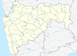
Bhilkati is a village in Phaltan tehsil of Satara district in Maharashtra state of India. The main profession of the community is farming. The village has a primary school up to the fifth standard.
