Dalad Banner: Difference between revisions
| Line 243: | Line 243: | ||
|single line=y |
|single line=y |
||
|collapsed = Y |
|collapsed = Y |
||
|location = Dalad Banner (1991–2020 normals, extremes 1981–2010) |
|location = Dalad Banner, elevation {{convert|1011|m|ft|abbr=on}}, (1991–2020 normals, extremes 1981–2010) |
||
|Jan record high C = 7.3 |Jan record low C = -29.7 |
|Jan record high C = 7.3 |Jan record low C = -29.7 |
||
|Feb record high C = 16.0 |Feb record low C = -30.3 |
|Feb record high C = 16.0 |Feb record low C = -30.3 |
||
Latest revision as of 11:24, 18 May 2024
Dalad Banner
达拉特旗 • ᠳᠠᠯᠠᠳ ᠬᠣᠰᠢᠭᠤ | |
|---|---|
| Coordinates: 40°24′N 110°02′E / 40.400°N 110.033°E | |
| Country | China |
| Autonomous region | Inner Mongolia |
| Prefecture-level city | Ordos |
| Banner seat | Shulinzhao |
| Area | |
• Total | 8,241.07 km2 (3,181.89 sq mi) |
| Elevation | 1,009 m (3,310 ft) |
| Population | |
• Total | 328,593 |
| • Density | 40/km2 (100/sq mi) |
| Time zone | UTC+8 (China Standard) |
| Website | www |
| Dalad Banner | |||||||
|---|---|---|---|---|---|---|---|
| Chinese name | |||||||
| Simplified Chinese | 达拉特旗 | ||||||
| Traditional Chinese | 達拉特旗 | ||||||
| |||||||
| Mongolian name | |||||||
| Mongolian Cyrillic | Далт хошуу | ||||||
| Mongolian script | ᠳᠠᠯᠠᠳ ᠬᠣᠰᠢᠭᠤ | ||||||
| |||||||
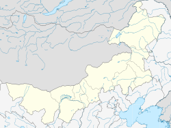
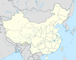
Dalad Banner (Mongolian: ᠳᠠᠯᠠᠳ ᠬᠣᠰᠢᠭᠤ; Chinese: 达拉特旗) is a banner of western Inner Mongolia, China, lying on the southern (right) bank of the Yellow River. It is under the administration of Ordos City, although it is closer to the city of Baotou, 33 kilometres (21 mi) to the north-northwest.
Administrative divisions
[edit]Dalad Banner is made up of 6 subdistrict, 8 towns, and 1 sum.
| Name | Simplified Chinese | Hanyu Pinyin | Mongolian (Hudum Script) | Mongolian (Cyrillic) | Administrative division code |
|---|---|---|---|---|---|
| Subdistricts | |||||
| Gongye Subdistrict | 工业街道 | Gōngyè Jiēdào | ᠠᠵᠤ ᠦᠢᠯᠡᠳᠪᠦᠷᠢ ᠶᠢᠨ ᠵᠡᠭᠡᠯᠢ ᠭᠤᠳᠤᠮᠵᠢ | Аж үйлдвэрийн зээл гудамж | 150621001 |
| Zhaojun Subdistrict | 昭君街道 | Zhāojūn Jiēdào | ᠵᠣᠤ ᠵᠢᠶᠦᠨ ᠵᠡᠭᠡᠯᠢ ᠭᠤᠳᠤᠮᠵᠢ | Жуу жион зээл гудамж | 150621002 |
| Xin Subdistrict | 锡尼街道 | Xīní Jiēdào | ᠰᠢᠨᠡ ᠵᠡᠭᠡᠯᠢ ᠭᠤᠳᠤᠮᠵᠢ | Шинэ зээл гудамж | 150621003 |
| Baita Subdistrict | 白塔街道 | Báitǎ Jiēdào | ᠴᠠᠭᠠᠨ ᠰᠤᠪᠤᠷᠭᠠ ᠵᠡᠭᠡᠯᠢ ᠭᠤᠳᠤᠮᠵᠢ | Цагаан суварга зээл гудамж | 150621004 |
| Xiyuan Subdistrict | 西园街道 | Xīyuán Jiēdào | ᠰᠢ ᠶᠤᠸᠠᠨ ᠵᠡᠭᠡᠯᠢ ᠭᠤᠳᠤᠮᠵᠢ | Ший юан зээл гудамж | 150621005 |
| Pingyuan Subdistrict | 平原街道 | Píngyuán Jiēdào | ᠫᠢᠩ ᠶᠤᠸᠠᠨ ᠵᠡᠭᠡᠯᠢ ᠭᠤᠳᠤᠮᠵᠢ | Пин юан зээл гудамж | 150621006 |
| Towns | |||||
| Shulinzhao Town | 树林召镇 | Shùlínzhào Zhèn | ᠱᠠᠭᠵᠠᠮᠤᠨᠢ ᠪᠠᠯᠭᠠᠰᠤ | Шагжамуни балгас | 150621100 |
| Jegstai Town | 吉格斯太镇 | Jígésītài Zhèn | ᠵᠡᠭᠡᠰᠦᠲᠠᠢ ᠪᠠᠯᠭᠠᠰᠤ | Зээстэй балгас | 150621101 |
| Bainijing Town | 白泥井镇 | Báiníjǐng Zhèn | ᠪᠠᠢ ᠨᠢ ᠵᠢᠩ ᠪᠠᠯᠭᠠᠰᠤ | Бай нь жин балгас | 150621102 |
| Wanggin Ju Town | 王爱召镇 | Wáng'àizhào Zhèn | ᠸᠠᠩ ᠤᠨ ᠵᠤᠤ ᠪᠠᠯᠭᠠᠰᠤ | Вангийн жуу балгас | 150621103 |
| Zhaojun Town | 昭君镇 | Zhāojūn Zhèn | ᠵᠣᠤ ᠵᠢᠶᠦ᠋ᠨ ᠪᠠᠯᠭᠠᠰᠤ | Жуу жион балгас | 150621104 |
| Enghebei Town | 恩格贝镇 | Ēngébèi Zhèn | ᠡᠩᠬᠡᠪᠡᠢ ᠪᠠᠯᠭᠠᠰᠤ | Энхбай балгас | 150621105 |
| Zhonghexi Town | 中和西镇 | Zhōnghéxī Zhèn | ᠵᠦᠩ ᠾᠧ ᠰᠢ ᠪᠠᠯᠭᠠᠰᠤ | Жүн ге ший балгас | 150621106 |
| Fengshuiliang Town | 风水梁镇 | Fēngshuǐliáng Zhèn | ᠹᠧᠩ ᠱᠦᠢ ᠯᠢᠶᠠᠩ ᠪᠠᠯᠭᠠᠰᠤ | Фен шүй лан балгас | 150621107 |
| Sum | |||||
| Zandan Ju Sum | 展旦召苏木 | Zhǎndànzhào Sūmù | ᠽᠠᠨᠳᠠᠨᠵᠤᠤ ᠰᠤᠮᠤ | Занданжуу сум | 150621200 |
Others:
- Dalad Economic Development Zone (达拉特经济开发区)
- Ordos City Ecological Demonstration Zone Management Committee (鄂尔多斯市生态示范区管理委员会)
Climate
[edit]| Climate data for Dalad Banner, elevation 1,011 m (3,317 ft), (1991–2020 normals, extremes 1981–2010) | |||||||||||||
|---|---|---|---|---|---|---|---|---|---|---|---|---|---|
| Month | Jan | Feb | Mar | Apr | May | Jun | Jul | Aug | Sep | Oct | Nov | Dec | Year |
| Record high °C (°F) | 7.3 (45.1) |
16.0 (60.8) |
25.3 (77.5) |
33.6 (92.5) |
36.4 (97.5) |
39.8 (103.6) |
39.3 (102.7) |
36.7 (98.1) |
34.8 (94.6) |
27.6 (81.7) |
19.3 (66.7) |
9.9 (49.8) |
39.8 (103.6) |
| Mean daily maximum °C (°F) | −3.9 (25.0) |
1.8 (35.2) |
9.6 (49.3) |
18.5 (65.3) |
24.6 (76.3) |
29.0 (84.2) |
30.3 (86.5) |
28.0 (82.4) |
23.1 (73.6) |
15.8 (60.4) |
5.9 (42.6) |
−2.1 (28.2) |
15.1 (59.1) |
| Daily mean °C (°F) | −10.9 (12.4) |
−5.6 (21.9) |
2.4 (36.3) |
11.0 (51.8) |
17.5 (63.5) |
22.1 (71.8) |
23.7 (74.7) |
21.5 (70.7) |
15.8 (60.4) |
8.2 (46.8) |
−0.8 (30.6) |
−8.5 (16.7) |
8.0 (46.5) |
| Mean daily minimum °C (°F) | −16.4 (2.5) |
−11.6 (11.1) |
−3.9 (25.0) |
3.6 (38.5) |
10.0 (50.0) |
15.0 (59.0) |
17.6 (63.7) |
15.8 (60.4) |
9.8 (49.6) |
2.2 (36.0) |
−5.9 (21.4) |
−13.5 (7.7) |
1.9 (35.4) |
| Record low °C (°F) | −29.7 (−21.5) |
−30.3 (−22.5) |
−20.7 (−5.3) |
−10.5 (13.1) |
−2.8 (27.0) |
1.4 (34.5) |
9.8 (49.6) |
5.9 (42.6) |
−2.7 (27.1) |
−10.0 (14.0) |
−22.1 (−7.8) |
−30.3 (−22.5) |
−30.3 (−22.5) |
| Average precipitation mm (inches) | 1.8 (0.07) |
4.0 (0.16) |
8.6 (0.34) |
12.8 (0.50) |
27.4 (1.08) |
36.0 (1.42) |
78.9 (3.11) |
83.8 (3.30) |
46.5 (1.83) |
17.8 (0.70) |
7.3 (0.29) |
2.1 (0.08) |
327 (12.88) |
| Average precipitation days (≥ 0.1 mm) | 1.4 | 2.1 | 3.3 | 3.0 | 5.4 | 7.6 | 9.9 | 9.9 | 7.9 | 4.3 | 2.4 | 1.9 | 59.1 |
| Average snowy days | 2.6 | 3.6 | 2.3 | 0.7 | 0.1 | 0 | 0 | 0 | 0 | 0.1 | 2.4 | 3.2 | 15 |
| Average relative humidity (%) | 57 | 49 | 41 | 34 | 37 | 46 | 60 | 65 | 63 | 56 | 56 | 56 | 52 |
| Mean monthly sunshine hours | 210.4 | 215.1 | 257.7 | 280.8 | 306.0 | 298.8 | 291.3 | 279.6 | 248.3 | 249.3 | 208.0 | 199.2 | 3,044.5 |
| Percent possible sunshine | 70 | 71 | 69 | 70 | 68 | 67 | 64 | 66 | 67 | 73 | 71 | 69 | 69 |
| Source: China Meteorological Administration[3][4] | |||||||||||||
Economy
[edit]The local industrial zone Dalad Economic Development Zone is home to chemical plants, aluminum smelters, and one of the world's largest bitcoin mining operations.[2] The operator of the zone's bitcoin mine Bitmain produced in 2017 about 5% of the world's daily production of Bitcoin in a facility with 25,000 computers tended to by about 50 employees.[2]
However, Inner Mongolia plans to ban cryptocurrency mining from April 2021.[5]
References
[edit]- ^ Inner Mongolia: Prefectures, Cities, Districts and Counties
- ^ a b c "In China's Hinterlands, Workers Mine Bitcoin for a Digital Fortune". New York Times. September 13, 2017.
- ^ 中国气象数据网 – WeatherBk Data (in Simplified Chinese). China Meteorological Administration. Retrieved 10 October 2023.
- ^ 中国气象数据网 (in Simplified Chinese). China Meteorological Administration. Retrieved 10 October 2023.
- ^ "Bitcoin rises after China region declares war on crypto mining - BNN Bloomberg". March 2021.
External links
[edit]- Official site (in Chinese)

