Eagle Airport: Difference between revisions
Appearance
Content deleted Content added
Editing information in article. |
No edit summary |
||
| (15 intermediate revisions by 13 users not shown) | |||
| Line 1: | Line 1: | ||
{{About|the airport in Alaska|the airport in Eagle County, Colorado|Eagle County Regional Airport}} |
{{Short description|Airport in Alaska, United States}} |
||
{{About|the airport in Alaska|the airport in Eagle County, Colorado|Eagle County Regional Airport}} |
|||
{{Infobox Airport |
{{Infobox Airport |
||
| name = Eagle Airport |
| name = Eagle (Alaska) Airport |
||
| image = Landing Fields - Alaska - Deacon Field through Eagle Creek - NARA - 68158788 (cropped).jpg |
|||
| ⚫ | |||
| caption = Eagle Airport, 1941 |
|||
| IATA = EAA |
| IATA = EAA |
||
| ICAO = PAEG |
| ICAO = PAEG |
||
| Line 16: | Line 17: | ||
| coordinates = {{coord|64|46|41|N|141|08|59|W|region:US_type:airport_scale:10000}} |
| coordinates = {{coord|64|46|41|N|141|08|59|W|region:US_type:airport_scale:10000}} |
||
| website = |
| website = |
||
| pushpin_map = USA Alaska#USA |
|||
| ⚫ | |||
| pushpin_relief = |
|||
| pushpin_map_caption = Location of airport in Alaska |
|||
| pushpin_label = '''EAA''' |
|||
| ⚫ | |||
| r1-length-f = 3,600 |
| r1-length-f = 3,600 |
||
| r1-length-m = 1,097 |
| r1-length-m = 1,097 |
||
| r1-surface = [[Gravel]] |
| r1-surface = [[Gravel]] |
||
| stat-year = |
| stat-year = 2016 |
||
| stat1-header = Aircraft operations |
| stat1-header = Aircraft operations |
||
| stat1-data = 2,400 |
| stat1-data = 2,400 (2014) |
||
| stat2-header = Based aircraft |
|||
| ⚫ | |||
| stat2-data = 1 |
|||
| stat3-header = Passengers |
|||
| stat3-data = 1,037 |
|||
| stat4-header = Freight |
|||
| stat4-data = 201,000 lbs |
|||
| ⚫ | |||
Source: [[Bureau of Transportation]]<ref name="transtats.bts.gov" /> |
|||
}} |
}} |
||
| Line 32: | Line 44: | ||
== Airlines and destinations == |
== Airlines and destinations == |
||
<!-- Please use only independent sources. The airport and airlines itself are not independent sources. --> |
|||
{{Airport-dest-list |
{{Airport-dest-list |
||
| [[ |
| [[Everts Air]] | [[Fairbanks International Airport|Fairbanks]]<ref>{{cite web | url = http://www.evertsair.com/pages/pax/schedule.php | title = Everts Air Schedule | publisher = Everts Air | access-date = May 5, 2017}}</ref> |
||
| ⚫ | |||
}} |
}} |
||
===Statistics=== |
|||
{{Bar graph |
|||
| title = Carrier shares: January – December 2016<ref name ="transtats.bts.gov" /> |
|||
| bar_width = 28 |
|||
| width_units = em |
|||
| label_type = Carrier |
|||
| data_type = Passengers (arriving and departing) |
|||
| data_max = 1,050 |
|||
| label1 = [[Everts Air|Tatonduk]] |
|||
| ⚫ | |||
| comment1 = 100.00% |
|||
}} |
|||
{| class="wikitable" |
|||
|+ Top domestic destinations: January – December 2016<ref name="transtats.bts.gov"> |
|||
{{cite web |
|||
| url = https://www.transtats.bts.gov/airports.asp?pn=1&Airport=EAA&Airport_Name=Eagle,%20AK:%20Eagle%20Airport&carrier=FACTS |
|||
| title = Eagle, AK: Eagle (EAA) |
|||
| publisher = [[Bureau of Transportation Statistics]] (BTS), [[Research and Innovative Technology Administration]] (RITA), [[U.S. Department of Transportation]] |
|||
| date = December 2016 | access-date = May 5, 2017 |
|||
}} |
|||
</ref> |
|||
! Rank |
|||
! City |
|||
! Airport |
|||
! Passengers |
|||
|- |
|||
| align=right | 1 |
|||
| {{flagicon|Alaska}} [[Fairbanks, AK]] |
|||
| ⚫ | |||
| align=right | 490 |
|||
|- |
|||
| align=right | 2 |
|||
|{{flagicon|Alaska}} [[Fort Yukon, AK]] |
|||
| [[Fort Yukon Airport]] |
|||
| align=right | 10 |
|||
|} |
|||
==See also== |
|||
* [[List of airports in Alaska]] |
|||
== References == |
== References == |
||
{{Reflist}} |
|||
<references /> |
|||
== External links == |
== External links == |
||
* [ |
* [https://web.archive.org/web/20050119181428/http://www.alaska.faa.gov/fai/images/ARPT_DIAGRAMS/EAA.gif FAA Alaska airport diagram] <small>([[GIF]])</small> |
||
{{US-airport2|EAA|PAEG}} |
|||
{{Portal bar|Alaska|Aviation}} |
|||
{{Airports in Alaska}} |
|||
{{Alaska-airport-stub}} |
|||
[[Category:Airports in the Southeast Fairbanks Census Area, Alaska]] |
[[Category:Airports in the Southeast Fairbanks Census Area, Alaska]] |
||
Latest revision as of 22:28, 15 July 2024
Eagle (Alaska) Airport | |||||||||||
|---|---|---|---|---|---|---|---|---|---|---|---|
 Eagle Airport, 1941 | |||||||||||
| Summary | |||||||||||
| Airport type | Public | ||||||||||
| Owner | Alaska DOT&PF - Northern Region | ||||||||||
| Serves | Eagle, Alaska | ||||||||||
| Elevation AMSL | 908 ft / 277 m | ||||||||||
| Coordinates | 64°46′41″N 141°08′59″W / 64.77806°N 141.14972°W | ||||||||||
| Map | |||||||||||
 | |||||||||||
| Runways | |||||||||||
| |||||||||||
| Statistics (2016) | |||||||||||
| |||||||||||
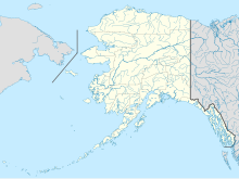
Eagle Airport (IATA: EAA, ICAO: PAEG, FAA LID: EAA) is a state-owned public airport two miles east of Eagle, in the Southeast Fairbanks Census Area of Alaska.[1]
Facilities and aircraft
[edit]Eagle Airport covers 87 acres (35 ha) at an elevation of 908 feet (277 m) above mean sea level. Its one runway, 6/24, is gravel, 3,600 by 75 feet (1,097 x 23 m). In 2005 the airport had 2,400 aircraft operations, 83% general aviation and 17% air taxi.[1]
Airlines and destinations
[edit]| Airlines | Destinations |
|---|---|
| Everts Air | Fairbanks[3] |
Statistics
[edit]| Carrier | Passengers (arriving and departing) |
|---|---|
| Tatonduk |
| Rank | City | Airport | Passengers |
|---|---|---|---|
| 1 | Fairbanks International Airport | 490 | |
| 2 | Fort Yukon Airport | 10 |
See also
[edit]References
[edit]- ^ a b c FAA Airport Form 5010 for EAA PDF, effective April 27, 2017.
- ^ a b c "Eagle, AK: Eagle (EAA)". Bureau of Transportation Statistics (BTS), Research and Innovative Technology Administration (RITA), U.S. Department of Transportation. December 2016. Retrieved May 5, 2017.
- ^ "Everts Air Schedule". Everts Air. Retrieved May 5, 2017.
External links
[edit]- FAA Alaska airport diagram (GIF)
- Resources for this airport:
- FAA airport information for EAA
- AirNav airport information for PAEG
- ASN accident history for EAA
- FlightAware airport information and live flight tracker
- NOAA/NWS latest weather observations for PAEG
- SkyVector aeronautical chart for EAA

