El Ali District: Difference between revisions
No edit summary Tags: Reverted Mobile edit Mobile web edit |
Troutfarm27 (talk | contribs) m Reverted edits by 62.152.11.74 (talk) (AV) |
||
| (10 intermediate revisions by 5 users not shown) | |||
| Line 1: | Line 1: | ||
{{short description|City in Somalia}} |
{{short description|City in Somalia}} |
||
{{Infobox settlement |
{{Infobox settlement |
||
|official_name =El Ali |
|official_name = El Ali |
||
| native_name |
| native_name = Degmada Ceel Cali |
||
|other_name = |
|other_name = |
||
|nickname = |
|nickname = |
||
|settlement_type = |
|settlement_type = [[Administrative divisions of Somalia|District]] |
||
|motto = |
|motto = |
||
|image_skyline = |
|image_skyline = |
||
| Line 24: | Line 24: | ||
|subdivision_name ={{flag|Somalia}} |
|subdivision_name ={{flag|Somalia}} |
||
|subdivision_type1 =[[Administrative divisions of Somalia|Region]] |
|subdivision_type1 =[[Administrative divisions of Somalia|Region]] |
||
|subdivision_name1 =[[Hiran, |
|subdivision_name1 =[[Hiran, Somalia|Hiran]] |
||
|subdivision_type2 = |
|subdivision_type2 = |
||
|subdivision_name2 = |
|subdivision_name2 = |
||
|government_footnotes = |
|government_footnotes = |
||
|government_type = |
|government_type = |
||
| ⚫ | |||
| mayor [[ Aadan qaawane]] |
|||
| ⚫ | |||
|established_date = |
|established_date = |
||
|area_magnitude = |
|area_magnitude = |
||
| Line 38: | Line 36: | ||
|area_total_km2 = |
|area_total_km2 = |
||
|area_land_km2 = |
|area_land_km2 = |
||
|population_as_of = |
|population_as_of = |
||
|population_footnotes = |
|population_footnotes = |
||
|population_note = |
|population_note = |
||
|population_total = |
|population_total = |
||
|population_density_km2 = |
|population_density_km2 = |
||
|timezone =[[East Africa Time|EAT]] |
|timezone =[[East Africa Time|EAT]] |
||
| Line 53: | Line 51: | ||
|postal_code = |
|postal_code = |
||
|area_code = |
|area_code = |
||
|blank_name = |
|blank_name = |
||
|blank_info = |
|blank_info = |
||
|website = |
|website = |
||
|footnotes = |
|footnotes = |
||
}} |
}} |
||
'''El Ali''' ({{lang-so| |
'''El Ali''' ({{lang-so|Degmada Ceel Cali}}) is a [[Administrative divisions of Somalia|district]] in the central [[Hiran, Somalia|Hiran]] region of [[Somalia]]. El Ali has a population of around 120,000 inhabitants. The broader El Ali District has a total population of 543,345 residents. El Ali means (Ali's well). |
||
El-Ali's residents belong to the Gaaljecel |
El-Ali's residents largely belong to the Galje'el (or Gaaljecel) sub-clan of [[Dirisame]]. |
||
== History == |
== History == |
||
| Line 69: | Line 67: | ||
==Demographics== |
==Demographics== |
||
El Ali is predominantly inhabited by people from the [[Somali people|Somali]] ethnic group, with the Dirisame |
El Ali is predominantly inhabited by people from the [[Somali people|Somali]] ethnic group, with the Dirisame sub-clan of the main Gaaljecel clan especially well represented. |
||
==References== |
==References== |
||
{{Reflist}} |
{{Reflist}} |
||
*[http://www.geographic.org/geographic_names/name.php?uni=-4558503&fid=5775&c=somalia Ceel Cali, Hiiraan Somalia] |
*[http://www.geographic.org/geographic_names/name.php?uni=-4558503&fid=5775&c=somalia Ceel Cali, Hiiraan Somalia] |
||
{{Districts of Somalia}} |
|||
[[Category:Populated places in Hiran, Somalia]] |
[[Category:Populated places in Hiran, Somalia]] |
||
Revision as of 21:10, 10 October 2024
El Ali
Degmada Ceel Cali | |
|---|---|
| Coordinates: 4°12′0″N 44°59′0″E / 4.20000°N 44.98333°E | |
| Country | |
| Region | Hiran |
| Time zone | UTC+3 (EAT) |
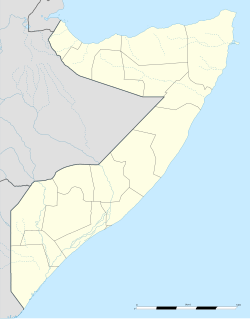
El Ali (Somali: Degmada Ceel Cali) is a district in the central Hiran region of Somalia. El Ali has a population of around 120,000 inhabitants. The broader El Ali District has a total population of 543,345 residents. El Ali means (Ali's well). El-Ali's residents largely belong to the Galje'el (or Gaaljecel) sub-clan of Dirisame.
History
The El Ali meteorite was identified by Kureym Mining and Rocks Company's staff in 2020 and trucked towards Mogadishu. [1] Prior to that, the rock had been celebrated for between five and seven generations, featuring in songs, folklore, dances, and poems.[1] In 2022, the mineral elaliite was named after El Ali after being identified in the meteorite by scientists at the University of Alberta.[2]
Location
It is situated 75 km south west of Beledweyne, the capital of the Hiiraan region.
Demographics
El Ali is predominantly inhabited by people from the Somali ethnic group, with the Dirisame sub-clan of the main Gaaljecel clan especially well represented.
References
- ^ a b "Meteoritical Bulletin: Entry for El Ali". www.lpi.usra.edu. Retrieved 2022-11-30.
- ^ Global News: In meteorite, Alberta researchers discover 2 minerals never before seen on Earth
