Gaj nad Mariborom: Difference between revisions
m →External links: Remove stub template(s). Page is start class or higher. Also check for and do General Fixes + Checkwiki fixes using AWB |
|||
| (10 intermediate revisions by 7 users not shown) | |||
| Line 31: | Line 31: | ||
|pushpin_label_position =bottom |
|pushpin_label_position =bottom |
||
|pushpin_map_caption =Location in Slovenia |
|pushpin_map_caption =Location in Slovenia |
||
|coordinates_display = inline,title |
|||
|coordinates_region = SI |
|||
|subdivision_type = Country |
|subdivision_type = Country |
||
|subdivision_name = [[Image:Flag of Slovenia.svg|25px]] [[Slovenia]] |
|||
|subdivision_name = [[Image:Flag of Slovenia.svg|25px]] [[Slovenia]] |
|subdivision_name = [[Image:Flag of Slovenia.svg|25px]] [[Slovenia]] |
||
|subdivision_type1 = Traditional region |
|subdivision_type1 = Traditional region |
||
|subdivision_name1 = [[Lower Styria|Styria]] |
|subdivision_name1 = [[Lower Styria|Styria]] |
||
|subdivision_type2 = [[Statistical regions of Slovenia|Statistical region]] |
|subdivision_type2 = [[Statistical regions of Slovenia|Statistical region]] |
||
|subdivision_name2 = [[ |
|subdivision_name2 = [[Drava Statistical Region|Drava]] |
||
|subdivision_type3 = [[Municipalities of Slovenia|Municipality]] |
|subdivision_type3 = [[Municipalities of Slovenia|Municipality]] |
||
|subdivision_name3 = [[Maribor]] |
|subdivision_name3 = [[City Municipality of Maribor|Maribor]] |
||
|subdivision_type4 = |
|subdivision_type4 = |
||
|subdivision_name4 = |
|subdivision_name4 = |
||
| Line 76: | Line 73: | ||
|area_blank1_km2 = |
|area_blank1_km2 = |
||
|area_blank1_sq_mi = |
|area_blank1_sq_mi = |
||
|population_as_of = |
|population_as_of =2021 |
||
|population_footnotes =<ref>{{cite web |title=Prebivalstvo po naseljih, podrobni podatki, Slovenija, 1. januar 2021 |url=https://www.stat.si/StatWeb/News/Index/9578 |website=stat.si |access-date=12 May 2022 |language=sl |archive-date=20 January 2022 |archive-url=https://web.archive.org/web/20220120213710/https://www.stat.si/StatWeb/News/Index/9578 |url-status=dead }}</ref> |
|||
|population_footnotes = |
|||
|population_note = |
|population_note = |
||
|population_total = |
|population_total = 217 |
||
|population_density_km2 = |
|population_density_km2 = |
||
|population_density_sq_mi = |
|population_density_sq_mi = |
||
| Line 98: | Line 95: | ||
|timezone_DST = |
|timezone_DST = |
||
|utc_offset_DST = |
|utc_offset_DST = |
||
|coordinates = {{coord|46|37|22|N|15|35|27.73|E|region:SI|display=inline,title}} |
|||
|latd=46 |latm=37 |lats=22 |latNS=N |
|||
|longd=15 |longm=35 |longs=27.73 |longEW=E |
|||
|elevation_footnotes = |
|elevation_footnotes = |
||
|elevation_m =402.3 |
|elevation_m =402.3 |
||
| Line 111: | Line 107: | ||
|blank1_info = |
|blank1_info = |
||
|website = |
|website = |
||
|footnotes = <ref> |
|footnotes = <ref>{{Cite web |url=http://www.stat.si/eng/index.asp |title=Statistical Office of the Republic of Slovenia |access-date=2008-04-03 |archive-date=2008-11-18 |archive-url=https://web.archive.org/web/20081118142042/http://www.stat.si/eng/index.asp |url-status=dead }}</ref> |
||
}} |
}} |
||
'''Gaj nad Mariborom''' ({{ |
'''Gaj nad Mariborom''' ({{IPA|sl|ˈɡaːi̯ nat ˈmaːɾibɔɾɔm|pron}}; {{langx|de|Heiligenkreuz}}<ref name="Leksikon">''Leksikon občin kraljestev in dežel zastopanih v državnem zboru,'' vol. 4: ''Štajersko''. 1904. Vienna: C. Kr. Dvorna in Državna Tiskarna, p. 208.</ref>) is a settlement in the hills northwest of [[Maribor]] in northeastern [[Slovenia]]. It belongs to the [[City Municipality of Maribor]].<ref>[http://www.maribor.si Maribor municipal site]</ref> |
||
==Name== |
==Name== |
||
The name of the settlement was changed from ''Sveti Križ'' (literally, 'Holy Cross') to ''Gaj nad Mariborom'' (literally, 'grove above Maribor') in 1955. The name was changed on the basis of the 1948 Law on Names of Settlements and Designations of Squares, Streets, and Buildings as part of efforts by Slovenia's postwar communist government to remove religious elements from toponyms.<ref>''Spremembe naselij 1948–95''. 1996. Database. Ljubljana: Geografski inštitut ZRC SAZU, DZS.</ref><ref>Premk, F. 2004. Slovenska versko-krščanska terminologija v zemljepisnih imenih in spremembe za čas 1921–1967/68. ''Besedoslovne lastnosti slovenskega jezika: slovenska zemljepisna imena''. Ljubljana: Slavistično društvo Slovenije, pp. 113–132.</ref><ref>Urbanc, Mimi, & Matej Gabrovec. 2005. Krajevna imena: poligon za dokazovanje moči in odraz lokalne identitete. ''Geografski vestnik'' 77(2): 25–43.</ref> In the |
The name of the settlement was changed from ''Sveti Križ'' (literally, 'Holy Cross') to ''Gaj nad Mariborom'' (literally, 'grove above Maribor') in 1955. The name was changed on the basis of the 1948 Law on Names of Settlements and Designations of Squares, Streets, and Buildings as part of efforts by Slovenia's postwar communist government to remove religious elements from toponyms.<ref>''Spremembe naselij 1948–95''. 1996. Database. Ljubljana: Geografski inštitut ZRC SAZU, DZS.</ref><ref>Premk, F. 2004. Slovenska versko-krščanska terminologija v zemljepisnih imenih in spremembe za čas 1921–1967/68. ''Besedoslovne lastnosti slovenskega jezika: slovenska zemljepisna imena''. Ljubljana: Slavistično društvo Slovenije, pp. 113–132.</ref><ref>Urbanc, Mimi, & Matej Gabrovec. 2005. Krajevna imena: poligon za dokazovanje moči in odraz lokalne identitete. ''Geografski vestnik'' 77(2): 25–43.</ref> In the past the German name was ''Heiligenkreuz''.<ref name="Leksikon"/> |
||
==History== |
==History== |
||
| Line 135: | Line 131: | ||
==External links== |
==External links== |
||
*[ |
*[https://www.geopedia.world/#T12_L362_F2473:5032_x1732315.1678969744_y5880940.408258526_s15_b2345 Gaj nad Mariborom on Geopedia] |
||
{{Maribor}} |
{{Maribor}} |
||
{{DEFAULTSORT:Gaj Nad Mariborom}} |
{{DEFAULTSORT:Gaj Nad Mariborom}} |
||
[[Category:Populated places in the Municipality of Maribor]] |
[[Category:Populated places in the City Municipality of Maribor]] |
||
Latest revision as of 22:53, 26 October 2024
Gaj nad Mariborom
Sveti Križ (until 1955) | |
|---|---|
 | |
| Coordinates: 46°37′22″N 15°35′27.73″E / 46.62278°N 15.5910361°E | |
| Country | |
| Traditional region | Styria |
| Statistical region | Drava |
| Municipality | Maribor |
| Area | |
• Total | 7.15 km2 (2.76 sq mi) |
| Elevation | 402.3 m (1,319.9 ft) |
| Population (2021)[1] | |
• Total | 217 |
| [2] | |
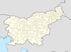
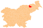
Gaj nad Mariborom (pronounced [ˈɡaːi̯ nat ˈmaːɾibɔɾɔm]; German: Heiligenkreuz[3]) is a settlement in the hills northwest of Maribor in northeastern Slovenia. It belongs to the City Municipality of Maribor.[4]
Name
[edit]The name of the settlement was changed from Sveti Križ (literally, 'Holy Cross') to Gaj nad Mariborom (literally, 'grove above Maribor') in 1955. The name was changed on the basis of the 1948 Law on Names of Settlements and Designations of Squares, Streets, and Buildings as part of efforts by Slovenia's postwar communist government to remove religious elements from toponyms.[5][6][7] In the past the German name was Heiligenkreuz.[3]
History
[edit]A school was established in the rectory in the settlement in 1810. A schoolhouse was built in 1898. Towards the end of the Second World War, the Partisans established positions in the settlement. The Partisans burned the school in 1944, and in 1945 they also burned the inn and rectory. A Partisan base was established at the Tojzl farm in 1944. In May 1945, German forces surrounded the Terbižar farm, where they killed two Partisans and the farm owner, Karl Dobaj.[8]
Church
[edit]The parish church in the settlement is dedicated to the Holy Cross and belongs to the Roman Catholic Archdiocese of Maribor. It was first mentioned in written documents dating to 1473.[9] The church was renovated after a fire in 1769, and was extended in 1884. It has Baroque furnishings. The two sculptures on the main altar are works by Veit Königer (1729–1792). The church records date back to 1786. The cemetery chapel is dedicated to John the Evangelist.[8]
Notable people
[edit]Notable people that were born or lived in Gaj nad Mariborom include:
- Franc Hauptman (1847–1925), education specialist and textbook author[8]
- Radoslav Pipuš (1864–1928), politician[8]
- Franc Simonič (1803–1866), education activist[8]
- Edo Verdonik (1908–1978), actor, singer, and director[8]
References
[edit]- ^ "Prebivalstvo po naseljih, podrobni podatki, Slovenija, 1. januar 2021". stat.si (in Slovenian). Archived from the original on 20 January 2022. Retrieved 12 May 2022.
- ^ "Statistical Office of the Republic of Slovenia". Archived from the original on 2008-11-18. Retrieved 2008-04-03.
- ^ a b Leksikon občin kraljestev in dežel zastopanih v državnem zboru, vol. 4: Štajersko. 1904. Vienna: C. Kr. Dvorna in Državna Tiskarna, p. 208.
- ^ Maribor municipal site
- ^ Spremembe naselij 1948–95. 1996. Database. Ljubljana: Geografski inštitut ZRC SAZU, DZS.
- ^ Premk, F. 2004. Slovenska versko-krščanska terminologija v zemljepisnih imenih in spremembe za čas 1921–1967/68. Besedoslovne lastnosti slovenskega jezika: slovenska zemljepisna imena. Ljubljana: Slavistično društvo Slovenije, pp. 113–132.
- ^ Urbanc, Mimi, & Matej Gabrovec. 2005. Krajevna imena: poligon za dokazovanje moči in odraz lokalne identitete. Geografski vestnik 77(2): 25–43.
- ^ a b c d e f Savnik, Roman, ed. 1980. Krajevni leksikon Slovenije, vol. 4. Ljubljana: Državna založba Slovenije. pp. 226–227.
- ^ Slovenian Ministry of Culture register of national heritage reference number 3085

