Gaj nad Mariborom: Difference between revisions
Appearance
Content deleted Content added
m Stub-sorting. You can help! |
|||
| Line 117: | Line 117: | ||
==External links== |
==External links== |
||
*[http://www.geopedia.si/# |
*[http://www.geopedia.si/Geopedia_en.html#L5567_F10147492_T1193_vF_b4_x543380.906_y164600_s13 Gaj nad Mariborom at Geopedia] |
||
*[http://www.maplandia.com/ Search satellite map at Maplandia.com] |
*[http://www.maplandia.com/ Search satellite map at Maplandia.com] |
||
Revision as of 19:33, 15 September 2009
Gaj nad Mariborom | |
|---|---|
 | |
| Country | |
| Region | Lower Styria |
| Municipality | Maribor |
| [1] | |
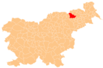
Gaj nad Mariborom is a village in north-eastern Slovenia in the municipality of Maribor [2].
References
- ^ Statistical Office of the Republic of Slovenia
- ^ Falling rain gazetteer
