Hardgate: Difference between revisions
m en-GB |
Fix Easter Egg |
||
| (9 intermediate revisions by 9 users not shown) | |||
| Line 2: | Line 2: | ||
{{Use British English|date=September 2019}} |
{{Use British English|date=September 2019}} |
||
{{Infobox UK place |
{{Infobox UK place |
||
| static_image_name = Hardgate from the air (geograph 3988302).jpg |
|||
| static_image_caption = An aerial view of the town of Hardgate |
|||
| country = Scotland |
|||
| official_name = Hardgate |
|||
| gaelic_name = |
|||
| label_position = left |
|||
| population = |
|||
| population_ref = |
|||
| os_grid_reference = NS502725 |
|||
| coordinates = {{coord|55.922|-4.403|display=inline,title}} |
|||
| pushpin_map = Scotland West Dunbartonshire#Scotland Glasgow |
|||
| civil_parish = |
|||
| unitary_scotland = |
|||
| lieutenancy_scotland = [[Dunbartonshire]] |
|||
| constituency_westminster = [[West Dunbartonshire (UK Parliament constituency)|West Dunbartonshire]] |
|||
| constituency_scottish_parliament = [[Clydebank and Milngavie (Scottish Parliament constituency)|Clydebank and Milngavie]] |
|||
| post_town = Clyddebank |
|||
| postcode_district = G81 |
|||
| postcode_area = G |
|||
|dial_code= 01389 |
|||
| dial_code = 01389 |
|||
}} |
|||
'''Hardgate''' is a village in [[West Dunbartonshire]], [[Scotland]]. |
'''Hardgate''' is a village in [[West Dunbartonshire]], [[Scotland]]. |
||
Hardgate has probably been settled since [[neolithic]] times with a burial site at Knappers Farm, |
Hardgate has probably been settled since [[neolithic]] times with a burial site at Knappers Farm, the [[Cochno Stone]] (a [[cup and ring mark]]ed stone), and a [[Chamber tomb|burial chamber]] near [[Cochno Loch]] providing evidence of this.<ref name=clydebankstory>{{cite web|url=http://www.theclydebankstory.com/story_TCSA08.php |title=The Leading The Clydebank Story Site on the Net |publisher=TheClydebankStory.com |date= |accessdate=2014-06-18}}</ref> |
||
Although it is a far older settlement, it is administratively part of nearby [[Clydebank]] along with the neighbouring village of [[Duntocher]] and now lies in the [[West Dunbartonshire]] local authority area. |
Although it is a far older settlement, it is administratively part of nearby [[Clydebank]] along with the neighbouring village of [[Duntocher]] and now lies in the [[West Dunbartonshire]] local authority area. Along with Duntocher and [[Faifley]], Hardgate falls within West Dunbartonshiire's ''Kilpatrick'' ward with a combined population of 12,719 in 2011.<ref>[https://www.west-dunbarton.gov.uk/council/about-west-dunbartonshire/council-ward-boundaries-and-profiles/kilpatrick-ward/ Kilpatrick Central Ward - Area Profile], [[West Dunbartonshire Council]]</ref> |
||
Dunn's Mills operated a cotton mill in the 19th century. It continued to produce thread and yarn until its destruction during the [[Clydebank Blitz]] in 1941.<ref>{{cite book|last=Hood|first=John|title=Old Bowling, Duntocher, Hardgate, Milton and Old Kilpatrick|publisher=Stenlake Publishing|isbn=1840333197|page=45}}</ref> |
Dunn's Mills operated a cotton mill in the 19th century. It continued to produce thread and yarn until its destruction during the [[Clydebank Blitz]] in 1941.<ref>{{cite book|last=Hood|first=John|title=Old Bowling, Duntocher, Hardgate, Milton and Old Kilpatrick|publisher=Stenlake Publishing|isbn=1840333197|page=45}}</ref> |
||
The village expanded due to house building by [[Clydebank]] town council after [[World War II]], and later by the Wimpey firm in the early 1970s on what had been [[green belt]] land. |
The village expanded due to house building by the [[Clydebank]] town council after [[World War II]], and later by the [[George Wimpey|Wimpey]] firm in the early 1970s on what had been [[green belt]] land. |
||
The village has one [[non-denominational]] school, Goldenhill Primary School. |
|||
==References== |
==References== |
||
| Line 38: | Line 41: | ||
==External links== |
==External links== |
||
{{commons |
{{commons category-inline|Hardgate, West Dunbartonshire}} |
||
{{Areas of Clydebank}} |
{{Areas of Clydebank}} |
||
{{West Dunbartonshire Settlements}} |
{{West Dunbartonshire Settlements}} |
||
{{authority control}} |
|||
[[Category:Villages in West Dunbartonshire]] |
[[Category:Villages in West Dunbartonshire]] |
||
[[Category:Neolithic Scotland]] |
[[Category:Neolithic Scotland]] |
||
[[Category:Clydebank]] |
[[Category:Clydebank]] |
||
{{WestDunbartonshire-geo-stub}} |
{{WestDunbartonshire-geo-stub}} |
||
Latest revision as of 21:11, 23 September 2024
| Hardgate | |
|---|---|
 An aerial view of the town of Hardgate | |
| OS grid reference | NS502725 |
| Lieutenancy area | |
| Country | Scotland |
| Sovereign state | United Kingdom |
| Post town | Clyddebank |
| Postcode district | G81 |
| Dialling code | 01389 |
| Police | Scotland |
| Fire | Scottish |
| Ambulance | Scottish |
| UK Parliament | |
| Scottish Parliament | |
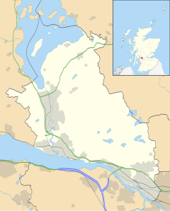
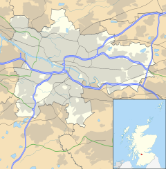
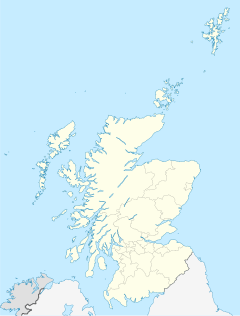
Hardgate is a village in West Dunbartonshire, Scotland.
Hardgate has probably been settled since neolithic times with a burial site at Knappers Farm, the Cochno Stone (a cup and ring marked stone), and a burial chamber near Cochno Loch providing evidence of this.[1]
Although it is a far older settlement, it is administratively part of nearby Clydebank along with the neighbouring village of Duntocher and now lies in the West Dunbartonshire local authority area. Along with Duntocher and Faifley, Hardgate falls within West Dunbartonshiire's Kilpatrick ward with a combined population of 12,719 in 2011.[2]
Dunn's Mills operated a cotton mill in the 19th century. It continued to produce thread and yarn until its destruction during the Clydebank Blitz in 1941.[3]
The village expanded due to house building by the Clydebank town council after World War II, and later by the Wimpey firm in the early 1970s on what had been green belt land.
The village has one non-denominational school, Goldenhill Primary School.
References
[edit]- ^ "The Leading The Clydebank Story Site on the Net". TheClydebankStory.com. Retrieved 18 June 2014.
- ^ Kilpatrick Central Ward - Area Profile, West Dunbartonshire Council
- ^ Hood, John. Old Bowling, Duntocher, Hardgate, Milton and Old Kilpatrick. Stenlake Publishing. p. 45. ISBN 1840333197.
External links
[edit]![]() Media related to Hardgate, West Dunbartonshire at Wikimedia Commons
Media related to Hardgate, West Dunbartonshire at Wikimedia Commons


