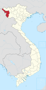
Huổi Só: Difference between revisions
Appearance
Content deleted Content added
m WP:CHECKWIKI error 54|52|37|88|6|57|44|26|38|55|63|65 fixes + general fixes using AWB (7879) |
m Moving Category:Communes of Điện Biên Province to Category:Communes of Điện Biên province per Wikipedia:Categories for discussion/Speedy |
||
| (10 intermediate revisions by 9 users not shown) | |||
| Line 1: | Line 1: | ||
{{Unreferenced|date=November 2019}} |
|||
{{Infobox settlement |
{{Infobox settlement |
||
|name =Huổi |
|name = Huổi Só |
||
|other_name = |
|other_name = |
||
|native_name = |
|native_name = |
||
|settlement_type =[[ |
|settlement_type = [[Commune-level subdivisions (Vietnam)|Commune]] and village |
||
|image_skyline = |
|image_skyline = |
||
|imagesize = |
|imagesize = |
||
|image_caption = |
|image_caption = |
||
|pushpin_map = |
|pushpin_map = |
||
|pushpin_label_position =right |
|pushpin_label_position = right |
||
|pushpin_map_caption =Location in Vietnam |
|pushpin_map_caption = Location in Vietnam |
||
|subdivision_type = Country |
|subdivision_type = Country |
||
|subdivision_name = {{flag|Vietnam}} |
|subdivision_name = {{flag|Vietnam}} |
||
|subdivision_type1 = [[Provinces of Vietnam|Province]] |
|subdivision_type1 = [[Provinces of Vietnam|Province]] |
||
|subdivision_name1 |
|subdivision_name1 = [[Điện Biên Province|Điện Biên]] |
||
|subdivision_type2 =[[Districts of Vietnam|District]] |
|subdivision_type2 = [[Districts of Vietnam|District]] |
||
|subdivision_name2 |
|subdivision_name2 = [[Tủa Chùa District|Tủa Chùa]] |
||
|leader_title = |
|leader_title = |
||
|leader_name = |
|leader_name = |
||
|established_title = |
|established_title = |
||
|established_date = |
|established_date = |
||
|area_total_km2 |
|area_total_km2 = |
||
|population_as_of |
|population_as_of = |
||
|population_footnotes |
|population_footnotes = |
||
|population_total |
|population_total = |
||
|population_density_km2 |
|population_density_km2 = |
||
|timezone = |
|timezone = Indochina Time |
||
|utc_offset = + |
|utc_offset = +07:00 |
||
|timezone_DST = |
|timezone_DST = |
||
|utc_offset_DST = |
|utc_offset_DST = |
||
|coordinates = |
|||
|latd=|latm=|lats= |latNS=N |
|||
|longd=|longm=|longs=|longEW=E |
|||
|coordinates_type = region:VN_type:city |
|||
|elevation_footnotes = |
|elevation_footnotes = |
||
|elevation_m = |
|elevation_m = |
||
| Line 38: | Line 38: | ||
|footnotes = |
|footnotes = |
||
}} |
}} |
||
'''Huổi''' is a [[ |
'''Huổi Só''' is a [[Commune-level subdivisions (Vietnam)|commune]] (''xã'') and village of the [[Tủa Chùa District]] of [[Điện Biên Province]], northwestern [[Vietnam]]. |
||
{{Dien Bien Province}} |
{{Dien Bien Province}} |
||
{{coord missing|Vietnam}} |
|||
| ⚫ | |||
| ⚫ | |||
{{coord|22.0803|N|103.4156|E|source:wikidata|display=title}} |
|||
{{DEFAULTSORT:Huoi}} |
|||
| ⚫ | |||
| ⚫ | |||
{{DienBien-geo-stub}} |
{{DienBien-geo-stub}} |
||
