Jibshit, Nabatieh: Difference between revisions
removed vandalism Tag: Reverted |
|||
| Line 131: | Line 131: | ||
In 1875 [[Victor Guérin]] found here a village of 400 [[Metualis]], and a [[Wali]], named Nabi Seth.<ref>Guérin, 1880, p. [https://archive.org/stream/descriptiongogr00gugoog#page/n567/mode/1up 527]</ref> |
In 1875 [[Victor Guérin]] found here a village of 400 [[Metualis]], and a [[Wali]], named Nabi Seth.<ref>Guérin, 1880, p. [https://archive.org/stream/descriptiongogr00gugoog#page/n567/mode/1up 527]</ref> |
||
In 1993, during a [[Operation Accountability|week-long attack]] by [[Israel]] on Lebanon; "an Israeli Army spokesperson said that “70 percent of the village of |
In 1993, during a [[Operation Accountability|week-long attack]] by [[Israel]] on Lebanon; "an Israeli Army spokesperson said that “70 percent of the village of Jibchit is totally destroyed, its inhabitants will not recognize it.” The goal is “to wipe the villages from the face of the earth,” a senior officer added."<ref>[[Noam Chomsky]], [https://chomsky.info/199309__/ “Limited War” in Lebanon], orig. published in [[Z Magazine]], September, 1993</ref> |
||
==See also== |
==See also== |
||
Revision as of 22:34, 23 October 2021
Jebchit
جبشيت | |
|---|---|
village | |
| Coordinates: 33°21′50″N 35°25′48″E / 33.36389°N 35.43000°E | |
| Grid position | 121/159 L |
| Country | |
| Governorate | Nabatieh Governorate |
| District | Nabatieh District |
| Time zone | UTC+2 (EET) |
| • Summer (DST) | +3 |
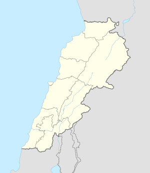
Jebchit (Template:Lang-ar) is a village in the Nabatieh Governorate region of southern Lebanon located north of the Litani River.
History
In 1596, it was named as a village, Jibsid, in the Ottoman nahiya (subdistrict) of Sagif under the liwa' (district) of Safad, with a population of 39 households and 10 bachelors, all Muslim. The villagers paid a fixed tax-rate of 25% on agricultural products, such as wheat, barley, olive trees, fruit trees, goats, beehives and "Occasional revenues"; a total of 5,040 akçe.[1][2]
In 1875 Victor Guérin found here a village of 400 Metualis, and a Wali, named Nabi Seth.[3]
In 1993, during a week-long attack by Israel on Lebanon; "an Israeli Army spokesperson said that “70 percent of the village of Jibchit is totally destroyed, its inhabitants will not recognize it.” The goal is “to wipe the villages from the face of the earth,” a senior officer added."[4]
See also
References
- ^ Hütteroth and Abdulfattah, 1977, p. 184
- ^ Note that Rhode, 1979, p. 6 writes that the register that Hütteroth and Abdulfattah studied was not from 1595/6, but from 1548/9
- ^ Guérin, 1880, p. 527
- ^ Noam Chomsky, “Limited War” in Lebanon, orig. published in Z Magazine, September, 1993
Bibliography
- Guérin, V. (1880). Description Géographique Historique et Archéologique de la Palestine (in French). Vol. 3: Galilee, pt. 2. Paris: L'Imprimerie Nationale.
- Hütteroth, Wolf-Dieter; Abdulfattah, Kamal (1977). Historical Geography of Palestine, Transjordan and Southern Syria in the Late 16th Century. Erlanger Geographische Arbeiten, Sonderband 5. Erlangen, Germany: Vorstand der Fränkischen Geographischen Gesellschaft. ISBN 3-920405-41-2.
- Rhode, H. (1979). Administration and Population of the Sancak of Safed in the Sixteenth Century (PhD). Columbia University.
External links
- Official Website : www.jebchit.com
- Jibchit, Localiban

