Pala, Kerala: Difference between revisions
Tag: Disambiguation links added |
|||
| Line 87: | Line 87: | ||
== Transportation == |
== Transportation == |
||
KL-35 is the RTO code for Pala RTO division. Auto rickshaws are commonly used for small distances. Taxis are also available. The Cochin International Airport at Nedumbassery is 70 km away from Pala town. The nearest railway station is [[Ettumanoor]] at 17 Km and [[Kottayam railway station]] of 28 km away. |
KL-35 is the RTO code for Pala RTO division. Auto rickshaws are commonly used for small distances. Taxis are also available. The [[Cochin International Airport]] at Nedumbassery is 70 km away from Pala town. The nearest railway station is [[Ettumanoor]] at 17 Km and [[Kottayam railway station]] of 28 km away. |
||
Pala is well connected with State Highway 32 (SH 32) Ettumanoor- Pala- Poonjar Highway. This highway connects Pala to [[Ettumanoor]] [[MC Road]][[(SH-01)]] and gives access to [[Kottayam]],[[Thiruvananthapuram]], Alappuzha, Kumarakom and to major towns in south Kerala. Also its connects to Erattupetta and give access to [[Bharananganam]], [[Aruvithura Church]], [[Poonjar]], [[Vagamon]], [[Elappara]], [[Kattappana]] and to various places of high ranges in Kerala. |
[[Pala]] is well connected with State Highway 32 (SH 32) Ettumanoor- Pala- Poonjar Highway. This highway connects Pala to [[Ettumanoor]] [[MC Road]][[(SH-01)]] and gives access to [[Kottayam]],[[Thiruvananthapuram]], Alappuzha, Kumarakom and to major towns in south Kerala. Also its connects to Erattupetta and give access to [[Bharananganam]], [[Aruvithura Church]], [[Poonjar]], [[Vagamon]], [[Elappara]], [[Kattappana]] and to various places of high ranges in Kerala. |
||
The [[Main Eastern Highway]] ([[Punalur]]- [[Muvattupuzha]]) also passing through Pala. It's categorized as State Highway - 08 is the second-longest State Highway of Kerala covering a distance of {{cvt|153.6|km}}. The districts it passes through are Kollam, Pathanamthitta, Kottayam, Idukki, and Ernakulam. These highway connect Pala to [[Muvattupuzha]] [[MC Road]][[ (SH-01)]], [[Thodupuzha]], [[Ponkunnam]], [[Manimala]], [[Ranni]], [[Pathanamthitta]], [[Punalur]]. The [[Ponkunnam]]- Pala- [[Thodupuzha]]- [[Muvattupuzha]] stretch of [[Main Eastern Highway]] was upgraded in 2016 to a width of {{convert|15|meter}}.This makes it easy to access for the people of Highranges, tourists to [[Thekkady]] and pilgrims of [[Sabarimala]] to reach [[Muvattupuzha]] and [[Angamaly]]. |
The [[Main Eastern Highway]] ([[Punalur]]- [[Muvattupuzha]]) also passing through Pala. It's categorized as State Highway - 08 is the second-longest State Highway of Kerala covering a distance of {{cvt|153.6|km}}. The districts it passes through are [[Kollam]], |
||
[[Pathanamthitta]], [[Kottayam]], [[Idukki]], and [[Ernakulam]]. These highway connect Pala to [[Muvattupuzha]] [[MC Road]][[ (SH-01)]], [[Thodupuzha]], [[Ponkunnam]], [[Manimala]], [[Ranni]], [[Pathanamthitta]], [[Punalur]]. The [[Ponkunnam]]- Pala- [[Thodupuzha]]- [[Muvattupuzha]] stretch of [[Main Eastern Highway]] was upgraded in 2016 to a width of {{convert|15|meter}}.This makes it easy to access for the people of Highranges, tourists to [[Thekkady]] and pilgrims of [[Sabarimala]] to reach [[Muvattupuzha]] and [[Angamaly]]. |
|||
Pala is connected with [[Vaikom]] and [[Ernakulam]] through Pala- [[Kozha]] road and [[Koothattukulam]] is connected via [[Ramapuram, Kottayam|Ramapuram]] and [[Uzhavoor]] roads. Pala also have |
Pala is connected with [[Vaikom]] and [[Ernakulam]] through Pala- [[Kozha]] road and [[Koothattukulam]] is connected via [[Ramapuram, Kottayam|Ramapuram]] and [[Uzhavoor]] roads. Pala also have bypass, river view road and ring road which serves the town to reduce traffic |
||
Pala is served with a KSRTC Bus station and two private bus stands. Daily, there are many buses to [[Kottayam]], [[Changanassery]], [[Kumily]], [[Kochi]], [[Thiruvananthapuram]], [[Thrissur]], [[Kozhikode]],[[Kannur]], [[Wayanad]],[[Kasargod]],[[Mysore]], [[Bangalore]],[[Coimbatore]] and also to the nearest towns: |
Pala is served with a KSRTC Bus station and two private bus stands. Daily, there are many buses to [[Kottayam]], [[Changanassery]], [[Kumily]], [[Kochi]], [[Thiruvananthapuram]], [[Thrissur]], [[Kozhikode]],[[Kannur]], [[Wayanad]],[[Kasargod]],[[Mysore]], [[Bangalore]],[[Coimbatore]] and also to the nearest towns: |
||
Revision as of 08:34, 6 July 2022
This article has multiple issues. Please help improve it or discuss these issues on the talk page. (Learn how and when to remove these messages)
|
Pala | |
|---|---|
 Pala___Town | |
| Coordinates: 9°42′46″N 76°41′01″E / 9.71278°N 76.68353°E | |
| Country | India |
| State | Kerala |
| District | Kottayam |
| Government | |
| • Type | Municipality |
| • Body | Pala Municipality |
| • Municipal Chairperson | Mrs. Mary Dominic |
| • Member of the Legislative Assembly of Kerala (MLA) | Mani C. Kappan |
| Area | |
| • Total | 16 km2 (6 sq mi) |
| Elevation | 31 m (102 ft) |
| Population | |
| • Total | 22,056 |
| • Density | 1,400/km2 (3,600/sq mi) |
| Languages | |
| • Official | Malayalam, English |
| Time zone | UTC+5:30 (IST) |
| PIN | 686574, 686575 |
| Telephone code | +9148 22 |
| Vehicle registration | KL 35 |
| Nearest city | Kottayam |
| Vidhan Sabha constituency | Pala |
| Lok Sabha constituency | Kottayam |
| Official website | Official site |
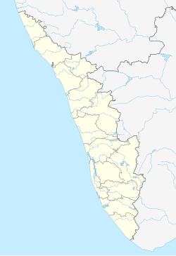
Pala (also written as Palai) is a town and a municipality in Kerala, India. It is the headquarters of the Meenachil Taluk and the Pala Revenue Division.
Pala is situated on the banks of the Meenachil river. It is one of the main gateways to the southern high ranges of the Western Ghats.[3]
Demographics
As of 2001[update] Indian census,[4] Pala had a population of 22,640. Males constitute 49% of the population and females 51%. Pala has an average literacy rate of 98%, higher than the national average of 73%: male literacy is 98.5%, and female literacy is 97.8%, still much higher than the state average. 10% of the population is under 6 years of age. Christians make up 65.09% of the population, Hindus 34.19%, Muslims 0.00%, Jain 0.00%, other religions 0.05% and 0.15% not stated.
Cuisine of Pala
Appams, Kallappams, or Vellayappams are rice flour pancakes that have soft, thick white spongy centres and crisp, lace-like edges.[5]
Beef ularthiyathu is a beef dish cooked with a variety of Indian spices. Other dishes include Peralan (chicken stir-fries), Meat Thoran (dry curry with shredded coconut), sardine and duck curries, and Meen molee (spicy stewed fish).[5]
Transportation
KL-35 is the RTO code for Pala RTO division. Auto rickshaws are commonly used for small distances. Taxis are also available. The Cochin International Airport at Nedumbassery is 70 km away from Pala town. The nearest railway station is Ettumanoor at 17 Km and Kottayam railway station of 28 km away.
Pala is well connected with State Highway 32 (SH 32) Ettumanoor- Pala- Poonjar Highway. This highway connects Pala to Ettumanoor MC Road(SH-01) and gives access to Kottayam,Thiruvananthapuram, Alappuzha, Kumarakom and to major towns in south Kerala. Also its connects to Erattupetta and give access to Bharananganam, Aruvithura Church, Poonjar, Vagamon, Elappara, Kattappana and to various places of high ranges in Kerala.
The Main Eastern Highway (Punalur- Muvattupuzha) also passing through Pala. It's categorized as State Highway - 08 is the second-longest State Highway of Kerala covering a distance of 153.6 km (95.4 mi). The districts it passes through are Kollam,
Pathanamthitta, Kottayam, Idukki, and Ernakulam. These highway connect Pala to Muvattupuzha MC Road(SH-01), Thodupuzha, Ponkunnam, Manimala, Ranni, Pathanamthitta, Punalur. The Ponkunnam- Pala- Thodupuzha- Muvattupuzha stretch of Main Eastern Highway was upgraded in 2016 to a width of 15 meters (49 ft).This makes it easy to access for the people of Highranges, tourists to Thekkady and pilgrims of Sabarimala to reach Muvattupuzha and Angamaly.
Pala is connected with Vaikom and Ernakulam through Pala- Kozha road and Koothattukulam is connected via Ramapuram and Uzhavoor roads. Pala also have bypass, river view road and ring road which serves the town to reduce traffic
Pala is served with a KSRTC Bus station and two private bus stands. Daily, there are many buses to Kottayam, Changanassery, Kumily, Kochi, Thiruvananthapuram, Thrissur, Kozhikode,Kannur, Wayanad,Kasargod,Mysore, Bangalore,Coimbatore and also to the nearest towns:
- Nearest Airport - Cochin International Airport - 70 km
- Nearest Railway Station - Ettumanoor railway station - 17 km
- Nearest Bus Station - Pala
Sports
The Municipal Stadium is the centre of sports in Pala.[6] The multipurpose stadium can be used for conducting athletic events and football. The stadium also has a synthetic track and a football turf. There is also an indoor swimming pool in the sports complex.
The 61st Kerala State Schools Athletics Championships was held at the stadium in 2017.[7] At least 2500 students from 100 schools attended the sports meet.[8] The 63rd Kerala State Athletics Championship was also held at the stadium in the month of October, 2019.[9]
Meenachil River
The Meenachil River (Malayalam: മീനച്ചിലാർ) flows through the heart of Kottayam district, Kerala state in southern India. 78km long, the river originates in the Western Ghats near Poonjar, flowing westward through the city of Kottayam and other towns like Poonjar, Teekoy, Erattupetta, Bharananganam, Pala, Mutholy, Cherpunkal, Kidangoor and Kumarakom before emptying into the Vembanad Lake on the shore of the Indian Ocean.[1][2]
General elevation ranges from 77 m to 1156 m in the highlands and less than 2 m in the lowlands and 8 to 68 m in the midlands. The Meenachil has a watershed area of 1208.11 km². The river has a total annual yield of 2,349 million cubic metre and an annual utilizable yield of 1110 million cubic metre. The river has 38 tributaries including major and minor ones.
The name Meenachil is derived from the name of Goddess Meenakshi of Madurai. The river finds mention in Arundhati Roy's Booker Prize-winning novel, The God of Small Things.[3]
See also
- Bharananganam
- Cherpunkal
- List of people from Pala
- Meenachil
- Meenachil River
- Pala (State Assembly constituency)
- Ullanadu
References
- ^ "Kerala (India): Districts, Cities and Towns - Population Statistics, Charts and Map".
- ^ "About Pala". The Hindu. Retrieved 25 May 2017.
- ^ "Home | Pala Municipality". Pala Municipality. Archived from the original on 10 November 2020. Retrieved 8 July 2021.
- ^ "Census of India 2001: Data from the 2001 Census, including cities, villages and towns (Provisional)". Census Commission of India. Archived from the original on 16 June 2004. Retrieved 1 November 2008.
- ^ a b Marks, Gil (2010), Encyclopedia of Jewish Food, John Wiley and sons
- ^ "Municipal Stadium". Pala Municipality.
- ^ "State School sports meet to begin tomorrow; Rally carrying torch reaches Pala".
- ^ "Stage set for Kerala schools athletics meet but field wide open". Times Of India. 20 October 2017.
- ^ "Kerala state junior athletics: Young stars get chance to make big".


