Puerto Rico Bank: Difference between revisions
Simplified note tag Tags: Mobile edit Mobile web edit |
→Notes: Corrected note format Tags: Mobile edit Mobile web edit |
||
| Line 39: | Line 39: | ||
==Notes== |
==Notes== |
||
{{ |
{{Notelist}} |
||
==References== |
==References== |
||
{{reflist}} |
{{reflist}} |
||
Latest revision as of 01:21, 6 October 2024
 Puerto Rico Bank and major surrounding geological features | |
| Other names | Greater Puerto Rico Bank |
| Geography | |
| Location | Caribbean |
| Coordinates | 18°17′00″N 65°36′00″W / 18.28333°N 65.60000°W |
| Archipelago | Puerto Rico Virgin Islands |
| Area | 21.000 km2 (8.108 sq mi) |
| Administration | |
| Islands and Cays | 140[a] |
| Islands and Cays | 52[b][1] |
| Islands and Cays | 36[1] |
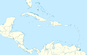
The Puerto Rico Bank (PRB) (Spanish: Banco de Puerto Rico), also known as the Greater Puerto Rico Bank (PRB), is a submerged carbonate platform comprising the archipelagos of Puerto Rico[a] and the Virgin Islands.[b] Measuring 350 km (218 mi) in length, 40 to 80 km (25 to 50 mi) in width, and up to 79 m (260 ft) in depth, the bank is separated from the Greater Antilles by the Mona Passage, and from the Lesser Antilles by the Anegada passage. With an area of 21,000 sq km (8,108 sq mi), it was last fully exposed during the Last Glacial Maximum when the sea level was 120 m (400 ft) lower than the present-day. The bank was inundated by sea level rise during the Late Pleistocene and Early Holocene, losing subaerial connection the Virgin Islands with each other and with Puerto Rico 10,000 to 8,000 years ago, and the main island of Puerto Rico with the islands of Vieques, Caja de Muertos, and other cays and islets 6,000 years ago.

Notes
[edit]- ^ a b Excluding the westernmost islands of Desecheo, Mona, and Monito, which are politically part of the archipelago of Puerto Rico, but are not geologically part of the Puerto Rico Bank.
- ^ a b Excluding the southernmost island of Saint Croix, which is politically part of the Virgin Islands, but is not geologically part of the Puerto Rico Bank.
References
[edit]- ^ a b "Where is the U.S. Virgin Islands: Geography". Virgin Islands. Retrieved 2024-10-05.
