Shibchar Upazila: Difference between revisions
cleanup |
Information added with citation. Tags: Visual edit Mobile edit Mobile web edit |
||
| Line 51: | Line 51: | ||
==Administration== |
==Administration== |
||
Shibchar Thana was formed in 1930 and it was turned into an upazila in 1983.<ref name="Banglapedia" /> |
|||
Shibchar Upazila is divided into Shibchar Municipality and 19 [[union parishad]]s: Bahertala Dakshin, Baheratala Uttar, Bandarkhola, Baskandi, Charjanazat, Dattapara, Ditiyakhando, Kadirpur, Kathalbari, Kutubpur, Madbarerchar, Nilokhe, Panchar, Sannasirchar, Shibchar, Shiruail, Umedpur, Vhadrasion, and Vhandarikandi. The union parishads are subdivided into 108 mauzas and 519 villages.<ref name="district-stats" /> |
Shibchar Upazila is divided into Shibchar Municipality and 19 [[union parishad]]s: Bahertala Dakshin, Baheratala Uttar, Bandarkhola, Baskandi, Charjanazat, Dattapara, Ditiyakhando, Kadirpur, Kathalbari, Kutubpur, Madbarerchar, Nilokhe, Panchar, Sannasirchar, Shibchar, Shiruail, Umedpur, Vhadrasion, and Vhandarikandi. The union parishads are subdivided into 108 mauzas and 519 villages.<ref name="district-stats" /> |
||
Revision as of 16:38, 31 March 2023
Shibchar
শিবচর | |
|---|---|
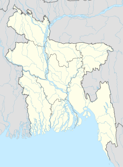
| Coordinates: 23°21′N 90°10′E / 23.350°N 90.167°E | |
| Country | Bangladesh |
| Division | Dhaka Division |
| District | Madaripur District |
| Area | |
| • Total | 321.88 km2 (124.28 sq mi) |
| Population (2011) | |
| • Total | 318.220[1] |
| Time zone | UTC+6 (BST) |
| Website | shibchar |
Shibchar (Bengali: শিবচর) is an upazila of Madaripur District in the Division of Dhaka, Bangladesh.[2]
Geography
Shibchar is located at 23°21′00″N 90°10′00″E / 23.3500°N 90.1667°E. It has 58085 households and total area 321.88 km2.
Demographics
As of the 1991 Bangladesh census, Shibchar has a population of 306082. Males constitute 51.46% of the population, and females 48.54%. This Upazila's eighteen up population is 143975. Shibchar has an average literacy rate of 26.9% (7+ years), and the national average of 32.4% literate.[3]
Administration
Shibchar Thana was formed in 1930 and it was turned into an upazila in 1983.[2]
Shibchar Upazila is divided into Shibchar Municipality and 19 union parishads: Bahertala Dakshin, Baheratala Uttar, Bandarkhola, Baskandi, Charjanazat, Dattapara, Ditiyakhando, Kadirpur, Kathalbari, Kutubpur, Madbarerchar, Nilokhe, Panchar, Sannasirchar, Shibchar, Shiruail, Umedpur, Vhadrasion, and Vhandarikandi. The union parishads are subdivided into 108 mauzas and 519 villages.[4]
Shibchar Municipality is subdivided into 9 wards and 17 mahallas.[4]
See also
- Upazilas of Bangladesh
- Districts of Bangladesh
- Divisions of Bangladesh
- Fazlur Khan, designer of Sears Tower.
References
- ^ "Bangladesh: Administrative Division (Districts and Subdistricts) - Population Statistics, Charts and Map".
- ^ a b Md. Shajahan Khan (2012), "Shibchar Upazila", in Sirajul Islam and Ahmed A. Jamal (ed.), Banglapedia: National Encyclopedia of Bangladesh (Second ed.), Asiatic Society of Bangladesh
- ^ "Population Census Wing, BBS". Archived from the original on 2005-03-27. Retrieved November 10, 2006.
- ^ a b "District Statistics 2011: Madaripur" (PDF). Bangladesh Bureau of Statistics. Archived from the original (PDF) on 13 November 2014. Retrieved 14 July 2014.

