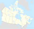
File:Canada location map 2.svg
Appearance

Size of this PNG preview of this SVG file: 709 × 600 pixels. Other resolutions: 284 × 240 pixels | 568 × 480 pixels | 908 × 768 pixels | 1,211 × 1,024 pixels | 2,422 × 2,048 pixels | 1,114 × 942 pixels.
Original file (SVG file, nominally 1,114 × 942 pixels, file size: 365 KB)
File history
Click on a date/time to view the file as it appeared at that time.
| Date/Time | Thumbnail | Dimensions | User | Comment | |
|---|---|---|---|---|---|
| current | 17:42, 29 December 2020 |  | 1,114 × 942 (365 KB) | MapGrid | added an international boundary line between Canada and St Pierre & Miquelon |
| 18:53, 25 December 2020 |  | 1,114 × 942 (365 KB) | MapGrid | Christmas Day edition... a few more rivers and other minor tweaks. | |
| 17:51, 15 November 2020 |  | 1,114 × 942 (360 KB) | MapGrid | Uploaded own work with UploadWizard |
File usage
More than 100 pages use this file. The following list shows the first 100 pages that use this file only. A full list is available.
- 100 Mile House
- 108 Mile Ranch
- Amherst, Nova Scotia
- Barkerville
- Beaver Creek, Yukon
- Belcher Islands
- Billy Bishop Toronto City Airport
- Black Diamond, Alberta
- Brandon, Manitoba
- Caledonia, Ontario
- Cambridge, Ontario
- Campobello Island
- Camrose, Alberta
- Canadian Baseball League
- Canadian Rocky Mountain Parks World Heritage Site
- Charlevoix
- Churchill, Manitoba
- Coleville, Saskatchewan
- Dartmouth, Nova Scotia
- Edmonton International Airport
- Elora, Ontario
- Faro, Yukon
- Flin Flon
- Fort McMurray
- Gaspé Peninsula
- Grande Prairie
- Greater Moncton Roméo LeBlanc International Airport
- Greater Sudbury
- Greater Toronto Area
- Grise Fiord
- Halifax Stanfield International Airport
- Hamilton, Ontario
- Igloolik
- Inuvik
- Kamloops
- Kentville
- Kingston, Ontario
- Kitchener, Ontario
- Lake Louise, Alberta
- Leduc, Alberta
- Lennoxville, Quebec
- Lethbridge
- Lillooet
- London International Airport
- Medicine Hat
- Moncton
- Montréal–Mirabel International Airport
- Moosonee
- Niagara Falls, Ontario
- Nipawin
- North Battleford
- Ottawa
- Parry Sound, Ontario
- Penticton
- Point Pelee National Park
- Pond Inlet
- Port Hawkesbury
- Prince Albert, Saskatchewan
- Prince George, British Columbia
- Prince Rupert, British Columbia
- Quebec City
- Quttinirpaaq National Park
- Rankin Inlet
- Red Deer, Alberta
- Regina, Saskatchewan
- Regional Municipality of Peel
- Richmond Hill, Ontario
- Rosthern
- Sable Island
- Saint John, New Brunswick
- San Diego International Airport
- Sarnia
- Saskatoon
- Sherbrooke
- Spruce Grove
- St. Albert, Alberta
- Stratford, Ontario
- Swastika, Ontario
- Swift Current
- Sylvan Lake, Alberta
- The Pas
- Timmins
- Toronto Islands
- Trois-Rivières
- Tulita
- Ukkusiksalik National Park
- Vancouver
- Vernon, British Columbia
- Victoria, British Columbia
- Vulcan, Alberta
- Wainwright, Alberta
- Waterloo, Ontario
- Weyburn
- Whatì
- Whistler, British Columbia
- White City, Saskatchewan
- Whitehorse
- Windsor, Ontario
- Wrigley, Northwest Territories
- Yarmouth, Nova Scotia
View more links to this file.
Global file usage
The following other wikis use this file:
- Usage on af.wikipedia.org
- Usage on azb.wikipedia.org
- Usage on ban.wikipedia.org
- Usage on ca.wikipedia.org
- Usage on es.wikipedia.org
View more global usage of this file.


