Conference Presentations by Mustafa Çidem
Küçük Asya'da irili ufaklı pek çok kentte tapınak, tiyatro, agora, bouleuterion (meclis binası), ... more Küçük Asya'da irili ufaklı pek çok kentte tapınak, tiyatro, agora, bouleuterion (meclis binası), nypheum (çeşme), propylaion (anıtsal giriş kapısı), villa, hamam ve kütüphane gibi mimari yapılar yer almaktadır. Öyle ki, bu yapılar yeknesak değildir; kıvrık dal, taç yapraklı rozet, giyoş, ranke, mask, defneyapraklı, gorgon ve mitolojik konulu kabartmalar gibi çeşitli süslemelere yer verilmiştir. Taş, mermer gibi sert ve sağlam parçalara işlenmiş bu süslemeler, estetik açıdan oldukça ilgi çekicidir ve eserlere canlı bir özellik katmıştır. Yanı sıra tarihleme açısından da büyük önem taşır. Sanatkar, süslemeleriyle taşa hayat vermiştir, bu canlılığı binlerce yıl sonra bize, ilgililerine sezdirmiştir. Bu bakımdan Kremna Antik Kenti'nin neredeyse hemen hemen her yapısında diğer kentlerdekine benzer ve yer yer ünik süslemeler görmek mümkündür.
Papers by Mustafa Çidem

GEPHYRA, 2024
İnarası is located within the borders of Taşyayla village in Bucak district of Burdur province. T... more İnarası is located within the borders of Taşyayla village in Bucak district of Burdur province. This place was discovered in 2008 by F. Gülşen from Burdur Museum, who went with the court committee to investigate the illegal excavation incident in İnarası; the registration efforts were completed in 2009, and the boundaries of the area were determined and added to the cultural inventory in 2014. The data obtained during the rescue excavations carried out in the cave, which was determined to be used as a sacred area and naos in 2016-2017, belong to the Late Neolithic Age and the Ottoman Period. One of the most striking issues in this study is the inscriptions. The first of the inscriptions is the one that documents that the sanctuary was dedicated to the goddess Artemis. The second inscription, it is learned that it is not the name of the person who had votived, but the name of his father. In addition, it is suggested that a fragmentary inscription containing the letters ΜΗΤΡΙ<O may have been associated with Meter Oreia or Demeter. Another important subject of the study is the architectural elements that provide important clues regarding the restitution of the two facade arrangements of the sanctuary. It is known that in the Anatolian theological tradition, the continuity of the cult was ensured by the identification of the Mother Goddess with the belief in Ephesian Artemis. For this reason, the presence of worship areas related to the Mother Goddess on the main rock surrounding the sacred area in İnarası and on the hill to the north, and the construction of the Artemis sacred area in the same region later, are important evidence of the continuity of the cult.
Türkiye Turizm Ansiklopedisi, 2024
Türkiye Turizm Ansiklopedisi (Madde yazımı), 2024. Herakles Lahdi (Beyşehir), Eroslu Lahit (Side)... more Türkiye Turizm Ansiklopedisi (Madde yazımı), 2024. Herakles Lahdi (Beyşehir), Eroslu Lahit (Side), Antigonos Lahdi (İznik).
N A Z İ L L İ, Cumhuriyetin 100. Yıl Anısına / In memory of the 100 th year of the Republic, 2023., 2023
In memory of the 100 th year of the Republic DOĞA-KÜLTÜR-TURİZM NATURE-CULTURE-TOURISM Eren GÖNÜL... more In memory of the 100 th year of the Republic DOĞA-KÜLTÜR-TURİZM NATURE-CULTURE-TOURISM Eren GÖNÜL-Aytekin KALKAN Editörler ''Nazilli will become a province with its development in the future'' ''Nazilli atide göstereceği gelişme ile vilayet merkezi olacaktır.'' Mustafa Kemal Atatürk, 9 Ekim 1937.

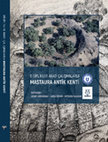
Mastaura Antik Kenti Su Sistemleri Üzerine İlk Gözlemler/First Observations on Water Systems of the Ancient City Of Mastaura, 2022
The ancient city of Mastaura is in a valley surrounded by high hills on the borders of Bozyurt, D... more The ancient city of Mastaura is in a valley surrounded by high hills on the borders of Bozyurt, Dereağzı and Eycelli neighborhoods of Nazilli District of Aydın Province. The city was founded on fertile lands irrigated by the Kharysaoris Stream flowing into the Maiandros River. It is located close to the Capu Viae trade route, which starts from Ephesos and progresses to Kelainai. Archaeological data documented as belonging to the Hellenistic, Roman, Byzantine and Ottoman Periods have been identified in the city. Since the 18th century, it has been the subject of some studies, attracting the attention of travelers and researchers. Archaeological studies initiated by S. Akkurnaz since 2020 are still continuing. The article presented here aims to introduce the observations and available data regarding the water supply in the territory of Mastaura. Firstly, the water transmission systems of the city were examined under two headings as north and south. Among these structures, components of water systems such as aqueduct, terracotta pipe, canal on the wall line and waste water line were evaluated. Then, subjects such as construction techniques of water transmission systems, construction materials and gps coordinates were tried to be conveyed. Today, water-related structures are partially, if not completely preserved, and some are observable on the surface. In line with the aforementioned data, the coordinates of the buildings were transferred to the topographic map of the city. In this way, the visibility of the structures belonging to the waterway on the map was ensured, and the first investigations were made on the city's clean water supply and waste water line in the light of the available data.

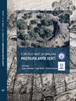
Mastaura'dan Bezemeli İki Mimari Blok/Two Archıtectural Block Decorated From Mastaura, 2022
The ancient city of Mastaura is located among the neighborhoods of Bozyurt, Dereağzı and Eycelli,... more The ancient city of Mastaura is located among the neighborhoods of Bozyurt, Dereağzı and Eycelli, 3 kilometers north of Nazilli District in the province of Aydın. It is one of the major cities along the old Caput Viae road, which connected the Aegean coast to the interior of Anatolia. The city is located in the valley where the Khrysaoris brook, one of the northern tributaries connected to the Maiandros River, passes in the parts where the Messogis (Aydın Mountains) meets the plain. It is bordered by steep slopes and large and tiny hills. The city has been frequented by visitors and researchers in Nazilli and its environs since the 18th century. Since 2020, modern archaeological studies have been started. The city's archaeological records contain information from the Hellenistic, Roman, Byzantine, and Ottoman eras. This study examines two ornamented architectural blocks. These are the M1 embellished lintel-frieze block and the M2 corner crown block. Lesbos kymation, Ionic kymation, and anthemion decorations on the blocks were compared with various specimens in terms of typological and stylistic characteristics, and their developmental stage was determined. The intermediate leaf tips of the Lesbos kymation ornament in M1 produce a concave fold and acquire the appearance of a volute, which is a distinctive characteristic. The Ionic kymation and anthemion ornaments in M2 closely resemble the classically utilized embellishments in Anatolia's architectural field. Based on our research, the M1 and M2 architectural blocks can be dated to the second half of the second century BC and the first half of the first century AD.
Türkiye Turizm Ansiklopedisi, 2022
Türkiye Turizm Ansiklopedisi (Madde yazımı), 2022. Cilt 8- Kaman Kalehöyük Arkeoloji Müzesi, s. 1... more Türkiye Turizm Ansiklopedisi (Madde yazımı), 2022. Cilt 8- Kaman Kalehöyük Arkeoloji Müzesi, s. 155-156. Cilt 13- Tefenni Kent Belleği Tarım ve Antika Müzesi, s. 362-363. Cilt 13- Tekirdağ Arkeoloji ve Etnografya Müzesi, s. 368-369.

Kremna'da Bulunan Roma Dönemi'ne Ait Başlıkların Değerlendirilmesi, 2021
Cremna ancient city is located in the east of Hacıbağ District of Çamlık Village in Bucak Distric... more Cremna ancient city is located in the east of Hacıbağ District of Çamlık Village in Bucak District of Burdur Province. While cliffs surround the three sides of the city, the west is arranged with city walls. Due to its strategic location and geological features, it was organized as a Roman colonial city in Pisidia during the time of Emperor Augustus. Numerous explanations about the city were included in the notes written by travelers and researchers in the 19th century on Anatolia. The first scientific archaeological excavations in the city were carried out in 1970 by J. Inan. S. Mitchell carried out surveys between 1985-1987 and by H. Metin between 2013-2019. The subject of the article is the architectural capitals in the Colonnaded Street and the Great Propylaion. These are a total of six vertical bearing architectural elements in the form of Composite head (1), Corinthian head (3), and Anta header (2). Since the capitals, they were first made typological classification. Then, analogical comparisons with similar titles in Pisidian Region and other regions in Anatolia are given. The decorations are dated to the Early Antonine Period and the Early Severan Period. It should be noted that the Roman Empire coincided with a period of increased prosperity and increased construction activities. Namely, the Great Propylaion and the Colonnaded Street, which have a monumental facade architecture, appeared as architectural elements reflecting the Empire's glory in the Pisidian Region with some architectural arrangements in the second half of the 2nd century AD and the 3rd century AD. Based on the decorations on the headings used in this article, it aims to determine the related local examples in the region and reveal the headings' style developments by comparing them with the headings in different regions.
II. Uluslararası Kapadokya Sosyal Bilimler Öğrenci Kongresi Özet Bildiriler Kitabı, Feb 5, 2021

AMİSOS, 2020
Kremna, which is in the Pisidia Region, is located in the Hacıbağ neighborhood of the Çamlık Vill... more Kremna, which is in the Pisidia Region, is located in the Hacıbağ neighborhood of the Çamlık Village in the Bucak District of Burdur in Turkey. The cliff on three sides is surrounded by the city walls. The city, which was strategically located, was transformed into a Roman colony called “Colonia Iulia Agusta Felix Cremnensium” in the Augustus Period. After these dates, the city was connected to the other colonial cities through Via Sebaste. The only official archaeological excavation in Kremna, which has become a point frequently visited by travelers
and researchers coming to the region since the 19th century, was carried out by J. Inan in 1970. Between 1985 and 1987, S. Mitchell conducted a survey in the city. Since 2013, H. Metin has been conducting surveys in and around the city. In this study, eight ceiling cassettes from Kremna were examined. The earliest of these (K1) was found in the city walls as reused material. Others belonged to the Colonnaded Street and the Large Propylaion. Although there were many ceiling cassettes around these two structures, they were left out of scope because they
were quite destroyed. The decorated cassettes were compared to those of the exact dated structures and evaluated according to their developmental stages. Based on the decorat Ion style, it is possible to talk about locality in Kremna at the end of the 1st century BC. However, it is understood that, in the 2nd century AD, especially in the Early Severus Period, the regional interaction reached a peak with the common understanding of art. The main purpose of this study is to examine the architectural practices and regional interactions specific to the city. With this study, similar stylistic features with Kremna and surrounding cities have been revealed.

Uluslararası Sosyal Araştırmalar Dergisi, 2020
Cremna is city of Pisidia which is located in the east of Hacıbağ District of Çamlık Village, Buc... more Cremna is city of Pisidia which is located in the east of Hacıbağ District of Çamlık Village, Bucak District, Burdur Province. It is surrounded on three sides by cliffs, and it has been sheltered by west walls of city. İt was strategic importance in the region increased with the conversion of the Roman colony during the Augustus Period. After these dates, the city was selected via Via Sebaste and connection with other colonial cities was provided. Cremna focused research goes back to the 19th century. The only official archaeological excavation in the city was carried out in 1970 by J. Inan. Between 1985 and 1987, S. Mitchell conducted a survey in the city. Since 2013, H. Metin had been making surface survey. In this study, twenty-three decorated architrave-lintel-frieze fragments of different structures were examined in the city center of Cremna. The aim of the study is to introduce the architectural decoration of the city and to examine its regional interactions. The assessed parts belong to the South Memorial Tomb, Forum-Basilica, Small Hadrianus Temple, Antoninus Pius Temple, Colonnaded Street, Small Propylaion, Large Hadrianus Temple, Marcus Aurelius-Commodus Temple and Large Propylaion. The decorated architrave-lintel-friezes here were compared with examples of similar structures and evaluated according to the stage of development. The date range of the ornaments is the end of the 1st century BC - Early Severus Period (193-211 AD). Based on the style of decoration, it can be mentioned partially in Cremna in the late 1st century BC. In the 2nd century AD, there is a regional interaction especially in the Early Severus Period. With this study, the interaction of Cremna with the surrounding cities was tried to be revealed.

Kremna ve Çevresi Yüzey Araştırması 2018, 2019
Ancient City of Kremna and Vicinity Survey Project was
carried out for thirteen days from August ... more Ancient City of Kremna and Vicinity Survey Project was
carried out for thirteen days from August 31 to September 12, 2018, with permit no. 97973013-604.01.01-
E.16280 dated August 27 to September 12, issued by the
Ministry of Culture and Tourism General Directorate of
Cultural Heritage and Museums, and with the participation of expert T. Sümer of Nevşehir Hacıbektaş Museum
Directorate as the Ministry representative.1 The survey
area extended from Keraitai (Belören) in the north and
Evciyeri in the east to Millias (Kocaaliler) in the south
and Sazakköy Alatepe in the west. The sixth campaign
of surveys at Kremna in 2018 centered around Kocaaliler Karain Cave, Kocaaliler Kocagözet Sacred Precinct,
Avdancık Sakızlık Area, Ardıçlık Tepesi Watchtower, and
Panemoteikhos (Boğazköy). Identification and registration of archaeological finds and technical illustrations
were completed, GPS coordinates and measurements
were recorded and plotted on digital maps, and internal project reports were completed during the season.
Books by Mustafa Çidem
Nazilli'yi Boyuyorum, 2024
Geleceğimizin teminatı çocuklarımız için sosyal katkı çalışmasıdır. Aytekin KALKAN-Mustafa ÇİDEM,... more Geleceğimizin teminatı çocuklarımız için sosyal katkı çalışmasıdır. Aytekin KALKAN-Mustafa ÇİDEM, Editörler. “Çocuklar geleceğimizin güvencesi, yaşama sevincimizdir. Bugünün çocuğunu, yarının büyüğü olarak yetiştirmek hepimizin insanlık görevidir.” Mustafa Kemal Atatürk.


Uploads
Conference Presentations by Mustafa Çidem
Papers by Mustafa Çidem
and researchers coming to the region since the 19th century, was carried out by J. Inan in 1970. Between 1985 and 1987, S. Mitchell conducted a survey in the city. Since 2013, H. Metin has been conducting surveys in and around the city. In this study, eight ceiling cassettes from Kremna were examined. The earliest of these (K1) was found in the city walls as reused material. Others belonged to the Colonnaded Street and the Large Propylaion. Although there were many ceiling cassettes around these two structures, they were left out of scope because they
were quite destroyed. The decorated cassettes were compared to those of the exact dated structures and evaluated according to their developmental stages. Based on the decorat Ion style, it is possible to talk about locality in Kremna at the end of the 1st century BC. However, it is understood that, in the 2nd century AD, especially in the Early Severus Period, the regional interaction reached a peak with the common understanding of art. The main purpose of this study is to examine the architectural practices and regional interactions specific to the city. With this study, similar stylistic features with Kremna and surrounding cities have been revealed.
carried out for thirteen days from August 31 to September 12, 2018, with permit no. 97973013-604.01.01-
E.16280 dated August 27 to September 12, issued by the
Ministry of Culture and Tourism General Directorate of
Cultural Heritage and Museums, and with the participation of expert T. Sümer of Nevşehir Hacıbektaş Museum
Directorate as the Ministry representative.1 The survey
area extended from Keraitai (Belören) in the north and
Evciyeri in the east to Millias (Kocaaliler) in the south
and Sazakköy Alatepe in the west. The sixth campaign
of surveys at Kremna in 2018 centered around Kocaaliler Karain Cave, Kocaaliler Kocagözet Sacred Precinct,
Avdancık Sakızlık Area, Ardıçlık Tepesi Watchtower, and
Panemoteikhos (Boğazköy). Identification and registration of archaeological finds and technical illustrations
were completed, GPS coordinates and measurements
were recorded and plotted on digital maps, and internal project reports were completed during the season.
Books by Mustafa Çidem
and researchers coming to the region since the 19th century, was carried out by J. Inan in 1970. Between 1985 and 1987, S. Mitchell conducted a survey in the city. Since 2013, H. Metin has been conducting surveys in and around the city. In this study, eight ceiling cassettes from Kremna were examined. The earliest of these (K1) was found in the city walls as reused material. Others belonged to the Colonnaded Street and the Large Propylaion. Although there were many ceiling cassettes around these two structures, they were left out of scope because they
were quite destroyed. The decorated cassettes were compared to those of the exact dated structures and evaluated according to their developmental stages. Based on the decorat Ion style, it is possible to talk about locality in Kremna at the end of the 1st century BC. However, it is understood that, in the 2nd century AD, especially in the Early Severus Period, the regional interaction reached a peak with the common understanding of art. The main purpose of this study is to examine the architectural practices and regional interactions specific to the city. With this study, similar stylistic features with Kremna and surrounding cities have been revealed.
carried out for thirteen days from August 31 to September 12, 2018, with permit no. 97973013-604.01.01-
E.16280 dated August 27 to September 12, issued by the
Ministry of Culture and Tourism General Directorate of
Cultural Heritage and Museums, and with the participation of expert T. Sümer of Nevşehir Hacıbektaş Museum
Directorate as the Ministry representative.1 The survey
area extended from Keraitai (Belören) in the north and
Evciyeri in the east to Millias (Kocaaliler) in the south
and Sazakköy Alatepe in the west. The sixth campaign
of surveys at Kremna in 2018 centered around Kocaaliler Karain Cave, Kocaaliler Kocagözet Sacred Precinct,
Avdancık Sakızlık Area, Ardıçlık Tepesi Watchtower, and
Panemoteikhos (Boğazköy). Identification and registration of archaeological finds and technical illustrations
were completed, GPS coordinates and measurements
were recorded and plotted on digital maps, and internal project reports were completed during the season.