Papers by Bradford Wilcox
AGUFM, Dec 1, 2003
Reducing woody vegetation cover may be an effective way of increasing water supplies in semiarid ... more Reducing woody vegetation cover may be an effective way of increasing water supplies in semiarid landscapes. Using public monies to subsidize the control of woody vegetation for this purpose has broad support among the public. In Texas, around 30 million dollars has been spent or appropriated for this purpose. Unfortunately, there is remarkably little scientific evidence for the efficacy of

Ambiente e Agua - An Interdisciplinary Journal of Applied Science, 2021
This article presents an overview of the application of soil bioengineering techniques, also mode... more This article presents an overview of the application of soil bioengineering techniques, also modeled as natural engineering, in the state of Sergipe, northeastern Brazil, showing the importance of integrating living and inert elements to protect river banks from erosion. The employed techniques are different, ranging from the characterization of susceptibility to erosion to the use of biotechniques, considering knowledge in the areas of agronomic engineering, forestry engineering, civil engineering, biology, pedology, geology, geomorphology and geotechnics. It is an approach that uses techniques and methodologies in a multidisciplinary way, seeking to maximize synergies (for example, natural engineering techniques to combine inert materials in ways that help plants to develop increasingly efficient systems). This approach also considers maintenance-cost optimization in the conduction of the works, using different materials, differing from traditional engineering, which uses predomin...
Mountain Research and Development, 2015
BioOne Complete (complete.BioOne.org) is a full-text database of 200 subscribed and open-access t... more BioOne Complete (complete.BioOne.org) is a full-text database of 200 subscribed and open-access titles in the biological, ecological, and environmental sciences published by nonprofit societies, associations, museums, institutions, and presses.

Journal of Range Management, 1986
The objective of this study was to develop a smaii plot (1 m*) rainfall simulator operational on ... more The objective of this study was to develop a smaii plot (1 m*) rainfall simulator operational on steep terrain in the Guadalupe Mountains of New Mexico. The simuiator developed is bandportable and consists of a spray head assembly mounted on 3 adjustable legs. A 946-liter tank equipped with a gasoline powered pump was connected to the spray head assembly via rubber garden hoses. On steep slopes gravity provided sufficient pressure to operate the simulator. Site selection was limited to areas where the water tank could be located in a suitable upsiope position. The simuiator has been used for 2 years on 170 plots and has proved durable. Advantages of this device are the low cost of construction and operation, and the flexibility in plot-site selection it provides. The principal disadvantages are associated with the single stationary nozzle, such as uneven application of water at small drop sizes and low kinetic energies. An ideal rainfall simulator has yet to be developed. Those that most closely reproduce rainfall patterns and intensity are expensive and require large expenditures of manpower for setup and operation (Foster et al. 1979). However, rainfall simulators, even though imperfect, are essential tools for investigating hydrologic processes on arid and semiarid rangeland where rainfall events are sporadic. Simulator experiments can be used to estimate infiltration, interrili erosion runoff rates, and chemical water quality for given storm events. Impacts of range management practices (grazing strategy, brush control, reseeding) on the watershed can also be evaluated using rainfall simulators. Rainfall simulators can be used to collect data in a relatively short period, rather than the 10 to 20 years needed to collect sufficient information from natural rainfall events. Rainfall simulators also provide maximum control over plot conditions and rainfall characteristics. Rainfall simulators in common use by range watershed scientists are the mobile drop-forming (Blackburn et al. 1974), Rocky Mountain infiltrometer (Dortignac 1951) and versions of the Purdue type (Bertrand and Parr 1961). Ail the above provide mobility, but use of each is restricted to relatively flat terrain. Hand-portable infiltrometers have been developed (Adams et al. 1957, McQueen 1963, Seiby 1970, Munn and Huntington 1976, Malekuti and Gifford 1978) and are more suitable for rugged terrain. Munn and Huntington (1976) report the Tahoe Basin infiltrometer to be functional on slopes to 60%. Hand-portable infiltrometers, however, have not been widely used, perhaps because many are bulky, heavy, require pumps or motors, or have a limited water supply. This paper presents the construction, operation, rainfall characteristics, and limitations of a hand-portable small rainfall simulator developed for use on steep slopes in the Guadalupe Mountains of New Mexico. Materials and Methods The simulator employs a single stationary nozzle. Various full cone nozzles can be used depending on the desired drop size and velocity, area to be covered, and application rate (Bubenzer 1979).

Wetlands, 2011
Depressional wetlands are distributed throughout the United States and provide many essential eco... more Depressional wetlands are distributed throughout the United States and provide many essential ecosystem services. It is important, from both an ecological and a regulatory perspective, to understand the surface water pathways that connect such wetlands to each other and to surrounding water bodies. For many of these wetlands systems, the amount of surface water discharged is poorly quantified. In this paper we report on a 45-month study quantifying the surface discharge characteristics of a wetland on the Texas Gulf of Mexico Coastal Plain. The results of this study indicate that surface runoff, although intermittent, occurred regularly and accounted for more than 17% of watershed precipitation over the 45 months, with annual runoff ranging from 0% to 27%. Runoff typically occurred in precipitation-driven pulses and coincided with increased runoff in adjacent waterways. The detailed results of this study and similar observations from other locations run contrary to the widespread perception that depressional wetlands on the Texas Gulf Coast are hydrologically isolated-which calls into question the regulatory policies governing large tracts of coastal plain wetlands (at least 400,000 ha in Texas alone).

Water Resources Research, 1998
The mechanisms controlling lateral subsurface flow in semiarid environments have received relativ... more The mechanisms controlling lateral subsurface flow in semiarid environments have received relatively little attention despite the fact that lateral subsurface flow can be an important runoff process in these environments. The objective of the current study is to better understand lateral subsurface flow process in semiarid environments. Natural chloride, dissolved organic carbon, and stable isotope (8D and 8 18 0) tracers were used to investigate the lateral subsurface flow process and the chemical changes that occur as a result of lateral subsurface flow. Observed differences in chemistry between soil matrix water and lateral subsurface flow were large (for example, chloride concentrations in matrix soil water samples were >200 mg!L, compared with only 2 mg!L in lateral subsurface flow samples obtained at the same time). This difference in chemistry is indicative of a two-domain flow system in which macropores conduct lateral subsurface flow that is not in chemical or hydrological equilibrium with the soil matrix. The size of precipitation events appeared to have a strong influence on the variations in old/new water percentages, and examples of both old and new water dominated events were observed. There were also large variations in the chemistry of lateral subsurface flow with time. For example, chloride and dissolved organic carbon concentrations were 10 and 70 times greater, respectively, under saturated conditions than under unsaturated conditions.
Water Resources Research, 1997

Journal of the American Water Resources Association, 2000
Detailed measurements of soil moisture and ET in semiarid forest environments have not been widel... more Detailed measurements of soil moisture and ET in semiarid forest environments have not been widely reported in the literature. In this study, soil moisture and water balance components were measured over a four-year period on a semiarid ponderosa pine hillslope, with evapotranspiration (ET) determined as the residual of measured precipitation, runoff, and change in soil moisture storage. ET accounts for approximately 95 percent of the water budget and has a distinctly bimodal annual pattern, with peaks occurring after spring snowmelt and during the late summer monsoon season, periods that coincide with high soil moisture. Weekly growing season ET rates determined by the hillslope water balance are found to be invariably below calculated potential rates. Normalized ET rates are linearly correlated (r2 = 0.62) with soil moisture; therefore, a simple linear relation is proposed. Growing season soil moisture dynamics were modeled based on this relation. Results are in fair agreement (r2 = 0.63) with the observed soil moisture data over the four growing seasons; however, for two dry summers with little surface runoff, much better results (r2 >0.90) were obtained.

Hydrological Processes, 2004
Lateral subsurface flow is generally assumed to occur as a result of the development of a saturat... more Lateral subsurface flow is generally assumed to occur as a result of the development of a saturated zone above a low-permeability interface such as at the soil-bedrock contact, and it is often augmented by macropore flow. Our objective was to evaluate the development of lateral subsurface flow and soil saturation at a semiarid ponderosa pine forest in New Mexico with respect to the conceptual model of saturation building above the soil-bedrock contact. At this site, we have long-term observations of the water budget components, including lateral flow. A 1•5 m deep by 7 m long trench was constructed to observe lateral subsurface flow and development of saturation directly. Our observations are based on flow resulting from a melting snowdrift. The edge of the drift was about 7 m upslope from the trench. Lateral subsurface flow only occurred from root macropores in the Bt soil horizon. Saturation developed and grew outward from flowing root macropores, rather than growing upward from the soil-bedrock interface. This macropore-centred saturation resulted in a highly heterogeneous distribution of water content until enough macropores began flowing and individual macropore saturated zones grew large enough to coalesce and saturate large volumes of the soil. Our observations are based on one snowmelt event and a relatively short hillslope flow path, and thus do not represent a full range of hydrologic conditions. Nevertheless, the observed behaviour did not conform to the traditional model of soil-bedrock control of saturation and lateral flow.

Geoderma, 1988
Little has been reported on the soils of the high-elevation grassland known as the "puna" of Peru... more Little has been reported on the soils of the high-elevation grassland known as the "puna" of Peru. The objectives of this study were to characterize and classify some of these little-known soils on a 17000-ha area in the puna as part of a vegetation inventory. Morphological and chemical descriptions of eleven soils are presented. Soils differed mainly because of distinctions in topographic position, slope and parent material. Topographic position strongly influenced moisture regimes of the soils which were grouped according to occurrence: floodplains, upland depressions, glaciated uplands and unglaciated mountain slopes. Parent materials were alluvium; glacial till; siltstone residuum; and colluvium derived from andesite, limestone, and siitstone. The mineral soils had histic, mollic, umbric or ochric epipedons. All upland mineral soils had argillic horizons. Upper profile horizons commonly had pH values between 4 and 5. High CEC values in the upper horizons are attributed to high quantities of organic matter or amorphous clays derived from volcanic ash falls or both. Soils were tentatively placed in five taxa: (1) Mollic Cryoboralfs; (2) Argic Pachic Cryoborolls; (3) Argic Cryoborolls; (4) Typic Cryohemists; and (5) Typic C ryaquents.

Hydrology, 2022
Páramos are particular ecosystems of the Tropical Andes, where fog and low-intensity rainfall suc... more Páramos are particular ecosystems of the Tropical Andes, where fog and low-intensity rainfall such as drizzle are commonly frequent—but the contribution of these water sources to soil water replenishment and discharge is not yet clear, mainly because the development of techniques for separating fog from drizzle and wind-driven rainfall has been challenging. Fog was measured with a cylindrical Juvik gauge and types of precipitation other than fog with a high-resolution disdrometer. Soil moisture was measured at 100 mm depth by means of Water Content Reflectometers, then Effective precipitation (EP) was calculated. We categorized events as two types: fog only (FO) and cloud water (CW). We found that in the case of FO events, only small amounts reached the soil (EP ranged between 0.1 and 0.2 mm); in contrast, greater amounts of EP originated from CW events (maximum value of 4.3 mm). Although we found that FO events are negligible for stream water contribution; they are ecologically imp...

Remote Sensing, 2022
Globally, native semiarid grasslands and savannas have experienced a densification of woody plant... more Globally, native semiarid grasslands and savannas have experienced a densification of woody plant species—leading to a multitude of environmental, economic, and cultural changes. These encroached areas are unique in that the diversity of tree species is small, but at the same time the individual species possess diverse phenological responses. The overall goal of this study was to evaluate the ability of very high resolution drone imagery to accurately map species of woody plants encroaching on semiarid grasslands. For a site in the Edwards Plateau ecoregion of central Texas, we used affordable, very high resolution drone imagery to which we applied maximum likelihood (ML), support vector machine (SVM), random forest (RF), and VGG-19 convolutional neural network (CNN) algorithms in combination with pixel-based (with and without post-processing) and object-based (small and large) classification methods. Based on test sample data (n = 1000) the VGG-19 CNN model achieved the highest ove...
BioScience, 2018
Grasslands and savannas worldwide have been dramatically altered by woody-plant encroachment (WPE... more Grasslands and savannas worldwide have been dramatically altered by woody-plant encroachment (WPE). Maintaining remnant grasslands and restoring degraded grasslands for the people and animals that depend on them will require a new paradigm for WPE, one that views WPE as a complex social-ecological system. Here, we examine WPE in this light, using a conceptual framework designed to bridge the biophysical and social domains. On the basis of this press-pulse WPE framework, we develop a set of integrative hypotheses and identify key knowledge gaps using the Southern Great Plains as a case study. An alternative-and potentially complementary-approach to the press-pulse WPE framework is that of classical dynamic systems modeling, which has been widely adopted in ecology and economics. The explicit coupling of the press-pulse WPE framework with dynamic systems modeling has the potential to yield new insights for understanding the local-to regional-scale processes that drive and constrain changes in grass-woody plant abundances and for predicting the socioeconomic and ecological consequences of these changes.

Water, 2018
Woody plant encroachment has profound impacts on the sustainable management of water resources in... more Woody plant encroachment has profound impacts on the sustainable management of water resources in water-limited ecosystems. However, our understanding of the effects of this global phenomenon on groundwater recharge at local and regional scales is limited. Here, we reviewed studies related to (i) recharge estimation methods; (ii) mechanisms by which woody plants impact groundwater recharge; (iii) impacts of woody plant on recharge across different soil and geology; (iv) hydrological repercussions of woody plant removal; and (v) research gaps and needs for groundwater studies. We identified six different methods: water balance, water table, isotopes, chloride mass balance, electrical geophysical imaging, and modeling were used to study the impact of woody encroachment on groundwater. Woody plant encroachment could alter soil infiltration rates, soil water storage, transpiration, interception, and subsurface pathways to affect groundwater recharge. The impact is highly variable, with ...

Ecosystem changes from grassland to shrubland in the Rio Grande Plains are thought to have negati... more Ecosystem changes from grassland to shrubland in the Rio Grande Plains are thought to have negative effects on the hydrology of the region. The increase in woody plants, known as woody encroachment, may alter the amount of water moving beyond the root zone of plants. Water moving beyond the root zone is referred to as deep drainage, and has potential to become aquifer recharge. A vegetation manipulation project was designed to understand the effects of woody vegetation removal on soil water dynamics in the recharge zone of the Carrizo-Wilcox aquifer of south Texas. The primary objective of the project was to determine the potential to increase groundwater recharge through woody vegetation removal. To understand the effects of vegetation removal on various soil textures we studied changes in soil water, rooting depth, and the role of water redistribution by woody vegetation. Woody vegetation was removed using common methods of cut-stump and roller chop across three soil types. Soil water contents and changes were measured using neutron moisture meter to a depth of 180 cm. Average rooting depth was determined across three soil types. Soil and stem water stable isotopes were used to understand soil water movement. Rooting depth was determined to between 140 and 160 cm for all soil textures. Soil water content and changes were analyzed at three depth increments: 0-60, 60-120 and 120-180 cm. ANOVA analysis showed that there was no treatment response in average soil profile water in the sandy or sandy loam soils. There was a significant decrease in soil profile water for clay loam soil in response to roller chopping. Changes throughout the course of this research. Thanks also go to my friends, colleagues and the department faculty and staff for making my time at Texas A&M University a memorable experience. I also want to extend my gratitude to the Wintergarden Groundwater Conservation District and TWRI/USGS for providing funding for this research. I want to extent a special thanks to Martha Ariza for her help and support during critical stages of this process, including the defense, final edits, and statistical analysis. Martha is an exceptional woman, and sacrificed her time (when she was also trying to finish her dissertation) to help me. I couldn't have done it without her help. Tres leches cake! v

Rangeland Ecology & Management, 2015
ABSTRACT Woody plant encroachment—the conversion of grasslands to woodlands—continues to transfor... more ABSTRACT Woody plant encroachment—the conversion of grasslands to woodlands—continues to transform rangelands worldwide, yet its causes and consequences remain poorly understood. Despite this being a coupled human–ecological phenomenon, research to date has tended toward ecological aspects of the issue. In this paper, we provide new insight into the long-term relationships between human demographics and woody plant cover at the landscape scale. We used time-series aerial imagery and historical census data to quantify changes in population, land ownership patterns, and woody cover between 1937 and 2012 in three different settings in central Texas, USA. Woody cover closely paralleled population in a semi-urban watershed (R2 = 0.81) and two separate clusters of rural watersheds (R2 = 0.88 and 0.93), despite exhibiting very different directional trends over time in each setting. Woody cover also closely tracked average farm size in each rural watershed cluster (R2 = 0.57 and 0.90). These results highlight a tight coupling between demographic trends and the extent of woody plant cover. Such human factors may explain a great deal of woody plant cover patterns in other global rangeland systems with similar historical contexts and serve as a predictive proxy of landscape trends. Accordingly, policy recommendations should consider these demographic factors, and future woody plant encroachment research should explicitly include human dimensions.

Journal of Range Management, 1988
Infiltration, sediment concentration of runoff, and sedbnent production from lightly grazed and u... more Infiltration, sediment concentration of runoff, and sedbnent production from lightly grazed and ungrased semi&d slopes were compared using a band-portable rabrfall sbnulator. The study slope was located in tbe Guadalupe Mountabu of southeastern New Mexico. Average slope steepness was 50%. The objective of this study was to determine tbe impacts of llgbt grazing by sheep (10 ha/AU) on steep slope btflltrability and sediment production. Infiltrahllity on the grazed slopes WM 12-1796 lower than on the ungued slopes. These results are comparable to what has heen reported from modmte slope gmdients. Sedbuent concentration of runoff from the lightly grazed slopes was significantly higher than from tbe ungrazed slopes only at the end of the dry run (45 min). Sediment production WM significantly gruter from the grazed slopes for tbe dry run, but not the wet run. Percentage difference of sedbnent production between the grazed and ungrazed slopes was well within the range published for moderate slope conditions. These data give no indication that steep slopes (3C70%) in semiarid regions are my more bydrologlcally sensitive to light grazing than 8re moderate slopes (<HI%).

Journal of Range Management, 2002
In this paper, the linkage between streamflow and shrub cover on rangelands is examined, with a f... more In this paper, the linkage between streamflow and shrub cover on rangelands is examined, with a focus on the extensive Texas rangelands dominated by mesquite and juniper. The conclusions drawn are consistent with results from field studies and with our understanding of runoff processes from rangelands. Whether and how shrub control will affect streamflow depends on shrub characteristics, precipitation, soils, and geology. Precipitation is perhaps the most fundamental of these factors: there is little if any real potential for increasing streamflow where annual precipitation is below about 500 mm. For areas in which precipitation is sufficient, a crucial indicator that there is potential for increasing streamflow through shrub control is the presence of springs or groundwater flow to streams. These conditions often occur at locations where soils are shallow and underlain by fractured parent material. Under such conditions, reducing shrub cover may increase streamflows because water that would otherwise be lost through interception by the canopy instead moves into the soil and quickly travels beyond the root zone. If, on the other hand, there is no obvious subsurface connection between the hillslope and the stream channel and when runoff occurs it occurs as overland flow, shrub control will have little if any influence on streamflow. In assessing the potential for shrub control to increase streamflow, the runoff generation process should be explicitly identified. An improved understanding of the linkages between shrubs and streamflow on rangelands will require additional research on (1) hillslope hydrologic processes and how these are altered by shrub cover (2) groundwater-surface water interactions and (3) hydrologic scale relationships from the patch to the hillslope to the landscape levels.
Sinkholes and the Engineering and Environmental Impacts of Karst, 2005
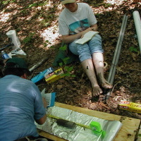
An experimental rainfall simulation plot (7 x 14 m) in the Edwards Aquifer region of Texas was es... more An experimental rainfall simulation plot (7 x 14 m) in the Edwards Aquifer region of Texas was established in dense juniper land cover to measure the effects of brush clearing on runoff. This project includes the monitoring of lateral subsurface flow using a trench (2.5 m deep x 8 m ...







Uploads
Papers by Bradford Wilcox