Jijel
| Jijel جيجل |
|
|---|---|
| City | |
Jijel
|
|
| Motto: "From the people, for the people" | |
 Location of Jijel in the Jijel Province |
|
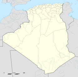
| Location of Jijel in Algeria | |
| Coordinates: Lua error in package.lua at line 80: module 'strict' not found. | |
| Country | |
| Province | Jijel Province |
| District | Jijel District |
| APC | 2012-2017 |
| Government | |
| • Type | Municipality |
| • Mayor | Yazid Abdellah |
| Area | |
| • Total | 62.38 km2 (24.09 sq mi) |
| Elevation | 10 m (30 ft) |
| Population (2008 census) | |
| • Total | 131,513 |
| • Density | 2,100/km2 (5,500/sq mi) |
| Time zone | CET (UTC+1) |
| Postal code | 18000 |
| ISO 3166 code | CP |
| Website | www |
Jijel (Arabic: جيجل, formerly known as Ighil Gili or Djidjelli) is the capital of Jijel Province in northeastern Algeria. It is flanked by the Mediterranean Sea in the region of Corniche Jijelienne, and has a 2008 census population of 131,513 inhabitants.
Jijel is the administrative and trade centre for a region specializing in cork processing, leather tanning and steelmaking. Local crops include citrus and grain. Fishing is also of great importance. Tourists (mainly Algerians) are attracted to Jijel for its landscapes and fine sand beaches. Being a resort town, there are many hotels and restaurants. There are Phoenician tombs nearby.
Contents
Geography and ecology
Jijel is situated 30 km from Taza National Park; this national park and other vicinity features support a variety of flora and fauna. In particular, the Taza National Park is habitat for the endangered Barbary Macaque, Macaca sylvanus; moreover, this primate prehistorically had a much broader distribution than at present.[1]
Communications
Due to the rugged landscape, Jijel is slightly isolated. However, it is connected by road to large cities like Bejaïa (90 km west), Setif (135 km southwest) and Constantine (150 km southeast). The city also has its own airport Jijel Ferhat Abbas Airport.
Infrastructure
Jijel is built along modern patterns with wide streets framed by trees. The surroundings consist largely of dense cork-oak forest. A peninsula lies right out from the coast and there is a citadel to the north. There is a hospital, previously a catholic church (but which was demolished), mosques and The Jijel University.
History
Jijel (Igilgili), was first inhabited by Berbers tribes, most known were the Kutama. Originally a Phoenician trading post,[2] the city passed successively for five centuries to the Romans with the name of Igilgili, then to the Vandals, the Byzantines, the Arabs, the Genoese and, in the 16th century, to the Ottoman Admiral Hayreddin Barbarossa.
In July 1664, the French took the city. Resistance was organized under the direction of Shaban Aga and the French were driven out in October of the same year. Jijel remained a Corsair stronghold until captured by the French in 1839. Strong local resistance, finally subdued in 1851, resulted in the construction of three forts along its southern fringe as well as minimal colonization. The original town was devastated by an earthquake in 1856.
Port
A relatively new port has been built at Djen Djen,[3] approximately 7 miles east of Jijel, which can handle large bulk carriers having depths up 18.2m. Presently, the port is mainly used by car carriers and break bulk vessels.
References
- C. Michael Hogan. 2008. Barbary Macaque: Macaca sylvanus, GlobalTwitcher.com, ed. Nicklas Stromberg
- Encyclopædia Britannica. 2002. Edition 15, v. 6 ISBN 0-85229-787-4, ISBN 978-0-85229-787-2
- Enterprise Portuaire de Djen Djen. 2009. Port Authority Website
Notes
Lua error in package.lua at line 80: module 'strict' not found.

