File:Eastern-settlement-eng.png
From Infogalactic: the planetary knowledge core
Eastern-settlement-eng.png (638 × 557 pixels, file size: 163 KB, MIME type: image/png)
Summary
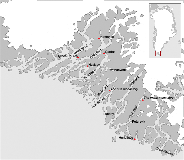
Map of the Eastern settlement of the Norse in medieval Greenland. The area is approximately the modern municipalities of Qaqortoq, Narssaq and Nanortalik. The known major farms and churches are identified on the map as some probable geographical names. The names are the English versions of the Norse names.
Licensing
Lua error in package.lua at line 80: module 'strict' not found.
File history
Click on a date/time to view the file as it appeared at that time.
| Date/Time | Thumbnail | Dimensions | User | Comment | |
|---|---|---|---|---|---|
| current | 14:34, 13 January 2017 |  | 638 × 557 (163 KB) | 127.0.0.1 (talk) | <p>Map of the Eastern settlement of the Norse in medieval Greenland. The area is approximately the modern municipalities of Qaqortoq, Narssaq and Nanortalik. The known major farms and churches are identified on the map as some probable geographical names. The names are the English versions of the Norse names. </p> |
- You cannot overwrite this file.
File usage
The following 4 pages link to this file:
