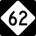
File:NC 62.svg
From Infogalactic: the planetary knowledge core

Size of this PNG preview of this SVG file: 600 × 600 pixels. Other resolution: 240 × 240 pixels.
Original file (SVG file, nominally 600 × 600 pixels, file size: 6 KB)
Summary
600 mm by 600 mm (24 in by 24 in) North Carolina highway shield, made to the specifications of the Manual on Uniform Traffic Control Devices (MUTCD), 2003 Edition (sign M1-5). Uses the Roadgeek 2005 fonts. (United States law does not permit the copyrighting of typeface designs, and the fonts are meant to be copies of a U.S. Government-produced work anyway.)
Licensing
Lua error in package.lua at line 80: module 'strict' not found.
File history
Click on a date/time to view the file as it appeared at that time.
| Date/Time | Thumbnail | Dimensions | User | Comment | |
|---|---|---|---|---|---|
| current | 02:57, 5 January 2017 |  | 600 × 600 (6 KB) | 127.0.0.1 (talk) | <p>600 mm by 600 mm (24 in by 24 in) North Carolina highway shield, made to the specifications of the Manual on Uniform Traffic Control Devices (MUTCD), 2003 Edition (sign M1-5). Uses the Roadgeek 2005 fonts. (United States law does not permit the copyrighting of typeface designs, and the fonts are meant to be copies of a U.S. Government-produced work anyway.) </p> |
- You cannot overwrite this file.
File usage
The following 21 pages link to this file:
- Alamance County, North Carolina
- Caswell County, North Carolina
- Davidson County, North Carolina
- Guilford County, North Carolina
- High Point, North Carolina
- Interstate 73 in North Carolina
- Interstate 85 in North Carolina
- List of highways numbered 62
- North Carolina Highway 100
- North Carolina Highway 22
- North Carolina Highway 49
- North Carolina Highway 54
- North Carolina Highway 610
- North Carolina Highway 62
- North Carolina Highway 86
- North Carolina Highway 87
- North Carolina Scenic Byways
- Randolph County, North Carolina
- U.S. Route 158
- U.S. Route 421 in North Carolina
- Virginia State Route 62