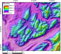
Bestand:DEMBauges.png
Uiterlijk

Grootte van deze voorvertoning: 669 × 599 pixels. Andere resoluties: 268 × 240 pixels | 536 × 480 pixels | 858 × 768 pixels | 1.143 × 1.024 pixels | 1.858 × 1.664 pixels.
Oorspronkelijk bestand (1.858 × 1.664 pixels, bestandsgrootte: 1,34 MB, MIME-type: image/png)
Bestandsgeschiedenis
Klik op een datum/tijd om het bestand te zien zoals het destijds was.
| Datum/tijd | Miniatuur | Afmetingen | Gebruiker | Opmerking | |
|---|---|---|---|---|---|
| huidige versie | 5 nov 2005 01:29 |  | 1.858 × 1.664 (1,34 MB) | Jide~commonswiki | DEM of the Bauges massifs (french Alps) created by Jide from the 90m pixel size SRTM dataset. The massif is located between the Bourget Lake (to the West) and the Annecy Lake (to the NE). The ENE-WSW valley to the South is the Isere valley downstrem to th |
Bestandsgebruik
Dit bestand wordt op de volgende pagina gebruikt:
Globaal bestandsgebruik
De volgende andere wiki's gebruiken dit bestand:
- Gebruikt op fr.wikipedia.org
- Gebruikt op zh.wikipedia.org