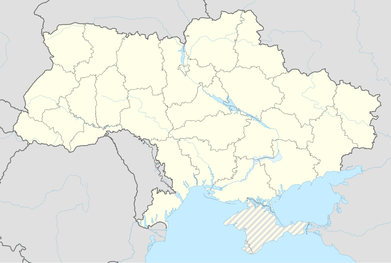
File:Ukraine adm location map.svg

Size of this PNG preview of this SVG file: 800 × 537 pixels. Ither resolutions: 320 × 215 pixels | 640 × 430 pixels | 1,024 × 688 pixels | 1,280 × 859 pixels | 2,560 × 1,719 pixels | 1,546 × 1,038 pixels.
Oreeginal file (SVG file, nominallie 1,546 × 1,038 pixels, file size: 499 KB)
File history
Clap oan ae date/time fer tae see the file aes it kithed at that time.
| Date/Time | Thummnail | Dimensions | Uiser | Comment | |
|---|---|---|---|---|---|
| current | 17:29, 9 Julie 2023 |  | 1,546 × 1,038 (499 KB) | NordNordWest | Kachovka Reservoir: https://apps.sentinel-hub.com |
| 08:24, 4 October 2022 |  | 1,546 × 1,038 (494 KB) | NordNordWest | Reverted to version as of 10:31, 3 October 2022 (UTC), this map won't show any war activities | |
| 21:37, 3 October 2022 |  | 3,780 × 2,540 (1.54 MB) | Yeagvr | update | |
| 10:31, 3 October 2022 |  | 1,546 × 1,038 (494 KB) | Thoroe | Reverted to version as of 16:19, 1 October 2022 (UTC); The original creator NordNordWest (currently unavailable) requests keeping the file unchanged per Commons:Overwriting existing files; you may upload your map as a new file under a new name | |
| 20:25, 2 October 2022 |  | 1,546 × 1,038 (457 KB) | Yeagvr | +former dnr-lnr | |
| 16:19, 1 October 2022 |  | 1,546 × 1,038 (494 KB) | Fenn-O-maniC | Poor quality edit | |
| 16:01, 1 October 2022 |  | 512 × 344 (1,014 KB) | Yeagvr | ||
| 14:42, 15 Apryle 2022 |  | 1,546 × 1,038 (494 KB) | NordNordWest | corr | |
| 12:43, 28 Februar 2018 |  | 1,546 × 1,038 (533 KB) | NordNordWest | Reverted to version as of 10:38, 3 February 2018 (UTC); no, please use File:Ukraine under russian occupation grey.svg | |
| 12:12, 28 Februar 2018 |  | 1,546 × 1,038 (457 KB) | Shmurak | added Donetsk People's Republic and Luhansk People's Republic |
Eimage airtins
The follaein pages airts tae this image:
- Apostolove
- Avdiivka
- Belz
- Beryslav
- Bila Tserkva
- Borodianka
- Busha
- Chaplynka
- Cherkasy
- Chernihiv
- Chernivtsi
- Chornobyl
- Debaltseve
- Dnipro
- Dobropillia
- Dokuchaievsk
- Donetsk
- Dovzhansk, Ukraine
- Fastiv
- Halych
- Henichesk
- Hlyniany
- Hola Prystan
- Horlivka
- Iziaslav, Ukraine
- Izium
- Kaharlyk
- Kakhovka
- Kamianets-Podilskyi
- Kamianske
- Kharkiv
- Kherson
- Khmelnytskyi, Ukraine
- Kostiantynivka
- Kostiantynivka Raion
- Kramatorsk
- Kremenchuk
- Kropyvnytskyi
- Kyiv
- Lisnyi Khlibychyn
- Luhansk
- Lutsk
- Lviv
- Lypivka
- Lysychansk
- Marinka Raion
- Melitopol
- Moshchena
- Mukachevo
- Mykolaiv
- Nova Kakhovka
- Novoselytsia
- Oblaznytsia
- Odessa
- Oleshky
- Ozaryntsi
- Piskivka
- Pokrovsk
- Pripyat
- Rivne
- Selydove
- Skadovsk
- Snizhne
- Tavriisk
- Uzhhorod
- Vinnytsia
- Volodymyr (сeety)
- Zaporizhia
- Zhytomyr
- Template:Location map Ukraine
Global file uisage
The follaein ither wikis uise this file:
- Uisage on af.wikipedia.org
- Uisage on als.wikipedia.org
- Uisage on ar.wikipedia.org
- Uisage on av.wikipedia.org
- Uisage on azb.wikipedia.org
- Uisage on ban.wikipedia.org
View mair global usage o this file.


