Missoula County, Montana
Appearance
Missoula County | |
|---|---|
 Missoula County Courthouse | |
 Location within the U.S. state of Montana | |
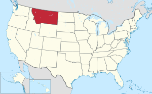
 Montana's location within the U.S. | |
| Coordinates: 47°02′N 113°56′W / 47.04°N 113.93°W | |
| Country | |
| State | |
| Founded | December 14, 1860 |
| Seat | Missoula |
| Largest city | Missoula |
| Area | |
| • Total | 2,618 sq mi (6,780 km2) |
| • Land | 2,593 sq mi (6,720 km2) |
| • Water | 25 sq mi (60 km2) 1.0% |
| Population (2020) | |
| • Total | 117,922 |
| • Density | 45/sq mi (17/km2) |
| Time zone | UTC−7 (Mountain) |
| • Summer (DST) | UTC−6 (MDT) |
| Congressional district | 1st |
| Website | www |
| |
Missoula County is a county found in the State of Montana. As of the 2020 United States Census, the population was 117,922,[1] making it Montana's third-most populous county. Its county seat and largest city is Missoula.[2] It was created in 1860.[3]
References
[change | change source]- ↑ "QuickFacts: Missoula County, Montana". United States Census Bureau. Retrieved January 5, 2024.
- ↑ "Find a County". National Association of Counties. Retrieved 7 June 2011.
- ↑ "Montana Place Names Companion". Montana Place Names From Alzada to Zortman. Montana Historical Society Research Center. Retrieved December 1, 2014.

