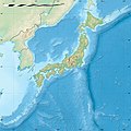
File:Japan location map.svg

Original file (SVG file, nominally 582 × 580 pixels, file size: 707 KB)
Captions
Captions
Summary
[edit]| DescriptionJapan location map.svg |
Deutsch: Postionskarte von Japan
Quadratische Plattkarte. Geographische Begrenzung der Karte:
English: Location map of Japan
Equirectangular projection. Geographic limits of the map:
|
||
| Date | |||
| Source | own work, using Image:Japan_admin_levels.svg | ||
| Author | Maximilian Dörrbecker (Chumwa) | ||
| Permission (Reusing this file) |
I, the copyright holder of this work, hereby publish it under the following licenses:
This file is licensed under the Creative Commons Attribution-Share Alike 3.0 Unported license.
You may select the license of your choice. |
||
| Other versions |
Derivative works of this file: National Treasures of Japan (archaeological materials).png
|

|
This map has been made or improved in the German Kartenwerkstatt (Map Lab). You can propose maps to improve as well.
azərbaycanca ∙ čeština ∙ Deutsch ∙ Deutsch (Sie-Form) ∙ English ∙ español ∙ français ∙ italiano ∙ latviešu ∙ magyar ∙ Nederlands ∙ Plattdüütsch ∙ polski ∙ português ∙ română ∙ sicilianu ∙ slovenščina ∙ suomi ∙ македонски ∙ русский ∙ ქართული ∙ հայերեն ∙ বাংলা ∙ ไทย ∙ +/−
|
File history
Click on a date/time to view the file as it appeared at that time.
| Date/Time | Thumbnail | Dimensions | User | Comment | |
|---|---|---|---|---|---|
| current | 05:18, 14 November 2020 |  | 582 × 580 (707 KB) | AichiWikiFixer (talk | contribs) | Reverted to version as of 16:25, 5 April 2020 (UTC) |
| 05:18, 14 November 2020 |  | 413 × 373 (980 KB) | AichiWikiFixer (talk | contribs) | Fix borders. | |
| 16:25, 5 April 2020 |  | 582 × 580 (707 KB) | NordNordWest (talk | contribs) | Reverted to version as of 10:32, 21 February 2013 (UTC); no discussion about this change; in this set of maps disputed areas are always shown in light grey | |
| 14:25, 5 April 2020 |  | 582 × 580 (726 KB) | Туча (talk | contribs) | Итуруп и Кунашир серым цветом | |
| 10:32, 21 February 2013 |  | 582 × 580 (707 KB) | NordNordWest (talk | contribs) | Reverted to version as of 13:56, 30 October 2010; no need to revert, no discussion for this | |
| 09:17, 21 February 2013 |  | 582 × 580 (1.21 MB) | Pauk (talk | contribs) | Reverted to version as of 01:23, 17 September 2010 | |
| 13:56, 30 October 2010 |  | 582 × 580 (707 KB) | NordNordWest (talk | contribs) | Liancourt Rocks boundary | |
| 01:23, 17 September 2010 |  | 582 × 580 (1.21 MB) | Dinamik (talk | contribs) | medium color for disputed territories | |
| 11:40, 21 March 2010 |  | 582 × 580 (1.18 MB) | Chumwa (talk | contribs) | Präfekturgrenzen bereinigt | |
| 09:55, 20 March 2010 |  | 582 × 580 (1.37 MB) | Chumwa (talk | contribs) | einige Inseln ergänzt und diverse Lagekorrekturen durchgeführt |
You cannot overwrite this file.
File usage on Commons
The following 21 pages use this file:
- User:Chumwa/Gallery
- User:Nahabino/sandbox
- User:SpinnerLaserz/Flags/Flags of France/Japan
- User:SpinnerLaserzthe2nd/Flags/Flags of Japan/Japan
- File:J-ALERT Image3-en.svg
- File:J-ALERT Image3.svg
- File:Japan bluemarble location map with side map of the Ryukyu Islands.jpg
- File:Japan location map-topographic.png
- File:Japan location map with side map of the Ryukyu Islands.svg
- File:Japan location map zoom south.svg
- File:Japan location map zoom west.svg
- File:Japan natural location map with side map of the Ryukyu Islands.jpg
- File:Japan relief location map.jpg
- File:Japan relief location map with side map of the Ryukyu Islands.jpg
- File:Japanese Macaque area.svg
- File:National Treasures of Japan (archaeological materials).png
- File:National Treasures of Japan (crafts- others).png
- File:National Treasures of Japan (crafts-swords).png
- File:National Treasures of Japan (sculptures).png
- File:National Treasures of Japan (writings- others).png
- File:Russian-occupied territories (extended).svg
File usage on other wikis
The following other wikis use this file:
- Usage on ba.wikipedia.org
- Usage on bcl.wikipedia.org
- Usage on bg.wikinews.org
- Usage on crh.wikipedia.org
- Usage on da.wikipedia.org
- Usage on de.wikipedia.org
- Usage on en.wikipedia.org
- Iwo Jima
- Cities designated by government ordinance of Japan
- Ogasawara, Tokyo
- Chichijima
- Hahajima
- Senhata, Akita
- Hiranai
- Hachijō-jima
- Yonaguni Monument
- North Iwo Jima
- South Iwo Jima
- Fukutoku-Okanoba
- Nishinoshima (Ogasawara)
- 2013–14 FIS Ski Jumping World Cup
- Wikipedia talk:WikiProject Geographical coordinates/Archive 29
- 2020 Summer Olympics torch relay
- Module:Location map/data/Japan complete
- Module:Location map/data/Japan complete/doc
- 2015 Ogasawara earthquake
- Chibusa Dam
- Nakōdo-jima
- Naval Base Iwo Jima
- User:Turbo Slayer 2021
- User:Mr J 2023
- 1931 Empress of Canada stabbings
- List of mass stabbing incidents (before 2010)
- Usage on eo.wikipedia.org
View more global usage of this file.
Metadata
This file contains additional information such as Exif metadata which may have been added by the digital camera, scanner, or software program used to create or digitize it. If the file has been modified from its original state, some details such as the timestamp may not fully reflect those of the original file. The timestamp is only as accurate as the clock in the camera, and it may be completely wrong.
| Width | 581.981px |
|---|---|
| Height | 579.907px |


