Category:Japanese Archipelago
Jump to navigation
Jump to search
East Asian archipelago in the North Pacific Ocean | |||||
| Upload media | |||||
| Instance of | |||||
|---|---|---|---|---|---|
| Location |
| ||||
| Has part(s) | |||||
| Said to be the same as | geography of Japan, Q125471262 | ||||
 | |||||
The Japanese Archipelago consists of the four mains islands +300 smaller ones.
Subcategories
This category has the following 5 subcategories, out of 5 total.
K
S
Media in category "Japanese Archipelago"
The following 24 files are in this category, out of 24 total.
-
Chugoku-Region-Shikoku-Japan-ISS-Space.png 1,920 × 1,080; 2.9 MB
-
Extreme points japan map.png 1,752 × 1,540; 1.29 MB
-
Japan bluemarble location map with side map of the Ryukyu Islands.jpg 2,497 × 2,256; 1.38 MB
-
Japan location map with side map of the Ryukyu Islands.svg 413 × 373; 980 KB
-
Japan location map.svg 582 × 580; 707 KB
-
Japan main islands.png 235 × 300; 7 KB
-
Japan Map CIA 2021.png 799 × 600; 425 KB
-
Japan Map Lincun.svg 1,024 × 1,024; 14 KB
-
Japan natural location map with side map of the Ryukyu Islands.jpg 2,497 × 2,256; 830 KB
-
Japan relief location map with side map of the Ryukyu Islands.jpg 2,497 × 2,256; 2.25 MB
-
Japan relief location map.jpg 1,482 × 1,477; 1.02 MB
-
Japan Relief Map of Land and Seabed.png 2,117 × 1,745; 7.47 MB
-
Japan Ryukyu Islands relief location map.jpg 1,328 × 1,328; 988 KB
-
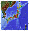
Japan topo en.jpg 1,400 × 1,498; 559 KB
-
Japan-Archipelago-Outlined-Islands-Map.png 2,012 × 1,644; 3.2 MB
-
Japan-CIA WFB Map.png 461 × 495; 254 KB
-
JapanCitiesTownsOMC.PNG 1,965 × 1,866; 227 KB
-
Japanese Propaganda - Japanese archipelago is like Black Japanese dragon.jpg 1,054 × 861; 84 KB
-
Migration routes into Japan.png 602 × 438; 73 KB
-
Ogasawara islands.png 1,011 × 798; 296 KB
-
Satellite image of Honshu in May 2003.png 2,312 × 2,003; 2.04 MB
-
Satellite View of Japan 1999.jpg 1,638 × 2,092; 1.04 MB
-
Satellitenaufnahme Japan 01 KMJ.jpg 768 × 597; 45 KB
-
日本列島におけるJCV亜型の分布.png 640 × 480; 26 KB


