اسلیفورد
ظاهر
| Sleaford | |
|---|---|
| Town | |
 St Denys' Church, the war memorial and the east side of the market place | |
| جمعیت | ۱۷٬۶۷۱ |
| Ethnicity | 93.57% White British 4.04% White Other 1.09% Asian or Asian British 0.26% Black or Black British 0.05% Arab 0.12% Other 0.87% Mixed Race (2011 est.)[۱] |
| OS grid reference | TF064455 |
| • لندن | ۱۰۰ mi (۱۶۰ km)* S |
| District | |
| Shire county | |
| Region | |
| اؤلکه | England |
| موستقیل دوولت | United Kingdom |
| Post town | SLEAFORD |
| Postcode district | NG34 |
| تیلفون کودو | 01529 |
| UK Parliament | |
| Website | www.sleaford.gov.uk |
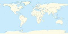
اسلیفورد (اینگیلیسیجه: Sleaford) بریتانیادا بیر یاشاییش منطقهسیدیر سوْن نۆفوس تخمینلرینه گؤره 17671 نفر دیر. بۇ شهر اینگیلیس اؤلکهسینده یئرلشیب.
- ^ قایناق خطاسی برچسب
<ref>نامعتبر؛ متنی برای ارجاعهای با نام:7وارد نشده است
