Paternostro-Gletscha
Erscheinungsbild
| Paternostro-Gletscha | ||
|---|---|---|
| Log | Viktorialand, Ostantarktika | |
| Gebiag | Wilson Hills, Transantarktischs Gebiag | |
| Läng | 18 km (grob gschedzd) | |
| Koordinaten | 69° 24′ S, 158° 37′ O | |
|
| ||
| Entwassarung | Somow-Sää | |
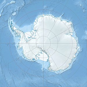
Da Paternostro-Gletscha (dt.: Paternostro-Gletscher) is a uma 18 km longa Gletscha in de Wilson Hills im Noadn van antarktischn Viktorialand. Ea fliassd zwischn om Gebiagskomm Cook Ridge und de Goodman Hills in on estlichn Tei vo da Davies Bay.
Kartografisch eafossd worn is's Gebiet duach Vermessungsoabatn van United States Geological Survey und midhuif vo Luftafnohma vo da United States Navy vo 1960 bis 1963. As Advisory Committee on Antarctic Names hod'n Gletscher noch Leitnont Joseph L. A. Paternostro vo de Reseavestreitkrefte vo da US-Navy, Navigatoa vo ana LC-130F bnennd im Rohma vo da Operation Deep Freeze in de Joar 1967 bis 1968.
Im Netz
[Werkeln | Am Gwëntext werkeln]- Paternostro Glacier im Geographic Names Information System vom United States Geological Survey (englisch)
- Paternostro Glacier af geographic.org (englisch)
