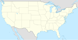
Craven County
Paghimo ni bot Lsjbot. |
| Craven County (Comté de Craven) | |
| Kondado | |
| Nasod | |
|---|---|
| Estado | North Carolina |
| Gitas-on | 7 m (23 ft) |
| Tiganos | 35°07′02″N 77°04′57″W / 35.11722°N 77.08263°W |
| Capital | New Bern |
| Area | 2,005.00 km2 (774 sq mi) |
| Population | 103,505 (2013-03-08) [1] |
| Density | 52 / km2 (135 / sq mi) |
| Timezone | EST (UTC-5) |
| - summer (DST) | EDT (UTC-4) |
| GeoNames | 4462398 |
Kondado ang Craven County (Prinanses: Comté de Craven) sa Tinipong Bansa.[1] Nahimutang ni sa estado sa North Carolina, sa sidlakang bahin sa nasod, 400 km sa habagatan sa Washington, D.C. Adunay 103,505 ka molupyo.[1] Naglangkob kin og 2,005 ka kilometro kwadrado. Craven County mopakigbahin sa usa ka utlanan sa Carteret County ang ulohan sa nasod.
Ang yuta sa Craven County kay daghan kaayong patag.[saysay 1]
Craven County may sa mosunod nga mga subdibisyon:
Mga lungsod sa Craven County:
- New Bern
- Havelock
- James City
- Trent Woods
- River Bend
- Brices Creek
- Fairfield Harbour
- Neuse Forest
- Vanceboro
- Bridgeton
- Dover
- Cove City
Sa mosunod nga mga natural nga mga bahin makita sa Craven County:
- Mga luuk:
- Mga kalapukan:
- Mga suba:
- Adams Creek (suba)
- Alligator Branch (suba)
- Alum Springs Branch (suba)
- Anderson Creek (suba)
- Bachelor Creek (suba)
- Back Creek (suba)
- Barney Branch (suba)
- Bear Branch (suba)
- Beaverdam Branch (suba)
- Beaverdam Swamp (suba)
- Beech Tree Branch (suba)
- Big Branch (suba)
- Black Branch (suba)
- Blackmans Creek (suba)
- Brice Creek (suba)
- Bridge Creek (suba)
- Bushy Fork (suba)
- Cahoogue Creek (suba)
- Caps Branch (suba)
- Caswell Branch (suba)
- Cedar Creek (suba)
- Cherry Branch (suba)
- Clubfoot Creek (suba)
- Core Creek (suba)
- Courts Creek (suba)
- Crooked Run (suba)
- Dam Creek (suba)
- Daniels Branch (suba)
- Deep Branch (suba)
- Deep Branch (suba)
- Deep Run (suba)
- Delamar Creek (suba)
- Dolls Gut (suba)
- Duck Creek (suba)
- East Branch Southwest Prong Slocum Creek (suba)
- East Prong Brice Creek (suba)
- East Prong Mortons Mill Pond (suba)
- East Prong Slocum Creek (suba)
- Fisher Swamp (suba)
- Flat Swamp (suba)
- Folley Branch (suba)
- Fork Swamp (suba)
- Georges Branch (suba)
- Godfrey Creek (suba)
- Goodwin Creek (suba)
- Great Branch (suba)
- Great Neck Creek (suba)
- Grinnel Creek (suba)
- Gulden Creek (suba)
- Gum Branch (suba)
- Gum Swamp (suba)
- Halfmoon Creek (suba)
- Hancock Creek (suba)
- Hayward Creek (suba)
- Hoods Creek (suba)
- Hunters Branch (suba)
- Isaac Creek (suba)
- Jack Smith Creek (suba)
- Jacks Branch (suba)
- Joes Branch (suba)
- Jumping Run (suba)
- Kearney Creek (suba)
- Kellum Creek (suba)
- King Creek (suba)
- Kit Swamp (suba)
- Lane Branch (suba)
- Lawson Creek (suba)
- Little John Creek (suba)
- Little Snake Hole Branch (suba)
- Little Swift Creek (suba)
- Long Creek (suba)
- Mauls Swamp (suba)
- McCoy Branch (suba)
- Mill Creek (suba)
- Mill Run (suba)
- Mills Branch (suba)
- Miry Branch (suba)
- Mitchell Creek (suba)
- Mococks Branch (suba)
- Mortons Mill Pond (suba)
- Mosley Creek (suba)
- Northwest Creek (suba)
- Otter Creek (suba)
- Palmetto Swamp (suba)
- Pine Tree Swamp (suba)
- Pinetree Creek (suba)
- Reeds Gut (suba)
- Rennys Creek (suba)
- Rocky Run (suba)
- Rollover Creek (suba)
- Round Tree Branch (suba)
- Sandy Branch (suba)
- Sandy Run (suba)
- Sassafras Branch (suba)
- Scotts Creek (suba)
- Shop Branch (suba)
- Slocum Creek (suba)
- Snake Branch (suba)
- Snake Hole Branch (suba)
- Southwest Prong Slocum Creek (suba)
- Spe Branch (suba)
- Still Gut (suba)
- Still Gut (suba)
- Stony Branch (suba)
- Swift Creek (suba)
- Taylor Creek (suba)
- Tracey Swamp (suba)
- Trent River (suba)
- Tucker Creek (suba)
- Turkey Quarter Creek (suba)
- West Branch Southwest Prong Slocum Creek (suba)
- West Prong Brice Creek (suba)
- West Prong Mortons Mill Pond (suba)
- Village Creek (suba)
- Wilson Creek (suba)
- Wolf Pit Branch (suba)
- Mga kanal:
- Mga lanaw:
- Mga estretso:
- Mga lapyahan:
- Kapuloan:
- Mga lawis:
- Mga lasang:
Ang klima umogon ug subtropikal.[3] Ang kasarangang giiniton 16 °C. Ang kinainitan nga bulan Hunyo, sa 24 °C, ug ang kinabugnawan Enero, sa 6 °C.[4] Ang kasarangang pag-ulan 1,554 milimetro matag tuig. Ang kinabasaan nga bulan Agosto, sa 205 milimetro nga ulan, ug ang kinaugahan Nobiyembre, sa 84 milimetro.[5]
| ||||||||||||||||||||||||||||||||||||||||||||||||||||||||||||||||||||||||||||||||||||||||||||||||||||||||||||||||||||||||||||
Saysay
[usba | usba ang wikitext]- ↑ Kalkulado gikan sa gitas-on data (DEM 3") gikan sa Viewfinder Panoramas.[2] Ang bug-os nga algoritmo anaa dinhi.
Ang mga gi basihan niini
[usba | usba ang wikitext]- ↑ 1.0 1.1 1.2 Craven County sa Geonames.org (cc-by); post updated 2013-03-08; database download sa 2017-02-28
- ↑ "Viewfinder Panoramas Digital elevation Model". 2015-06-21.
- ↑ Peel, M C; Finlayson, B L. "Updated world map of the Köppen-Geiger climate classification". Hydrology and Earth System Sciences. 11: 1633–1644. doi:10.5194/hess-11-1633-2007. Retrieved 30 Enero 2016.
{{cite journal}}: CS1 maint: unflagged free DOI (link) - ↑ 4.0 4.1 "NASA Earth Observations Data Set Index". NASA. Retrieved 30 Enero 2016.
- ↑ "NASA Earth Observations: Rainfall (1 month - TRMM)". NASA/Tropical Rainfall Monitoring Mission. Retrieved 30 Enero 2016.
Gikan sa gawas nga tinubdan
[usba | usba ang wikitext]| Aduna'y mga payl ang Wikimedia Commons nga may kalabotan sa artikulong: Craven County. |


