Edgefield County
Paghimo ni bot Lsjbot. |
| Edgefield County (Comté d'Edgefield) | |
| Condado de Edgefield, Comté dEdgefield | |
| Kondado | |
| Nasod | |
|---|---|
| Estado | South Carolina |
| Gitas-on | 130 m (427 ft) |
| Tiganos | 33°46′20″N 81°58′00″W / 33.77229°N 81.96658°W |
| Capital | Edgefield |
| Area | 1,312.00 km2 (507 sq mi) |
| Population | 26,985 (2013-03-08) [1] |
| Density | 21 / km2 (54 / sq mi) |
| Timezone | EST (UTC-5) |
| - summer (DST) | EDT (UTC-4) |
| GeoNames | 4577533 |
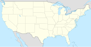
Kondado ang Edgefield County (Prinanses: Comté d'Edgefield, Kinatsila: Condado de Edgefield, Prinanses: Comté dEdgefield) sa Tinipong Bansa.[1] Nahimutang ni sa estado sa South Carolina, sa sidlakang bahin sa nasod, 700 km sa habagatan-kasadpan sa Washington, D.C. Adunay 26,985 ka molupyo.[1] Naglangkob kin og 1,312 ka kilometro kwadrado. Edgefield County mopakigbahin sa usa ka utlanan sa Saluda County, Richmond County, Aiken County, Columbia County, McCormick County, ug Greenwood County ang ulohan sa nasod.
Ang yuta sa Edgefield County kay patag.[saysay 1]
Edgefield County may sa mosunod nga mga subdibisyon:
Mga lungsod sa Edgefield County:
Sa mosunod nga mga natural nga mga bahin makita sa Edgefield County:
- Mga suba:
- Anderson Branch (suba)
- Bailey Branch (suba)
- Bakers Branch (suba)
- Bartley Branch (suba)
- Beaverdam Creek (suba)
- Bell Branch (suba)
- Big Branch (suba)
- Big Branch (suba)
- Big Creek (suba)
- Blue Branch (suba)
- Broadwater Branch (suba)
- Bubbling Branch (suba)
- Buck Branch (suba)
- Burkhalter Branch (suba)
- Bussy Creek (suba)
- Buzzard Branch (suba)
- Camp Branch (suba)
- Canaan Branch (suba)
- Cartledge Branch (suba)
- Cedar Creek (suba)
- Center Spring Branch (suba)
- Chap Branch (suba)
- Cheves Creek (suba)
- Clearwater Branch (suba)
- Crooked Run (suba)
- Cuffey Branch (suba)
- Cyper Creek (suba)
- Deep Step Branch (suba)
- Dry Branch (suba)
- Dry Creek (suba)
- Dunn Creek (suba)
- Flat Rock Branch (suba)
- Flat Rock Creek (suba)
- Gilroy Branch (suba)
- Gundy Creek (suba)
- Hall Branch (suba)
- Hardy Branch (suba)
- Hegwood Branch (suba)
- Hillyer Branch (suba)
- Hog Eye Branch (suba)
- Horn Creek (suba)
- Horse Branch (suba)
- Jim Branch (suba)
- Lick Fork (suba)
- Little Beaverdam Creek (suba)
- Little Mountain Creek (suba)
- Little Stevens Creek (suba)
- Little Turkey Creek (suba)
- Lloyd Creek (suba)
- Log Creek (suba)
- Long Branch (suba)
- Maulden Branch (suba)
- Miller Branch (suba)
- Monday Branch (suba)
- Moss Branch (suba)
- Mountain Creek (suba)
- Owl Branch (suba)
- Paces Branch (suba)
- Pike Branch (suba)
- Pitts Branch (suba)
- Quaker Branch (suba)
- Quarles Creek (suba)
- Ray Creek (suba)
- Red Hill Spring Branch (suba)
- Reedy Branch (suba)
- Rock Creek (suba)
- Rock Creek (suba)
- Rocky Creek (suba)
- Rocky Creek (suba)
- Sandhill Branch (suba)
- Satcher Branch (suba)
- Spring Branch (suba)
- Stevens Creek (suba)
- Stockman Branch (suba)
- Sweetwater Branch (suba)
- Temples Creek (suba)
- Tiger Creek (suba)
- Tobler Creek (suba)
- White Branch (suba)
- Williams Branch (suba)
- Wilson Branch (suba)
- Mga lanaw:
- Bigford Pond (tubiganan)
- Carpenters Pond (tubiganan)
- Corley Pond (tubiganan)
- Durkes Pond (tubiganan)
- Gregorys Lake (tubiganan)
- Harrison Pond (tubiganan)
- Holmes Pond (tubiganan)
- Holmes Pond (tubiganan)
- Holmes Pond (tubiganan)
- Johnston Sc Reservoir (tubiganan)
- Lick Fork Lake (tubiganan)
- Long Pond (tubiganan)
- Mathis Pond (tubiganan)
- Millers Pond (tubiganan)
- Odell Memorial Lake (tubiganan)
- One of the Arrowhead Lakes (tubiganan)
- Pearsons Pond (tubiganan)
- Rainsford Pond (tubiganan)
- Reynolds Pond (tubiganan)
- Ridgeview Lake (tubiganan)
- Ruckers Pond (tubiganan)
- Salters Pond (tubiganan)
- Samuels Pond (tubiganan)
- Scott Pond (tubiganan)
- Simons Lake (tubiganan)
- Slade Lake (tubiganan)
- Woodwards Lake (tubiganan)
- Yance Pond (tubiganan)
- Kabukiran:
Ang klima umogon ug subtropikal.[3] Ang kasarangang giiniton 16 °C. Ang kinainitan nga bulan Hulyo, sa 24 °C, ug ang kinabugnawan Enero, sa 6 °C.[4] Ang kasarangang pag-ulan 1,548 milimetro matag tuig. Ang kinabasaan nga bulan Agosto, sa 209 milimetro nga ulan, ug ang kinaugahan Oktubre, sa 46 milimetro.[5]
| ||||||||||||||||||||||||||||||||||||||||||||||||||||||||||||||||||||||||||||||||||||||||||||||||||||||||||||||||||||||||||||
Saysay
[usba | usba ang wikitext]- ↑ Kalkulado gikan sa gitas-on data (DEM 3") gikan sa Viewfinder Panoramas.[2] Ang bug-os nga algoritmo anaa dinhi.
Ang mga gi basihan niini
[usba | usba ang wikitext]- ↑ 1.0 1.1 1.2 Edgefield County sa Geonames.org (cc-by); post updated 2013-03-08; database download sa 2017-02-28
- ↑ "Viewfinder Panoramas Digital elevation Model". 2015-06-21.
- ↑ Peel, M C; Finlayson, B L. "Updated world map of the Köppen-Geiger climate classification". Hydrology and Earth System Sciences. 11: 1633–1644. doi:10.5194/hess-11-1633-2007. Retrieved 30 Enero 2016.
{{cite journal}}: CS1 maint: unflagged free DOI (link) - ↑ 4.0 4.1 "NASA Earth Observations Data Set Index". NASA. Retrieved 30 Enero 2016.
- ↑ "NASA Earth Observations: Rainfall (1 month - TRMM)". NASA/Tropical Rainfall Monitoring Mission. Retrieved 30 Enero 2016.
Gikan sa gawas nga tinubdan
[usba | usba ang wikitext]| Aduna'y mga payl ang Wikimedia Commons nga may kalabotan sa artikulong: Edgefield County. |


