Category:2010s maps of Greenland
Jump to navigation
Jump to search
Media in category "2010s maps of Greenland"
The following 16 files are in this category, out of 16 total.
-
Extreme-points-of-greenland-ru.svg 300 × 500; 28 KB
-
Greenland elections 2013.svg 1,075 × 2,213; 37 KB
-
Greenland elections 2014.svg 1,075 × 2,213; 37 KB
-
Greenland elections 2018.svg 1,008 × 2,075; 11 KB
-
Greenland municipalities and districts 2018.svg 1,008 × 2,075; 66 KB
-
Greenland Qeqertalik adm location map.svg 680 × 912; 164 KB
-
Greenland Qeqertalik rel location map.svg 680 × 912; 3.32 MB
-
Greenland, administrative divisions - de - colored 2018.svg 1,181 × 1,669; 994 KB
-
Greenland-municipalities-2018 mk.svg 300 × 500; 24 KB
-
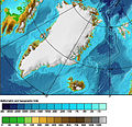
GreenlandSeaPolarProjectionTopo.jpg 427 × 414; 72 KB
-
Kujalleq in Greenland 2018.svg 1,181 × 1,669; 846 KB
-
Kulusuk-island-sketchmap.svg 350 × 280; 13 KB
-
PAT - Greenland and Iceland.gif 1,440 × 1,800; 331 KB
-
Sermersooq in Greenland 2018.svg 1,181 × 1,669; 846 KB
-
Thule in Greenland 2018.svg 1,181 × 1,669; 846 KB
-
Vatnahverfi Map2.jpg 507 × 446; 73 KB


