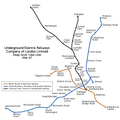
Category:London Underground maps
Jump to navigation
Jump to search
English: Maps and diagrams of London Underground lines, stations, zones and the entire network.
schematic map of the London Underground network | |||||
| Upload media | |||||
| Instance of |
| ||||
|---|---|---|---|---|---|
| Country of origin | |||||
| Creator | |||||
| Inception |
| ||||
| |||||
Subcategories
This category has the following 8 subcategories, out of 8 total.
Pages in category "London Underground maps"
The following 5 pages are in this category, out of 5 total.
Media in category "London Underground maps"
The following 37 files are in this category, out of 37 total.
-
Beckmap1.jpg 1,024 × 715; 112 KB
-
British Museum Map Mockup.png 267 × 177; 9 KB
-
Brompton Road disused station map.png 932 × 912; 29 KB
-
Down Street Map Mockup.png 447 × 150; 12 KB
-
Edgware road kearney tube proposal.jpg 755 × 657; 150 KB
-
Epping-Ongar-branch.png 278 × 94; 9 KB
-
Greater London rail frequency map.svg 595 × 466; 517 KB
-
Hounslow Branch.svg 1,052 × 744; 49 KB
-
Hounslow Underground stations.png 1,383 × 698; 46 KB
-
Hounslow West station.png 1,560 × 891; 144 KB
-
London airport links map.png 1,592 × 1,113; 237 KB
-
London Midland City.svg 524 × 255; 15 KB
-
London Underground Overground DLR Crossrail map + EOR.svg 2,500 × 1,320; 352 KB
-
London Underground Overground DLR Crossrail map zh-HK.svg 2,500 × 1,320; 216 KB
-
London Underground Overground DLR Crossrail map.svg 2,500 × 1,320; 219 KB
-
Mark Lane Map Mockup.png 390 × 205; 14 KB
-
Mini métro - Londres.jpg 1,920 × 1,080; 202 KB
-
North west london railway.svg 800 × 288; 8 KB
-
Pamiątka z Londynu z mapą metra 1.jpg 2,992 × 2,992; 750 KB
-
Pamiątka z Londynu z mapą metra 2.jpg 2,992 × 2,992; 734 KB
-
Pamiątka z Londynu z mapą metra 3.jpg 2,992 × 2,845; 711 KB
-
Report to the Minister of War Transport 21 January 1946 Map 2.png 4,384 × 3,880; 8.85 MB
-
Report to the Minister of War Transport 21 January 1946 Map 3.png 7,258 × 5,288; 50.3 MB
-
SW Chinese Map of the London Underground.svg 5,350 × 3,100; 729 KB
-
The Circle Routes of Victorian London.png 2,029 × 1,787; 203 KB
-
UERL map 1907 JP.png 3,200 × 3,200; 398 KB
-
UERL map 1907.png 3,200 × 3,200; 680 KB
-
Underground Stations in Shepherd's Bush.png 2,111 × 2,846; 215 KB
-
Underground Stations in Shepherd's Bush.svg 2,111 × 2,846; 29 KB
-
Unintentional Humor, Way In, No Entry.jpg 320 × 220; 16 KB
-
Willesden Junction map with Old Oak Common.png 1,467 × 903; 1.15 MB
-
Willesden junction map.png 1,467 × 903; 1.29 MB


