Category:SVG maps of the Middle East
Jump to navigation
Jump to search
Subcategories
This category has the following 4 subcategories, out of 4 total.
Media in category "SVG maps of the Middle East"
The following 106 files are in this category, out of 106 total.
-
1187 Kingdom Of Jerusalem based on 1889 map-es.svg 512 × 880; 495 KB
-
1187 Kingdom Of Jerusalem based on 1889 map.svg 512 × 880; 207 KB
-
2023 Gaziantep-Marash Earthquakes.svg 512 × 354; 9 KB
-
2023 Turkey-Syria Earthquakes.svg 512 × 354; 11 KB
-
Africa Black-Hebrew Israeli.svg 512 × 483; 330 KB
-
Anti-ISIS coalition air bases.svg 1,050 × 700; 224 KB
-
Arab Spring and Regional Conflict Map.svg 940 × 477; 533 KB
-
Arab World Green.svg 940 × 477; 404 KB
-
Archeological sites - wine and oil.svg 2,472 × 1,215; 304 KB
-
Asia minor 1140-es.svg 932 × 1,008; 978 KB
-
AsiamenorAntesDel90ACSinColores.svg 3,274 × 1,793; 630 KB
-
Blank SVG Map of the Arab World.svg 950 × 550; 167 KB
-
BritishMandatePalestine1920-fr.svg 675 × 542; 19 KB
-
Buyid amirates in the Middle East, ca. 970.svg 1,446 × 1,002; 10.34 MB
-
Canaanite City States In The Bronze Age.svg 512 × 1,142; 484 KB
-
Carte - Le Proche-Orient en 1095.svg 744 × 1,052; 161 KB
-
Carte de la Palestine et de la Transjordanie sous mandat britannique-fr.svg 3,368 × 3,177; 449 KB
-
Carte du Moyen-Orient.svg 942 × 1,110; 5.15 MB
-
Carte du Moyen-Orient2.svg 936 × 900; 5.15 MB
-
Ciudades del antiguo Oriente Medio.svg 1,247 × 691; 353 KB
-
Diadochi 301 Shepherd-es.svg 1,248 × 605; 1.12 MB
-
DinastíaIjshidí935-969ProyecciónOrtográfica.svg 553 × 553; 412 KB
-
Diádocos-200AC-es.svg 1,239 × 593; 1.04 MB
-
Electoral democracies in the Middle East and North Africa.svg 940 × 477; 535 KB
-
Episcopal Church in Jerusalem and the Middle East map.svg 675 × 525; 403 KB
-
Executive Order no. 13769 ban map.svg 1,035 × 531; 801 KB
-
Gamla on the map (ru).svg 1,016 × 1,285; 448 KB
-
Gd-middle east.svg 495 × 352; 205 KB
-
GolanBordersHE.svg 534 × 855; 73 KB
-
Golf-Kooperationsrat-ar.svg 682 × 664; 80 KB
-
Golf-Kooperationsrat.svg 682 × 664; 84 KB
-
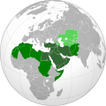
Greater Middle East (orthographic projection).svg 550 × 550; 1.51 MB
-
Greater Middle-East (orthographic projection).svg 550 × 550; 1.51 MB
-
Gulf Cooperation Council (map).svg 682 × 664; 85 KB
-
Gulf Cooperation Council-fr.svg 600 × 600; 104 KB
-
Gulf Cooperation Council.svg 682 × 664; 84 KB
-
Gulf Cooperation.svg 682 × 664; 80 KB
-
Iran–Saudi Arabia proxy conflict.svg 590 × 370; 1.28 MB
-
Islamic republics.svg 940 × 477; 534 KB
-
JordanRiver cs.svg 1,016 × 1,285; 858 KB
-
JordanRiver de.svg 1,016 × 1,285; 791 KB
-
JordanRiver en.svg 1,016 × 1,285; 809 KB
-
JordanRiver es.svg 1,016 × 1,285; 860 KB
-
JordanRiver it.svg 1,016 × 1,285; 872 KB
-
JordanRiver ko.svg 1,016 × 1,285; 860 KB
-
JordanRiver pt.svg 1,016 × 1,285; 860 KB
-
Karte Der bittere Weg.svg 1,221 × 536; 684 KB
-
Kings-Highway.svg 258 × 275; 61 KB
-
LevanteMapaBaseV2.svg 2,207 × 1,792; 1.16 MB
-
LocationMiddleEast.svg 1,000 × 500; 2.54 MB
-
Map of the Armenian Empire of Tigranes (English).svg 512 × 506; 61 KB
-
Mapa do Mediterrâneo Oriental.svg 1,250 × 1,600; 55 KB
-
Mappa Popoli del mare Levante.svg 810 × 1,212; 709 KB
-
Maps of the Armenian Empire of Tigranes-es.svg 1,975 × 1,958; 640 KB
-
Maps of the Armenian Empire of Tigranes-he.svg 512 × 506; 38 KB
-
Maps of the Armenian Empire of Tigranes-pt.svg 512 × 506; 50 KB
-
Medieval Georgian monasteries abroad-en.svg 993 × 1,023; 92 KB
-
Medieval Georgian monasteries abroad.svg 993 × 1,023; 1.31 MB
-
MENA according to the IMF 2003.svg 550 × 550; 1.51 MB
-
MENA according to UNAIDS.svg 802 × 486; 363 KB
-
MENA according to Wikimedia MENA steering committee.svg 760 × 330; 43 KB
-
MENA for Bridges across Cultures (orthographic projection).svg 550 × 550; 1.51 MB
-
MENA or WANA according to various definitions.svg 550 × 550; 1.51 MB
-
Middle East (historical definition)(orthographic projection).svg 553 × 553; 408 KB
-
Middle East (orthographic projection without Turkey).svg 553 × 553; 328 KB
-
Middle East (orthographic projection) (Homosexuality).svg 512 × 512; 214 KB
-
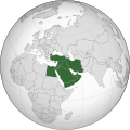
Middle East (orthographic projection).svg 553 × 553; 328 KB
-
Middle East Cultural Historical Zones.svg 800 × 608; 299 KB
-
Middle east dioceses with names-ar.svg 447 × 397; 881 KB
-
Middle east dioceses with names.svg 447 × 397; 451 KB
-
Middle East Endonyms.svg 936 × 1,368; 8.14 MB
-
Middle East location map 2.svg 201 × 169; 145 KB
-
Middle East location map2.svg 201 × 169; 145 KB
-
Middle East Topographic Political EN.svg 2,205 × 2,801; 1.31 MB
-
Middle east.svg 3,097 × 1,938; 10.35 MB
-
Mohammad adil-Khalid's conquest of Iraq-es.svg 1,531 × 1,128; 278 KB
-
Mohammad adil-Khalid's conquest of Iraq-pt.svg 1,531 × 1,128; 23 KB
-
Mohammad adil-Muslim invasion of Syria-3-pt.svg 1,367 × 1,520; 50 KB
-
Oil pipelines in Europe hu.svg 1,538 × 932; 462 KB
-
Oriente Medio.svg 1,247 × 691; 184 KB
-
Outline map of Middle East 2.svg 667 × 633; 2.16 MB
-
Outline map of Middle East major.svg 698 × 508; 263 KB
-
Outline map of Middle East.svg 1,000 × 654; 2.71 MB
-
P Middle east.svg 512 × 461; 30 KB
-
Persian Gulf naming dispute-bn.svg 600 × 600; 88 KB
-
Persian Gulf naming dispute.svg 600 × 600; 87 KB
-
Regions prod metal utilise en mesopotamie.svg 1,249 × 693; 251 KB
-
Semitic 1st AD-ar.svg 636 × 653; 120 KB
-
Syriac Dialects EN.svg 1,190 × 810; 72 KB
-
Tectonic map Mediterranean DE.svg 1,280 × 715; 622 KB
-
Tectonic map Mediterranean EN.svg 1,280 × 715; 623 KB
-
Tectonic map Mediterranean es.svg 1,280 × 715; 756 KB
-
Tectonic map Mediterranean IT.svg 1,280 × 715; 491 KB
-
Teyrnasoedd oddeutu Ammon 9g CC.svg 720 × 859; 65 KB
-
The Eastern world.svg 7,030 × 3,542; 3.38 MB
-
The Ralph Peters solution to the Middle East.svg 800 × 1,188; 2.5 MB
-
Three Easts.svg 2,754 × 1,398; 1.13 MB
-
WANA according to ICARDA 2011.svg 550 × 550; 1.51 MB
-
Wikimedia regions - Middle East & North Africa.svg 800 × 800; 361 KB
-
Wikinews Middle East (SVG).svg 759 × 415; 835 KB
-
WorldMap-MiddleEast.svg 863 × 443; 1.23 MB
-
מפת מסילות לשלום אזורי.svg 1,052 × 702; 5.06 MB
-
公元500年的萨珊王朝.svg 1,000 × 980; 792 KB


