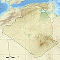
Category:Topographic maps of Algeria
Jump to navigation
Jump to search
Subcategories
This category has the following 2 subcategories, out of 2 total.
Media in category "Topographic maps of Algeria"
The following 55 files are in this category, out of 55 total.
-
Ahaggar-Tit.jpg 838 × 705; 58 KB
-
Algeria north monts des Ksour.jpg 800 × 469; 96 KB
-
Algeria north relief -Dayas.jpg 800 × 469; 97 KB
-
Algeria north relief -montsNemencha.jpg 800 × 469; 95 KB
-
Algeria north relief -OuedRigh.jpg 800 × 469; 96 KB
-
Algeria north relief -Zibans.jpg 800 × 469; 95 KB
-
Algeria north relief DjebelAmour.jpg 800 × 469; 97 KB
-
Algeria north relief monts Hodna.jpg 800 × 469; 95 KB
-
Algeria north relief Monts OuledNail.jpg 800 × 469; 97 KB
-
Algeria north relief MontsZab.jpg 800 × 469; 95 KB
-
Algeria north relief.jpg 870 × 510; 332 KB
-
Algeria north relieTell.jpg 800 × 469; 97 KB
-
Algeria northeast relief location edough.jpg 369 × 244; 37 KB
-
Algeria northeast relief location map.jpg 369 × 244; 74 KB
-
Algeria northeast relief location massif collo.jpg 369 × 244; 37 KB
-
Algeria northwest relief Dahra.jpg 300 × 281; 29 KB
-
Algeria northwest relief location map BeniChougrane.jpg 300 × 281; 28 KB
-
Algeria northwest relief location map.jpg 300 × 281; 57 KB
-
Algeria northwest relief MontsDaia.jpg 300 × 281; 28 KB
-
Algeria northwest relief MontsSaida.jpg 300 × 281; 28 KB
-
Algeria northwest relief MontTlemcen.jpg 300 × 281; 28 KB
-
Algeria northwest relief Tessala.jpg 300 × 281; 28 KB
-
Algeria Physiography.jpg 2,018 × 2,420; 1.34 MB
-
Algeria relief location map.jpg 1,287 × 1,279; 494 KB
-
Algeria relief.png 624 × 532; 527 KB
-
Algeria Topography-Chaines Ougarta.png 690 × 718; 1.03 MB
-
Algeria Topography-Tademaït.png 626 × 599; 804 KB
-
Algeria Topography.png 1,574 × 1,507; 2.96 MB
-
Atlas-Mountains-Labeled-2.jpg 3,755 × 1,884; 1.25 MB
-
Carte topographique du Tassili n'Ajjer et les alentours-jpg.jpg 7,792 × 7,420; 14.41 MB
-
Carte topographique du Tassili n'Ajjer et les alentours.png 7,792 × 7,420; 81.03 MB
-
Chott Ech Chergui kaart.jpg 955 × 492; 142 KB
-
Chott el Jerid.jpg 955 × 507; 140 KB
-
DZ - Touat Region - Algeria.png 1,323 × 1,310; 2.93 MB
-
Esquisse du Sahara algérien 1907.jpg 10,768 × 7,776; 10.42 MB
-
Extrem north east algeria topographic map.jpg 5,368 × 4,519; 7.35 MB
-
Issaouane Erg.png 934 × 795; 1.29 MB
-
Kabylie topographic blank map-fr.png 959 × 480; 458 KB
-
Karte der Tassili n'Ajjer und Umgebung-jpg.jpg 7,822 × 7,450; 14.37 MB
-
Karte der Tassili n'Ajjer und Umgebung.png 7,822 × 7,450; 79.71 MB
-
Karte des Erg Issaouane.png 4,167 × 3,215; 9.7 MB
-
Karte des Erg Tiffernine.png 3,045 × 2,804; 6.73 MB
-
Kem Kem.png 969 × 561; 921 KB
-
Les monts Atlas.png 969 × 561; 1.02 MB
-
Map of Erg Issaouane.png 4,167 × 3,215; 9.68 MB
-
Map of Tassili n'Ajjer and surroundings-jpg-en.jpg 7,822 × 7,450; 14.35 MB
-
Map of Tassili n'Ajjer and surroundings.png 7,822 × 7,450; 40.13 MB
-
North Algeria relief location map.png 616 × 366; 340 KB
-
Oranie Monts des Ouled Ali.GIF 856 × 1,042; 89 KB
-
Ouarsenis Algeria northwest relief location map.jpg 300 × 281; 29 KB
-
Sebkha d'Oran.PNG 638 × 599; 37 KB
-
Souf Algeria.png 626 × 599; 696 KB
-
Southeast Algeria 23to27N 1to9E Topo Rainbow Zebra 1122.jpg 9,517 × 4,763; 32.79 MB
-
Thopographie sidi bel abbes.jpg 540 × 540; 99 KB


