Category:Topographic maps of Indonesia
Jump to navigation
Jump to search
Subcategories
This category has the following 5 subcategories, out of 5 total.
Media in category "Topographic maps of Indonesia"
The following 98 files are in this category, out of 98 total.
-

-
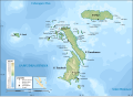
 Bacan Locator Topography.png 1,605 × 1,203; 1.16 MB
-
 Bacan Topography.png 1,785 × 1,291; 1.16 MB
-
 Bali Locator Topography.png 2,104 × 1,725; 1.83 MB
-
 Bali Mts Agung and Batur.jpg 1,400 × 704; 106 KB
-
 Bali sund och öar.png 2,104 × 1,725; 2.13 MB
-
 Bali topography plain.png 2,048 × 1,259; 1.31 MB
-
 Bali Topography.png 2,465 × 1,818; 1.76 MB
-
 Banggai Islands Locator Topography.png 1,706 × 1,616; 1.12 MB
-
 Banggai Islands Topography.png 1,999 × 1,879; 1.25 MB
-
 Bangka Topography.png 2,036 × 1,948; 2.38 MB
-
 Batavia-Bandung.jpg 848 × 598; 101 KB
-
 Batu Kepulauan peta topografi id.svg 2,000 × 1,454; 796 KB
-
 Belitung shipwreck location.jpg 2,584 × 1,706; 356 KB
-
 Belitung Topography.png 2,584 × 1,706; 1.12 MB
-
 Bengawan Solo topography map.png 800 × 481; 402 KB
-
 BirdsHeadPeninsula Topo nl.jpg 837 × 576; 77 KB
-
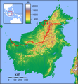 Borneo Locator Topography.png 1,605 × 1,739; 2.61 MB
-
 Borneo Topography Kutai basin.png 1,725 × 1,824; 2.53 MB
-
 Borneo Topography.png 1,725 × 1,824; 2.52 MB
-
 Borneo-H.jpg 1,848 × 1,880; 576 KB
-
 Buton Topography.png 1,776 × 2,180; 2.85 MB
-
 East Indies - btv1b53209798t (1 of 2).jpg 12,039 × 9,166; 16.03 MB
-
 Flores Locator Topography.png 2,559 × 1,514; 1.46 MB
-
 Flores Topography.png 2,745 × 1,665; 1.4 MB
-
 Halmahera Topography.png 1,508 × 2,158; 1.69 MB
-
 Helbig in Nordsumatra.jpg 2,603 × 1,386; 610 KB
-
 HKU Stephen Hui Geological Museum 地球儀 earth Globe map October 2016 Lnv 汶萊 印度尼西亞.jpg 3,264 × 2,448; 2.96 MB
-
 Indonesia Java relief location map.png 1,600 × 724; 915 KB
-
 Indonesia Physiography.jpg 2,726 × 1,845; 1.42 MB
-
 Indonesia relief location map.jpg 1,200 × 460; 527 KB
-
 Indonesia Sumatra relief location map.jpg 1,240 × 1,057; 360 KB
-
 Java Gunnung Merapi.JPG 2,525 × 1,040; 700 KB
-
 Java Locator Topography.png 2,525 × 1,627; 1.36 MB
-
 Java Relief Map.svg 1,587 × 849; 5.84 MB
-
 Java Sumbawa Flores 7to9S 106to124E Topo Rainbow Zebra 1530.jpg 21,600 × 2,400; 15.21 MB
-
 Java Topography.png 2,688 × 1,693; 1.16 MB
-
 Java-Vulkane.jpg 2,380 × 1,804; 873 KB
-
 Kaart van het eiland Java - Topografische Ausgabe.jpg 12,249 × 3,147; 9.24 MB
-
 Karte Pulau Nias.jpg 4,619 × 4,458; 4.96 MB
-
 Karte Pulau Sumba.jpg 6,405 × 3,615; 5.05 MB
-
 Lengguru topographical map.jpg 2,000 × 2,300; 5.01 MB
-
 Lombok Locator Topography.png 2,003 × 2,037; 1.93 MB
-
 Lombok Topography (labelled).png 2,003 × 2,037; 2.16 MB
-
 Lombok Topography.png 2,347 × 2,135; 1.75 MB
-
 Madura Topography-HE.png 2,453 × 1,614; 1.55 MB
-
 Madura Topography.png 2,453 × 1,614; 1.32 MB
-
 Makassar.png 1,017 × 738; 672 KB
-
 MalayArchipelago.jpg 830 × 617; 167 KB
-
 Maluku Locator Topography.png 1,567 × 1,688; 765 KB
-
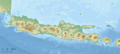
 Map of Indonesia Demis.png 1,492 × 670; 345 KB
-
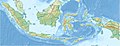
 Map of Indonesia relief location.png 800 × 307; 451 KB
-
 Mentawai Islands Topography.png 1,841 × 1,768; 1,017 KB
-
 Morotai Topography.png 1,120 × 1,049; 663 KB
-
 Mount Tambora Relief Map, SRTM-1.jpg 1,600 × 1,200; 992 KB
-
 Neck of Sulawesi.jpg 3,359 × 6,157; 14.24 MB
-
 Nias Topography.png 2,345 × 2,095; 1.05 MB
-
 Obi Islands Topography.png 1,999 × 1,496; 833 KB
-
 Papua Locator Topography.png 1,591 × 1,591; 1.57 MB
-
 Peta Relif Pulau Kalimantan (Borneo).jpg 870 × 967; 1.47 MB
-
 Peta Relif Pulau Papua.jpg 974 × 841; 1.38 MB
-
 Peta Relif Pulau Sulawesi.jpg 624 × 717; 805 KB
-
 Peta Relif Pulau Sumatera (cropped).jpg 984 × 1,167; 1.83 MB
-
 Peta topografi kaldera Beratan, Bali.png 2,560 × 2,560; 1.39 MB
-
 Poso Regency Topography.svg 378 × 365; 1,000 KB
-
 Pulau Sangeang.png 1,506 × 1,361; 2.44 MB
-
 Puncak Jaya glaciers 1850-2003 evolution map-fr.gif 511 × 590; 2.45 MB
-
 Raung-Krater mit Bergsturz.JPG 938 × 642; 209 KB
-
 Relief Map of Borneo.png 800 × 867; 747 KB
-
 Schouten Islands (IN) Topography.png 2,235 × 1,696; 722 KB
-
 Simeulue Topography.png 2,014 × 1,788; 568 KB
-
 Sula Islands Locator Topography.png 2,073 × 1,471; 634 KB
-
 Sula Islands Topography.png 2,223 × 1,567; 633 KB
-
 Sulawesi Locator Topography.png 1,991 × 1,858; 1.88 MB
-
 Sulawesi topography plain 2.png 2,179 × 2,646; 2.6 MB
-
 Sulawesi topography plain.png 2,219 × 2,799; 2.85 MB
-
 Sulawesi Topography.png 2,153 × 1,990; 1.71 MB
-
 Sumatra Locator Topography.png 1,866 × 2,002; 2.26 MB
-
 Sumatra topographic location map.png 900 × 768; 224 KB
-
 Sumatra Topography.png 2,080 × 2,109; 2.17 MB
-
 Sumatra-Enggano.jpg 918 × 994; 157 KB
-
 Sumba Locator Topography.png 1,940 × 1,350; 1.56 MB
-
 Sumba Topography.png 2,119 × 1,467; 1.4 MB
-
 Sumbawa Topography.png 2,440 × 1,860; 1.91 MB
-
 Tabuan Island 2.png 1,184 × 740; 1.23 MB
-
 Tabuan Island.png 899 × 721; 835 KB
-
 Timor and Wetar Endemic Bird Area.png 1,507 × 1,000; 941 KB
-
 Timor and Wetar Endemic Bird Area.svg 576 × 333; 563 KB
-
 Topography of Bali-SUBAK.jpg 1,576 × 1,076; 238 KB
-
 Topography of Bali.jpg 1,669 × 1,217; 498 KB
-
 Topomap Gunung Sanggabuana.png 1,828 × 1,828; 830 KB
-
 Weh Island.png 800 × 718; 1.17 MB
-
 Восточная Ява.png 1,066 × 708; 565 KB
-
 Восточный Калимантан.png 795 × 1,085; 1.45 MB
-
 Провинции Явы.png 2,257 × 812; 1.25 MB
-
 Физ. карта Суматры.png 1,968 × 1,881; 2.5 MB
-
 Физ. карта Явы.png 2,257 × 812; 1.25 MB
-
 Центральный Сулавеси.png 935 × 960; 1 MB


