Papers by Martina Polig

Opuscula. Annual of the Swedish Institutes at Athens and Rome
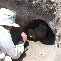
The tenth season of excavations at the Late Bronze Age city of Hala Sultan Tekke was carried out ... more The tenth season of excavations at the Late Bronze Age city of Hala Sultan Tekke was carried out in four areas: City Quarter 1 (CQ1), CQ4, City Wall 1 (CW1), and Area A (Tomb RR). The excavations in CQ1 provided additional information on the pre-LC IIIA occupation of the city. Stratum 3 which can be dated to the LC IIC (13th century BC) was further exposed. For the first time in the city even older phases, Strata 4 and 5, were found. These are tentatively dated to the LC I–II (15th to 14th century BC). In CQ4 numerous storage areas were exposed, which belong to a large compound. There is also evidence of production of textiles and purple dye. All remains can be associated to the most recent Stratum 1 and can be securely dated in the LC IIIA, i.e. the 12th century BC. A test trench (CW1) was opened up 150 m to the south-east of CQ4, in an area where the magnetometer survey indicated a possible city wall with moat. A c. 2.5 m-wide man-made construction consisting of small stones inter...

Studies in Digital Heritage
Traditionally, building archeology is conducted by creating and interpreting 2D documentation, ev... more Traditionally, building archeology is conducted by creating and interpreting 2D documentation, even though the spatial properties of a building are not fully expressed in 2D. The reason for neglecting the third dimension has been mostly due to technical limitations in data acquisition and creation, as well as visualization. The fast progress in 3D technology puts an end to those limitations even though its full potential is still yet to be explored.This study shows how a 3D GIS can be applied from the outset of a building archaeological study to create a three-dimensional information system connected to a geometrically accurate 3D model of a structure.The case study investigates Lund Cathedral (Sweden) and is linked to a larger research project launched in occasion of the cathedral’s 900th anniversary in 2023 (“Lund Cathedral 2023”). Within the framework of this project, the cathedral was acquired digitally through laser scanning and photogrammetry. The building is characterized by ...

Journal on Computing and Cultural Heritage, 2020
A challenging aspect of visibility studies is visual acuity, which concerns the clarity of vision... more A challenging aspect of visibility studies is visual acuity, which concerns the clarity of vision within a given space in relation to variables such as spatial geometry, lighting conditions, the physical properties of the viewed object, or the familiarity of viewers with the target. Our research proposes a novel approach to visibility studies, based on visual acuity and its related pipeline, which integrates qualitative and quantitative aspects such as the cultural background of viewers, the illumination values of space, contrast, and size of objects of interest as well as their meaning and context. The proposed pipeline relies on 3D documentation of the investigated space, light measurements, research in optics, trigonometry calculations, and 3D GIS set against images and architectural space. The method's effectiveness is demonstrated in the study of the iconography of the Cathedral of St. John the Theologian in Nicosia, Cyprus, the work hypothesis being that the church's spatial organization, choice of scenes, and level of detail were carefully planned to establish visual narratives with strong political and religious connotations and to overall dictate the ways the building was accessed and experienced. The method can be broadly applied for visibility analyses in a variety of case-studies in closed spaces.
NEΩTEΡOΣ. STUDIES IN BRONZE AGE AEGEAN ART AND ARCHAEOLOGY. Fest. JOHN G. YOUNGER (eds. B. DAVIS & R.LAFFINEUR), 2020
An extraordinary ring impression discovered among the Late Minoan
IB destruction debris inside B... more An extraordinary ring impression discovered among the Late Minoan
IB destruction debris inside Building 5 at Palaikastro, eastern Crete. Despite its unique imagery, publication (BSA 84 , 1989) did not bring the ring fame or favour; in fact, it has rarely been mentioned since. This paper sets out to reclaim the ring as a masterpiece of Minoan glyptic art.
PLEASE CONTACT ME FOR PDF (due to publisher's restriction)
Eurographics Proceedings 2018, 2018
This track of the SHREC 2018 originally aimed at recognizing relief patterns over a set of triang... more This track of the SHREC 2018 originally aimed at recognizing relief patterns over a set of triangle meshes from laser scan
acquisitions of archaeological fragments. This track approaches a lively and very challenging problem that remains open after
the end of the track. In this report we discuss the challenges to face to successfully address geometric pattern recognition over
surfaces; how the existing techniques can go further in this direction, what is currently missing and what is necessary to be
further developed.

Digital Applications in Archaeology and Cultural Heritage, 2018
Scientific visualization is a well-recognized method of inquiry into data across a wide range of ... more Scientific visualization is a well-recognized method of inquiry into data across a wide range of disciplines. 2D still images have a long history of use in archaeology, mainly depicting artifacts, structures or plans of archaeological sites. 3D models have a relative long history in modern archaeology, mostly for presentations to the public, musealisation services or engagement in education programs. The article below aims at filling the gap, by presenting a chaine opératoire archaeological investigation of an artifact, by implementing methods of scientific visualization and shape analysis on the 3D digital and physical replicas of the object. The item is a unique stone object found at the Late Bronze Age site of Pyla-Kokkinokremos; the article details the methodological approach, implemented analysis pipeline and critical discussion of adopted methodology and the resulting archaeological interpretation.

Traditionally, building archaeology is conducted by creating and interpreting 2D documentation, e... more Traditionally, building archaeology is conducted by creating and interpreting 2D documentation, even though the spatial properties of a building are not fully expressed in 2D. The third dimension has been mostly neglected, due to technical limitations that can be overcome through the rapid progress in 3D technology. This study shows how a 3D GIS can be applied from the outset of a building archaeological study to create a three-dimensional information system connected to a geometrically accurate 3D model of a structure. The building under investigation was Lund Cathedral (Sweden), whose long and complex history has been studied for two centuries. Gaining an understanding of all interventions, as well as managing the heterogonous datasets, is a challenge. In order to overcome these difficulties, various datasets and their relevant metadata were imported into the ArcGIS software and linked to a geometrically accurate 3D model of the church, placing all pieces of information in their correct spatial position. Thus, data that was previously impossible to view simultaneously and in the same space can be displayed together, creating a unique holistic oversight of the available material. Through the flexibility and versatility of the system, information can be displayed and queried at will, as well as updated continuously, greatly facilitating interpretation and making it an important resource throughout the entire building archaeological study.
The Holy Cross Church in Dalby (Sweden) dates back to the 11th century, making it one of the olde... more The Holy Cross Church in Dalby (Sweden) dates back to the 11th century, making it one of the oldest stone churches all across Scandinavia. The appearance of the original church has been discussed by the research community for about a century. The main aim of this study is to determine which of the many hypotheses regarding the first phase of the church is the most likely, what might have been the reason for its major alteration in the 12th century, and how digital methods – particularly 3D – can improve and aid building archaeology. The study consists of four parts. In the first one, excavation trenches close to the church are reconstructed from drawings in 3D-GIS and put in relation to a 3D model of the church derived from a laser scan acquisition of the entire building that was performed in 2013. It is an innovative way to assess and revisit old excavation material by recomposing vertical and horizontal 2D documentation accurately. Based on the results of the first part, other archaeological documentation, measurements from the 3D scan and literature, 3D reconstructions of the three most important hypotheses are created in the second part and are compared to the 3D scan of the church in order to validate them geometrically. An interactive reliability map of the reconstructions was created and made available online. The last two steps comprised the spatial exploration of the reconstructions and an examination of the potential of structural analysis through FEM (Finite Element Modelling) for building archaeology. It was possible to determine which hypothesis is the most likely, and that the alteration of the church in the 12th century might have been due to structural reasons. The study clearly shows that 3D methods can considerably enhance building archaeological investigations, and that FEM is a very promising method.
Conference Presentations by Martina Polig









Uploads
Papers by Martina Polig
IB destruction debris inside Building 5 at Palaikastro, eastern Crete. Despite its unique imagery, publication (BSA 84 , 1989) did not bring the ring fame or favour; in fact, it has rarely been mentioned since. This paper sets out to reclaim the ring as a masterpiece of Minoan glyptic art.
PLEASE CONTACT ME FOR PDF (due to publisher's restriction)
acquisitions of archaeological fragments. This track approaches a lively and very challenging problem that remains open after
the end of the track. In this report we discuss the challenges to face to successfully address geometric pattern recognition over
surfaces; how the existing techniques can go further in this direction, what is currently missing and what is necessary to be
further developed.
Conference Presentations by Martina Polig
IB destruction debris inside Building 5 at Palaikastro, eastern Crete. Despite its unique imagery, publication (BSA 84 , 1989) did not bring the ring fame or favour; in fact, it has rarely been mentioned since. This paper sets out to reclaim the ring as a masterpiece of Minoan glyptic art.
PLEASE CONTACT ME FOR PDF (due to publisher's restriction)
acquisitions of archaeological fragments. This track approaches a lively and very challenging problem that remains open after
the end of the track. In this report we discuss the challenges to face to successfully address geometric pattern recognition over
surfaces; how the existing techniques can go further in this direction, what is currently missing and what is necessary to be
further developed.