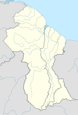
Arakaka is a community in the Barima-Waini region of Guyana, standing on the Barima River and 12 miles southerly of Port Kaituma, at an altitude of 63 metres (209 feet).
Arakaka | |
|---|---|
Community | |
| Coordinates: 7°35′N 60°01′W / 7.583°N 60.017°W | |
| Country | |
| Region | Barima-Waini |
| Population (2012)[1] | |
• Total | 196 |
It is the centre of the gold-bearing district,[2] featuring lateritic-saprolitic deposits. Gold mining in the area has attracted international mining companies, such as Alicanto Minerals Ltd (Australia) and Barrick Gold Corporation (Canada).[3]
The population of Arakaka varies according to the amount of mineral extraction in the region. Launches formerly ascended the river regularly to Arakaka, where a mining warden was stationed.[4] Arakaka has a police outpost.[5]
Matthews Ridge is a nearby settlement also in the Matarkai sub-region.[6]
Demographics
editAccording to the 2002 population census, it had 276 inhabitants. This number varies according to the mineral extraction activity in the region.
| Data | Officials | Professionals and technicians |
Clergy | Commerce and Services |
On. agricultural | On. industrial | Occup. elementals |
S/D | Total |
|---|---|---|---|---|---|---|---|---|---|
| Population | 0 | 6 | 0 | 101 | 10 | 5 | 64 | 87 | 276 |
References
edit- ^ "2012 Population by Village". Statistics Guyana. Retrieved 16 August 2020.
- ^ "Alicanto Minerals confirms high-grade assays from Arakaka gold project". Small Caps. 28 January 2020. Retrieved 19 August 2020.
- ^ "Canadian company pulls out from gold joint venture at Arakaka". Stabroek News. 2018-06-20. Retrieved 2021-01-12.
- ^ British Guiana British Empire exhibition, Wembley, 1924. London. 1924. p. 11.
{{cite book}}:|website=ignored (help)CS1 maint: location missing publisher (link) - ^ "Man to be charged with setting police outpost on fire". Stabroek News. 2020-12-16. Retrieved 2021-01-12.
- ^ "Thirty-eight trucks due next week for manganese mine - McLean". Stabroek News. 2018-10-29. Retrieved 2021-01-12.
- ^ "Data from the 2002 census". Archived from the original on 2012-09-09. Retrieved 2022-06-10.
{{cite web}}: CS1 maint: bot: original URL status unknown (link). Town 44
7°35′N 60°01′W / 7.583°N 60.017°W
