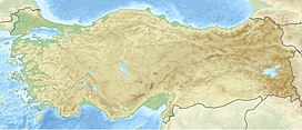
Cemalverdi Mountains (Turkish: Cemalverdi Dağları), is a mountain range in Turkey at the zero point of the provincial border of Muş and Ağrı.[1]
| Cemalverdi Mountains | |
|---|---|
| Highest point | |
| Elevation | 2.438 m (8.00 ft) |
| Coordinates | 39°16′54″N 42°37′58″E / 39.2816008°N 42.6326786°E |
| Geography | |
| Location | Malazgirt, Muş Province, Patnos, Ağrı Province, Turkey |
History
editThe Urartian name of the Cemalverdi Mountains was Adduri Mountain.[2]
Geology and geomorphology
editCemalverdi Mountains are located in the east of the Malazgirt basin[3] and it forms the eastern border of the Malazgirt Plain.[4]
References
edit- ^ "Muş il fiziki haritası" (PDF) (in Turkish). Harita genel müdürlüğü. September 28, 2023. Archived (PDF) from the original on August 18, 2023.
- ^ The kingdom of Armenia. by: M. Chahin. Croom Helm. 1987. p. 65. ISBN 978-0-7007-1452-0.
- ^ "Geomorphological properties of Bulanık-Malazgirt basin (Muş)" (in Turkish). Istanbul University. May 14, 2019. p. 1.
- ^ "Malazgirt ve Bulanik Ovalarında Erken Transkafkasya Dönemi Yerlesmeleri ve Çanak-Çömlekleri" (in Turkish). Van Yüzüncü Yıl University, Sosyal Bilimler Enstitüsü Dergisi. May 2017. p. 4.
