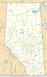
College Heights is a former hamlet located within the City of Lacombe that is home to the Burman University. It is located 1 kilometre (0.62 mi) south of Highway 2 and 26 kilometres (16 mi) north of Red Deer.
Location of College Heights Alberta
History
editPrior to 2000, College Heights was recognized by Alberta Municipal Affairs as a hamlet under the jurisdiction of Lacombe County.[12] However, its hamlet designation ceased in 2000[13] when it and other Lacombe County lands were absorbed by Lacombe via an annexation approved by the Province of Alberta on April 12, 2000, with a retroactive effective date of January 1, 2000.[14][15]
References
edit- ^ Ninth Census of Canada, 1951 (PDF). Vol. SP-7 (Population: Unincorporated villages and hamlets). Dominion Bureau of Statistics. March 31, 1954. Retrieved September 22, 2024.
- ^ Census of Canada, 1956 (PDF). Vol. Population of unincorporated villages and settlements. Dominion Bureau of Statistics. October 25, 1957. Retrieved September 23, 2024.
- ^ 1961 Census of Canada: Population (PDF). Series SP: Unincorporated Villages. Vol. Bulletin SP—4. Ottawa: Dominion Bureau of Statistics. April 18, 1963. Retrieved September 25, 2024.
- ^ Census of Canada 1966: Population (PDF). Special Bulletin: Unincorporated Places. Vol. Bulletin S–3. Ottawa: Dominion Bureau of Statistics. 1968. Retrieved September 25, 2024.
- ^ 1971 Census of Canada: Population (PDF). Special Bulletin: Unincorporated Settlements. Vol. Bulletin SP—1. Ottawa: Statistics Canada. 1973. Retrieved September 25, 2024.
- ^ "Geographical Identification and Population for Unincorporated Places of 25 persons and over, 1971 and 1976". 1976 Census of Canada (PDF). Supplementary Bulletins: Geographic and Demographic (Population of Unincorporated Places—Canada). Vol. Bulletin 8SG.1. Ottawa: Statistics Canada. 1978. Retrieved September 26, 2024.
- ^ 1981 Census of Canada (PDF). Place name reference list. Vol. Western provinces and the Territories. Ottawa: Statistics Canada. 1983. Retrieved September 26, 2024.
- ^ 1986 Census of Canada (PDF). Population. Vol. Unincorporated Places. Ottawa: Statistics Canada. 1988. Retrieved September 26, 2024.
- ^ 91 Census (PDF). Population and Dwelling Counts. Vol. Unincorporated Places. Ottawa: Statistics Canada. 1993. Retrieved September 26, 2024.
- ^ 96 Census (PDF). A National Overivew: Population and Dwelling Counts. Ottawa: Statistics Canada. 1997. Retrieved September 26, 2024.
- ^ "Population and Dwelling Counts, for Canada, Provinces and Territories, and Census Divisions, 2001 and 1996 Censuses - 100% Data (Alberta)". Statistics Canada. August 15, 2012. Retrieved September 19, 2024.
- ^ "1999 Municipal Codes" (PDF). Alberta Municipal Affairs. December 1999. Retrieved January 12, 2010.
- ^ "2000 Municipal Codes" (PDF). Alberta Municipal Affairs. December 2000. Retrieved January 12, 2010.
- ^ "Board Order: MGB 042/00" (PDF). Municipal Government Board. March 10, 2000. Retrieved November 20, 2012.
- ^ "Order in Council (O.C.) 135/2000" (PDF). Province of Alberta. April 12, 2000. Retrieved November 20, 2012.
52°29′20.85″N 113°43′58.80″W / 52.4891250°N 113.7330000°W
