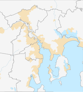
Granton is a rural residential locality in the local government areas (LGA) of Derwent Valley (80%) and Glenorchy (20%) in the South-east and Hobart LGA regions of Tasmania. The locality is about 9 kilometres (5.6 mi) north of the town of Glenorchy. The 2016 census recorded a population of 1736 for the state suburb of Granton.[1] It is a suburb of Hobart. Rust Road is the approximate boundary between the two municipalities at Granton.
| Granton City of Glenorchy, Tasmania | |||||||||||||||
|---|---|---|---|---|---|---|---|---|---|---|---|---|---|---|---|
 Bridgewater Causeway and Bridgewater Bridge with Granton and Mt Wellington behind. | |||||||||||||||
 | |||||||||||||||
| Coordinates | 42°45′6″S 147°13′41″E / 42.75167°S 147.22806°E | ||||||||||||||
| Population | 1,736 (2016 census)[1] | ||||||||||||||
| Postcode(s) | 7030 | ||||||||||||||
| Location | 9 km (6 mi) N of Glenorchy | ||||||||||||||
| LGA(s) | Derwent Valley Council (80%), City of Glenorchy (20%) | ||||||||||||||
| Region | South-east, Hobart | ||||||||||||||
| State electorate(s) | |||||||||||||||
| Federal division(s) | |||||||||||||||
| |||||||||||||||
Public facilities including the Granton War Memorial Hall, public toilets and Granton Green Reserve are located within the Derwent Valley Council section.
History
editGranton was gazetted as a locality in 1970.[2]
The locality was originally known as South Bridgewater,[3] and is home to the Granton Convict Site,[4] which consists of the Old Watch House (1838) and the quarry from which stone was extracted for the construction of the Bridgewater Causeway.
Geography
editThe waters of the River Derwent form the northern boundary.[5]
Road infrastructure
editRoute A10 (Lyell Highway) runs through from east to west.[2][6]
References
edit- ^ a b "2016 Census Quick Stats Granton (Tas.)". quickstats.censusdata.abs.gov.au. Australian Bureau of Statistics. 23 October 2017. Archived from the original on 14 April 2021. Retrieved 2 April 2021.
- ^ a b "Placenames Tasmania – Granton". Placenames Tasmania. Select "Search", enter "306H", click "Search", select row, map is displayed, click "Details". Retrieved 2 April 2021.
- ^ "Changes in Tasmanian Place Names". Hobart.tasfhs.org. Archived from the original on 3 February 2019. Retrieved 28 November 2018.
- ^ "Australian Heritage Database". Environment.gov.au. Retrieved 28 November 2018.
- ^ "Granton, Tasmania" (Map). Google Maps. Retrieved 2 April 2021.
- ^ "Tasmanian Road Route Codes" (PDF). Department of Primary Industries, Parks, Water & Environment. May 2017. Archived from the original (PDF) on 1 August 2017. Retrieved 2 April 2021.
