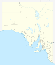
The Hundred of Belalie is a cadastral unit of hundred located in the Mid North of South Australia in the approach to the lower Flinders Ranges. It is one of the hundreds of the County of Victoria and its main town is Jamestown, South Australia. The Hundred corresponded to the former District Council of Belalie.[4] The rural localities of Belalie North and Belalie East[5] derive from the hundred.[6]
| Belalie South Australia | |||||||||||||||
|---|---|---|---|---|---|---|---|---|---|---|---|---|---|---|---|
 Belalie Council office | |||||||||||||||
| Coordinates | 33°13′16″S 138°38′26″E / 33.221015°S 138.640662°E[1] | ||||||||||||||
| Established | 10 February 1870[2] | ||||||||||||||
| Area | 370 square kilometres (144 sq mi)[1] | ||||||||||||||
| LGA(s) | Northern Areas Council[1] | ||||||||||||||
| Region | Yorke and Mid North[1] | ||||||||||||||
| County | Victoria[1] | ||||||||||||||
| |||||||||||||||
| Footnotes | Adjoining Hundreds[3] | ||||||||||||||
See also
editReferences
edit- ^ a b c d e "Search results for 'Belalie, HD' with the following datasets selected - 'Suburbs and Localities', 'Counties', 'Hundreds', 'Local Government Areas', 'SA Government Regions' and 'Gazetteer'". Location SA Map Viewer. Government of South Australian Government. Retrieved 13 September 2021.
- ^ Bagot, John. T. (10 February 1870). "PROCLAMATION BY THE GOVERNOR. COUNTY OF VICTORIA, HUNDRED OF BELALIE" (PDF). The South Australian Government Gazette. 1870. Government of South Australia: 128. Retrieved 13 September 2021.
- ^ "HUNDRED MAP Series Index Map" (PDF). Department of Environment and Heritage, Government of South Australia. December 2008. Archived from the original (PDF) on 27 September 2015. Retrieved 16 November 2015.
- ^ Marsden, Susan (2012). "A History of South Australian Councils to 1936" (PDF). Local Government Association of South Australia. p. 41. Retrieved 27 March 2016.
- ^ Belalie North, SA 5491.
- ^ "Place Names of South Australia - B". State Library of South Australia. Archived from the original on 8 March 2016. Retrieved 3 April 2016.
