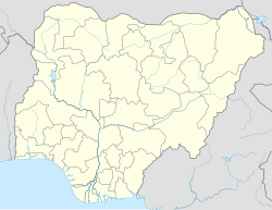
Madagali or Madagli is a town and local government area in Adamawa State, Nigeria, adjacent to the border with Cameroon.
Madagali | |
|---|---|
LGA and town | |
 The Sukur UNESCO World Heritage Site located in Madagali | |
 Map of Adamawa State highlighting Madagali | |
| Coordinates: 10°53′10″N 13°37′47″E / 10.88611°N 13.62972°E | |
| Country | |
| State | Adamawa State |
| Area | |
• Total | 369.7 sq mi (957.4 km2) |
| Population (2022)[1] | |
• Total | 208,400 |
| • Density | 560/sq mi (220/km2) |
| Time zone | UTC+1 (WAT) |
 | |
History
editThe name comes from a spear ('gali') of a Marghi named Madu.[2]: 6
The Local Government Area was created in 1991 when Taraba State was created out of Gongola State. It borders Michika to the south, Askira uba to the west, Gwoza local government area to the north and the Republic of Cameroon to the east.
Ethnic groups
editThe ethnic groups in Madagali include Fulbe, Marghi,Mafa, Sukur, Hdi (Tur), Vemgo, Ngoshe and Wagga.
Villages
editThe major villages in Madagali are Gulak,Shuwa and madagali. Madagali is richly blessed with fertile land which makes the people to heavily engage in Agricultural activities.
Boko Haram Insurgency
editIn September 2012, a Boko Haram commander was killed in Madgali by Nigerian government forces, and 156 arrests were made as a part of "Operation Restore sanity."[3]
The town was seized by Boko Haram in August 2014. In September 2014, residents of Madagali, Gulak, and Michika fled to mountainous areas and Mubi town, in the wake of a failed attempt by government troops to re-take the town from the insurgents.[4]
Climate
editThe rainy season in Madagali is oppressively humid and cloudy, whereas the dry season is stiflingly hot and partially cloudy. The average annual temperature ranges from 58 to 103 degrees Fahrenheit, with lows and highs of 53 and 108 degrees Fahrenheit being extremely rare.[5][6][7]
References
edit- ^ "Madagali (Local Government Area, Nigeria) - Population Statistics, Charts, Map and Location". www.citypopulation.de. Retrieved 2024-02-05.
- ^ Yaji, Hamman (1995). Vaughan, James H.; Kirk-Greene, Anthony H. M. (eds.). The diary of Hamman Yaji : chronicle of a West African Muslim ruler. Internet Archive. Bloomington : Indiana University Press. ISBN 978-0-253-36206-3.
- ^ Onah, Matthew (2012-09-24). "Nigeria: Boko Haram Kingpin Shot Dead in Adamawa". This Day - allAfrica.com. Retrieved 2014-10-21.
- ^ "Nigeria: Thousands Flee as Boko Haram Militants Seize Major Towns". Retrieved 2014-10-21.
- ^ "Madagali Climate, Weather By Month, Average Temperature (Nigeria) - Weather Spark". weatherspark.com. Retrieved 2023-08-06.
- ^ "Madagali, Adamawa, NG Climate Zone, Monthly Averages, Historical Weather Data". tcktcktck.org. Retrieved 2023-08-06.
- ^ "Madagali, Nigeria Weather Conditions | Weather Underground". www.wunderground.com. Retrieved 2023-08-06.
